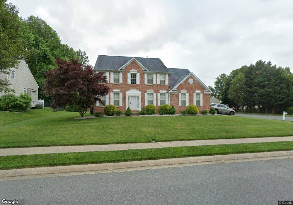
801 Foxborough Dr Bel Air, MD 21015
Estimated Value: $636,352 - $704,000
--
Bed
3
Baths
2,888
Sq Ft
$232/Sq Ft
Est. Value
About This Home
This home is located at 801 Foxborough Dr, Bel Air, MD 21015 and is currently estimated at $670,338, approximately $232 per square foot. 801 Foxborough Dr is a home located in Harford County with nearby schools including Fountain Green Elementary School, Southampton Middle School, and C. Milton Wright High School.
Ownership History
Date
Name
Owned For
Owner Type
Purchase Details
Closed on
Dec 19, 2024
Sold by
Phillips Curtis A and Phillips Cynthia H
Bought by
Phillips Family Living Trust and Phillips
Current Estimated Value
Purchase Details
Closed on
Jan 6, 2000
Sold by
Security Management Corp
Bought by
Phillips Curtis A and Phillips Cynthia N
Create a Home Valuation Report for This Property
The Home Valuation Report is an in-depth analysis detailing your home's value as well as a comparison with similar homes in the area
Home Values in the Area
Average Home Value in this Area
Purchase History
| Date | Buyer | Sale Price | Title Company |
|---|---|---|---|
| Phillips Family Living Trust | -- | None Listed On Document | |
| Phillips Curtis A | $251,131 | -- |
Source: Public Records
Mortgage History
| Date | Status | Borrower | Loan Amount |
|---|---|---|---|
| Closed | Phillips Curtis A | -- |
Source: Public Records
Tax History Compared to Growth
Tax History
| Year | Tax Paid | Tax Assessment Tax Assessment Total Assessment is a certain percentage of the fair market value that is determined by local assessors to be the total taxable value of land and additions on the property. | Land | Improvement |
|---|---|---|---|---|
| 2025 | $5,537 | $548,500 | $127,000 | $421,500 |
| 2024 | $5,537 | $518,900 | $0 | $0 |
| 2023 | $5,268 | $489,300 | $0 | $0 |
| 2022 | $5,010 | $459,700 | $127,000 | $332,700 |
| 2021 | $5,007 | $450,633 | $0 | $0 |
| 2020 | $5,007 | $441,567 | $0 | $0 |
| 2019 | $4,782 | $432,500 | $116,000 | $316,500 |
| 2018 | $4,508 | $407,100 | $0 | $0 |
| 2017 | $4,287 | $432,500 | $0 | $0 |
| 2016 | $140 | $356,300 | $0 | $0 |
| 2015 | $4,227 | $356,300 | $0 | $0 |
| 2014 | $4,227 | $356,300 | $0 | $0 |
Source: Public Records
Map
Nearby Homes
- 1219 Starmount Ln
- 1358 Merry Hill Ct
- 906 Whispering Ridge Ln
- 1453 Redfield Rd
- 1441 Valbrook Ct N
- 1313 Kelsey Ct
- 1505 Southview Rd
- 1818 Selvin Dr Unit 202
- 1402 E Macphail Rd
- 1600 Martha Ct Unit 304
- 1600 Martha Ct Unit 301
- Yorktown Plan at Roberts Crossing
- Coronado Plan at Roberts Crossing
- Hemingway Plan at Roberts Crossing
- 1605 Shady Tree Ct
- 1607 Shady Tree Ct
- 1609 Shady Tree Ct
- 1612 Shady Tree Ct
- 1614 Shady Tree Ct
- 1613 Shady Tree Ct
- 803 Foxborough Dr
- 1413 Brierhill Estates Dr
- 1409 Brierhill Estates Dr
- 805 Foxborough Dr
- 802 Foxborough Dr
- 1416 Brierhill Estates Dr
- 1412 Brierhill Estates Dr
- 1415 Brierhill Estates Dr
- 804 Foxborough Dr
- 1410 Brierhill Estates Dr
- 1418 Brierhill Estates Dr
- 1407 Brierhill Estates Dr
- 1408 Brierhill Estates Dr
- 1417 Brierhill Estates Dr
- 1420 Brierhill Estates Dr
- 1405 Brierhill Estates Dr
- 1137 Robin Hill Ct
- 1139 Robin Hill Ct
- 1135 Robin Hill Ct
- 1141 Robin Hill Ct