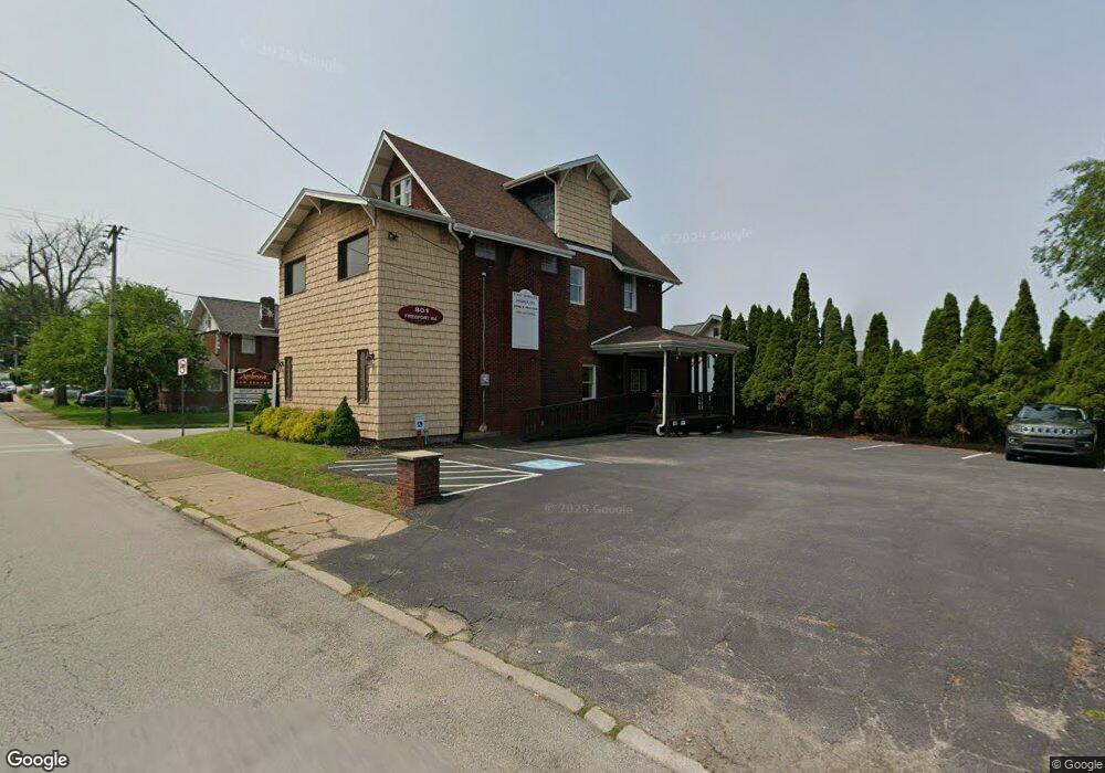
801 Freeport Rd New Kensington, PA 15068
Estimated Value: $102,261 - $158,000
--
Bed
--
Bath
2,830
Sq Ft
$48/Sq Ft
Est. Value
About This Home
This home is located at 801 Freeport Rd, New Kensington, PA 15068 and is currently estimated at $136,565, approximately $48 per square foot. 801 Freeport Rd is a home located in Westmoreland County with nearby schools including Mary Queen of Apostles School.
Ownership History
Date
Name
Owned For
Owner Type
Purchase Details
Closed on
Feb 15, 2022
Sold by
Susa Filo Maegan
Bought by
Susa Margan M
Current Estimated Value
Purchase Details
Closed on
Nov 5, 2021
Sold by
Filo Joel and Filo Maegan Susa
Bought by
Filo Maegan Susa
Purchase Details
Closed on
Feb 6, 2013
Sold by
Ambrose Donetta W
Bought by
Filo Joel and Filo Maegan Susa
Home Financials for this Owner
Home Financials are based on the most recent Mortgage that was taken out on this home.
Original Mortgage
$63,750
Interest Rate
3.38%
Mortgage Type
Future Advance Clause Open End Mortgage
Create a Home Valuation Report for This Property
The Home Valuation Report is an in-depth analysis detailing your home's value as well as a comparison with similar homes in the area
Home Values in the Area
Average Home Value in this Area
Purchase History
| Date | Buyer | Sale Price | Title Company |
|---|---|---|---|
| Susa Margan M | -- | None Listed On Document | |
| Filo Maegan Susa | -- | None Available | |
| Filo Joel | $75,000 | None Available |
Source: Public Records
Mortgage History
| Date | Status | Borrower | Loan Amount |
|---|---|---|---|
| Previous Owner | Filo Joel | $63,750 |
Source: Public Records
Tax History Compared to Growth
Tax History
| Year | Tax Paid | Tax Assessment Tax Assessment Total Assessment is a certain percentage of the fair market value that is determined by local assessors to be the total taxable value of land and additions on the property. | Land | Improvement |
|---|---|---|---|---|
| 2025 | $1,517 | $9,500 | $3,750 | $5,750 |
| 2024 | $1,502 | $9,500 | $3,750 | $5,750 |
| 2023 | $1,422 | $9,500 | $3,750 | $5,750 |
| 2022 | $1,378 | $9,500 | $3,750 | $5,750 |
| 2021 | $1,347 | $9,500 | $3,750 | $5,750 |
| 2020 | $3,201 | $23,060 | $3,750 | $19,310 |
| 2019 | $3,120 | $23,060 | $3,750 | $19,310 |
| 2018 | $3,074 | $23,060 | $3,750 | $19,310 |
| 2017 | $3,028 | $23,060 | $3,750 | $19,310 |
| 2016 | $3,028 | $23,060 | $3,750 | $19,310 |
| 2015 | $3,028 | $23,060 | $3,750 | $19,310 |
| 2014 | $2,909 | $23,060 | $3,750 | $19,310 |
Source: Public Records
Map
Nearby Homes
- 1400 Orchard Ave
- 1024 Knollwood Rd
- 1308 Taylor Ave
- 1038 Manor Rd
- 533 Freeport Rd
- 1719 Freeport Rd
- 1520 Woodmont Ave
- 1312 Woodmont Ave
- 1717 Ridge Ave
- 1515 Woodmont Ave
- 1735 Kimball Ave
- 1506 Victoria Ave
- 1741 Freeport Rd Unit U
- 1218 Woodmont Ave
- 1240 Victoria Ave
- 1521 Victoria Ave
- 1802 Kimball Ave
- 1802 Alcoa Dr
- 1809 Kimball Ave
- 1512 Kenneth Ave
- 809 Freeport Rd
- 921 North St
- 815 Freeport Rd
- 917 North St
- 783 Freeport Rd
- 1010 Parkview Dr
- 817 Freeport Rd
- 913 North St
- 819 Freeport Rd
- 920 North St
- 790 Freeport Rd
- 709 Freeport Rd
- 781 Freeport Rd
- 911 North St
- 1008 Parkview Dr
- 916 North St
- 720 Kimball Ave
- 905 North St
- 716 Kimball Ave
- 722 Kimball Ave