Estimated Value: $169,000 - $189,000
2
Beds
2
Baths
1,100
Sq Ft
$161/Sq Ft
Est. Value
About This Home
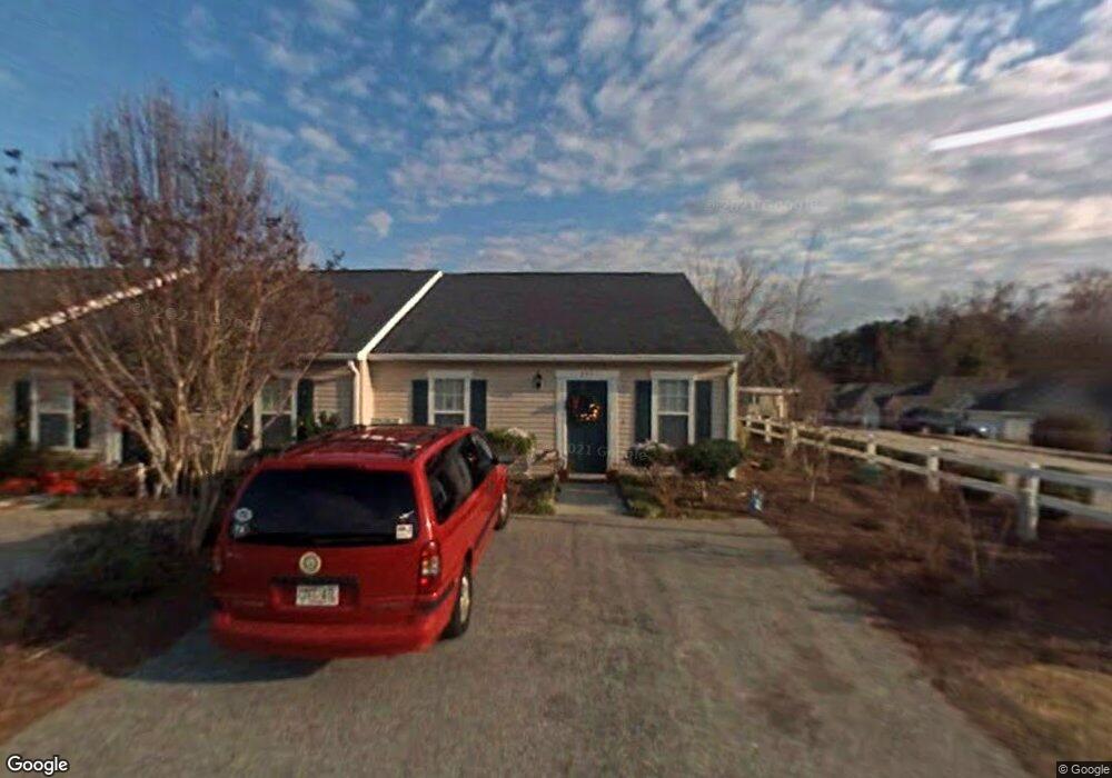
This home is located at 801 Fripp Ct, Evans, GA 30809 and is currently estimated at $177,183, approximately $161 per square foot. 801 Fripp Ct is a home located in Columbia County with nearby schools including River Ridge Elementary School, Riverside Middle School, and Lakeside High School.
Ownership History
Date
Name
Owned For
Owner Type
Purchase Details
Closed on
Sep 29, 2025
Sold by
Diane Riggs Sheffield Living Trust Dated
Bought by
John G Sheffield Jr Living Trust Dated J and Sheffield John G Jr Trust
Current Estimated Value
Purchase Details
Closed on
Jan 25, 2010
Sold by
Jones James Kevan
Bought by
Sheffield Diane R
Purchase Details
Closed on
Dec 6, 2004
Sold by
Skinner Marvin R and Skinner Lisa L
Bought by
Jones James Kevan
Home Financials for this Owner
Home Financials are based on the most recent Mortgage that was taken out on this home.
Original Mortgage
$69,255
Interest Rate
7.5%
Mortgage Type
Purchase Money Mortgage
Create a Home Valuation Report for This Property
The Home Valuation Report is an in-depth analysis detailing your home's value as well as a comparison with similar homes in the area
Home Values in the Area
Average Home Value in this Area
Purchase History
| Date | Buyer | Sale Price | Title Company |
|---|---|---|---|
| John G Sheffield Jr Living Trust Dated J | -- | -- | |
| Sheffield Diane R | $93,300 | -- | |
| Jones James Kevan | $65,000 | -- |
Source: Public Records
Mortgage History
| Date | Status | Borrower | Loan Amount |
|---|---|---|---|
| Previous Owner | Jones James Kevan | $69,255 |
Source: Public Records
Tax History
| Year | Tax Paid | Tax Assessment Tax Assessment Total Assessment is a certain percentage of the fair market value that is determined by local assessors to be the total taxable value of land and additions on the property. | Land | Improvement |
|---|---|---|---|---|
| 2025 | $1,766 | $74,109 | $13,004 | $61,105 |
| 2024 | $1,726 | $69,110 | $12,404 | $56,706 |
| 2023 | $1,726 | $64,194 | $12,404 | $51,790 |
| 2022 | $1,431 | $55,117 | $10,304 | $44,813 |
| 2021 | $1,309 | $48,172 | $9,204 | $38,968 |
| 2020 | $1,039 | $37,453 | $7,004 | $30,449 |
| 2019 | $1,207 | $43,492 | $8,004 | $35,488 |
| 2018 | $1,021 | $36,671 | $7,204 | $29,467 |
| 2017 | $1,048 | $37,503 | $7,204 | $30,299 |
| 2016 | $1,005 | $37,324 | $7,180 | $30,144 |
| 2015 | $907 | $33,627 | $6,380 | $27,247 |
| 2014 | $1,004 | $36,737 | $6,880 | $29,857 |
Source: Public Records
Map
Nearby Homes
- 854 Sparkleberry Rd
- 648 River Oaks Ln
- 809 Woodberry Dr
- 4484 Woodberry Ct
- 4489 Woodberry Ct
- 4481 Woodberry Ct
- 829 Woodberry Dr
- 726 Whitney Shoals Rd
- 881 Audubon Way
- 814 Audubon Way
- 606 Ridge Way
- 780 Springbrook Cir
- 4478 Cape Cod Dr
- 802 Sparkleberry Rd
- 4560 Mulberry Creek Dr
- 656 Deerwood Way
- 525 Pheasant Run Dr
- 4418 Pierwood Way
- 672 Deerwood Way
- 644 Deerwood Way
- 803 Fripp Ct
- 805 Fripp Ct
- 807 Fripp Ct
- 750 Folly Ct
- 752 Folly Ct
- 754 Folly Ct
- 809 Fripp Ct
- 802 Fripp Ct
- 804 Fripp Ct
- 756 Folly Ct
- 806 Fripp Ct
- 778 Faircloth Commons Rd
- 776 Faircloth Commons Rd
- 811 Fripp Ct
- 808 Fripp Ct
- 780 Faircloth Commons Rd
- 774 Faircloth Commons Rd
- 760 Folly Ct
- 0 Faircloth Commons Rd
- 782 Faircloth Commons Rd
Your Personal Tour Guide
Ask me questions while you tour the home.