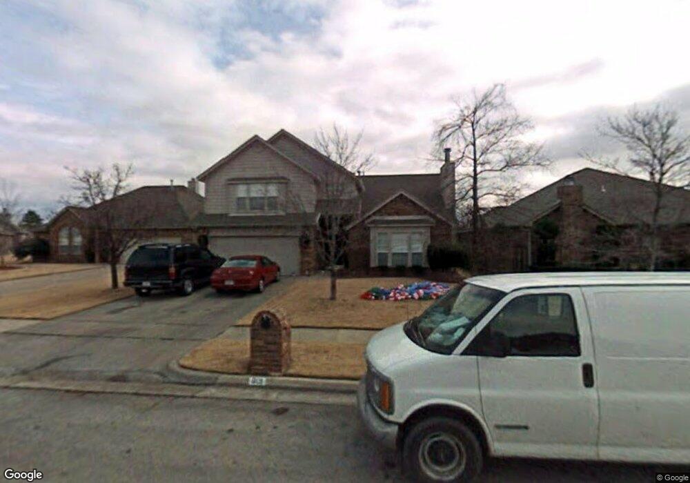
801 N Laurel Ave Broken Arrow, OK 74012
Country Aire Estates NeighborhoodEstimated Value: $304,964 - $321,000
--
Bed
1
Bath
2,370
Sq Ft
$133/Sq Ft
Est. Value
About This Home
This home is located at 801 N Laurel Ave, Broken Arrow, OK 74012 and is currently estimated at $314,241, approximately $132 per square foot. 801 N Laurel Ave is a home located in Tulsa County with nearby schools including Peters Elementary School, Union 8th Grade Center, and Union 6th-7th Grade Center.
Ownership History
Date
Name
Owned For
Owner Type
Purchase Details
Closed on
Sep 30, 2003
Sold by
Petron Daniel H and Petron Kathryn D
Bought by
Bradshaw Stephen S and Bradshaw Trudi L
Current Estimated Value
Home Financials for this Owner
Home Financials are based on the most recent Mortgage that was taken out on this home.
Original Mortgage
$142,100
Outstanding Balance
$66,449
Interest Rate
6.24%
Mortgage Type
FHA
Estimated Equity
$247,792
Purchase Details
Closed on
Jun 1, 1995
Create a Home Valuation Report for This Property
The Home Valuation Report is an in-depth analysis detailing your home's value as well as a comparison with similar homes in the area
Home Values in the Area
Average Home Value in this Area
Purchase History
| Date | Buyer | Sale Price | Title Company |
|---|---|---|---|
| Bradshaw Stephen S | $148,000 | Frisco Title Corporation | |
| -- | $115,500 | -- |
Source: Public Records
Mortgage History
| Date | Status | Borrower | Loan Amount |
|---|---|---|---|
| Open | Bradshaw Stephen S | $142,100 |
Source: Public Records
Tax History Compared to Growth
Tax History
| Year | Tax Paid | Tax Assessment Tax Assessment Total Assessment is a certain percentage of the fair market value that is determined by local assessors to be the total taxable value of land and additions on the property. | Land | Improvement |
|---|---|---|---|---|
| 2024 | $2,586 | $20,667 | $2,656 | $18,011 |
| 2023 | $2,586 | $21,035 | $2,604 | $18,431 |
| 2022 | $2,528 | $19,423 | $3,075 | $16,348 |
| 2021 | $2,458 | $18,828 | $2,981 | $15,847 |
| 2020 | $2,398 | $18,251 | $3,311 | $14,940 |
| 2019 | $2,321 | $17,690 | $3,209 | $14,481 |
| 2018 | $2,243 | $17,145 | $3,110 | $14,035 |
| 2017 | $2,203 | $17,617 | $3,196 | $14,421 |
| 2016 | $2,107 | $17,104 | $3,467 | $13,637 |
| 2015 | $2,042 | $16,606 | $3,366 | $13,240 |
| 2014 | $2,030 | $16,606 | $3,366 | $13,240 |
Source: Public Records
Map
Nearby Homes
- 3309 W Freeport St
- 705 N Indianwood Ave
- 701 N Indianwood Ave
- 409 N Palm Ave
- 3408 W College St
- 208 N Nyssa Ave
- 3200 W Lansing St
- 3033 W Oakland St
- 3108 W Norman Cir
- 2909 W Oakland St
- 1313 N Hemlock Ave
- 2509 W Iola St
- 3902 W Kenosha St
- 2701 W Madison St
- 6712 S 136th Ave E
- 2605 W Detroit St
- 0 S 136th East Ave
- 4201 W Detroit St
- 2604 W Broadway St
- 2640 W Dallas St
- 717 N Laurel Ave
- 805 N Laurel Ave
- 713 N Laurel Ave
- 800 N Kalanchoe Ave
- 712 N Kalanchoe Ave
- 809 N Laurel Ave
- 804 N Kalanchoe Ave
- 708 N Kalanchoe Ave
- 709 N Laurel Ave
- 800 N Laurel Ave
- 720 N Laurel Ave
- 804 N Laurel Ave
- 716 N Laurel Ave
- 705 N Laurel Ave
- 808 N Kalanchoe Ave
- 812 N Laurel Ave
- 808 N Laurel Ave
- 712 N Laurel Ave
- 700 N Kalanchoe Ave
- 708 N Laurel Ave
