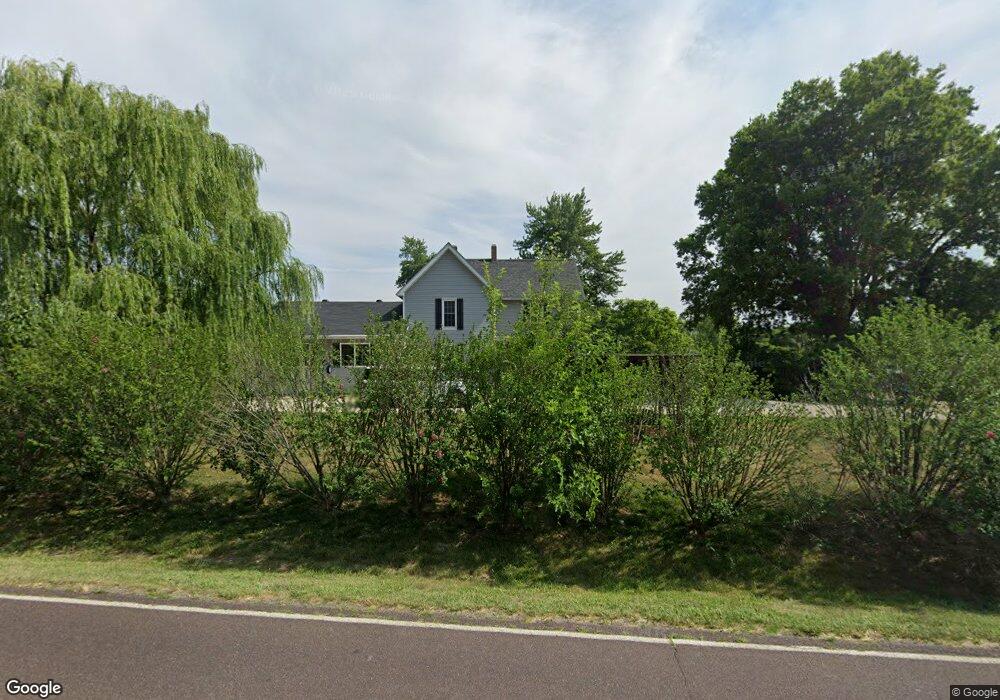
801 Redwood Dr New Bloomfield, MO 65063
Estimated Value: $164,275 - $212,000
Studio
--
Bath
2,422
Sq Ft
$79/Sq Ft
Est. Value
About This Home
This home is located at 801 Redwood Dr, New Bloomfield, MO 65063 and is currently estimated at $191,319, approximately $78 per square foot. 801 Redwood Dr is a home located in Callaway County with nearby schools including New Bloomfield Elementary School and New Bloomfield High School.
Ownership History
Date
Name
Owned For
Owner Type
Purchase Details
Closed on
Nov 18, 2020
Sold by
Shaffer Michael and Shaffer Jessica
Bought by
Shaffer Michael and Shaffer Jessica
Current Estimated Value
Purchase Details
Closed on
May 25, 2007
Sold by
Arnold Matthew T
Bought by
Shaffer Michael and Saffer Meatha
Purchase Details
Closed on
Apr 19, 2005
Sold by
Nichols Helen L and Helen L Nichols Living Trust
Bought by
Arnold Matthew T and Evans Cara E
Home Financials for this Owner
Home Financials are based on the most recent Mortgage that was taken out on this home.
Original Mortgage
$44,650
Interest Rate
5.25%
Mortgage Type
Adjustable Rate Mortgage/ARM
Create a Home Valuation Report for This Property
The Home Valuation Report is an in-depth analysis detailing your home's value as well as a comparison with similar homes in the area
Purchase History
| Date | Buyer | Sale Price | Title Company |
|---|---|---|---|
| Shaffer Michael | -- | None Available | |
| Shaffer Michael | -- | -- | |
| Arnold Matthew T | $47,000 | -- |
Source: Public Records
Mortgage History
| Date | Status | Borrower | Loan Amount |
|---|---|---|---|
| Previous Owner | Arnold Matthew T | $44,650 | |
| Closed | Shaffer Michael | $0 |
Source: Public Records
Tax History
| Year | Tax Paid | Tax Assessment Tax Assessment Total Assessment is a certain percentage of the fair market value that is determined by local assessors to be the total taxable value of land and additions on the property. | Land | Improvement |
|---|---|---|---|---|
| 2025 | $1,195 | $17,469 | $0 | $0 |
| 2024 | $1,195 | $17,469 | $0 | $0 |
| 2023 | $1,203 | $16,994 | $0 | $0 |
| 2022 | $1,168 | $16,994 | $2,381 | $14,613 |
| 2021 | $1,168 | $16,994 | $2,381 | $14,613 |
| 2020 | $743 | $16,994 | $2,381 | $14,613 |
| 2019 | $695 | $10,798 | $2,381 | $8,417 |
| 2018 | $701 | $10,798 | $2,381 | $8,417 |
| 2017 | $705 | $10,798 | $2,381 | $8,417 |
| 2016 | $640 | $9,620 | $0 | $0 |
| 2015 | $671 | $9,620 | $0 | $0 |
| 2014 | $385 | $5,680 | $0 | $0 |
Source: Public Records
Map
Nearby Homes
- 210 Alma St
- 208 Alma Dr
- 210 State Road Ae
- 335 State Road Ae
- 2143 Milanda Lake Rd Unit A & B
- 8549 Southfork Ln
- 0 Lot 8 Southfork Ln
- 8430 County Road 349
- 41 N Larand Dr
- 8350 Dry Fork Acres Rd
- TBD LOT 39 Payne Farm
- 3542 County Road 338
- 58 Kirk Dr
- 61 Kirk Dr
- 54 Kirk Dr
- 60 Kirk Dr
- 56 Kirk Dr
- 55 Kirk Dr
- 64 Kirk Dr
- 59 Kirk Dr
- 723 Redwood Dr
- 715 Redwood Dr
- 102 Chevychase Ln
- 103 Chevychase Ln
- 102 Chevy Chase Ln
- 711 Redwood Dr
- 808 Redwood Dr
- 106 Chevy Chase Ln
- 718 Redwood Dr
- 710 Redwood Dr
- 117 Chevychase Ln
- 820 Redwood Dr
- 108 Chevychase Ln
- 125 Chevychase Ln
- 141 Chevychase Ln
- 112 Chevy Chase Ln
- 112 Chevychase Ln
- 116 Chevychase Ln
- 127 Chevychase Ln
- 707 Redwood Dr
Your Personal Tour Guide
Ask me questions while you tour the home.