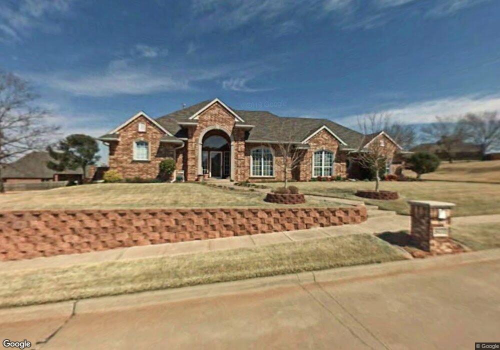
801 The Cliffs Dr Purcell, OK 73080
Estimated Value: $371,000 - $447,000
3
Beds
3
Baths
2,396
Sq Ft
$165/Sq Ft
Est. Value
About This Home
This home is located at 801 The Cliffs Dr, Purcell, OK 73080 and is currently estimated at $396,046, approximately $165 per square foot. 801 The Cliffs Dr is a home located in McClain County with nearby schools including Purcell Elementary School, Purcell Intermediate School, and Purcell Junior High School.
Ownership History
Date
Name
Owned For
Owner Type
Purchase Details
Closed on
Feb 15, 2018
Sold by
Davidson Terry Keith and Davidson Sherry Lyn
Bought by
The Davidson Family Revocable Trust
Current Estimated Value
Purchase Details
Closed on
Sep 29, 2006
Sold by
Don Cies Development Inc
Bought by
Davidson Terry K and Davidson Sherry L
Purchase Details
Closed on
Jan 26, 1998
Sold by
The Cliffs Group
Bought by
Davidson Terry and Davidson Sherry
Create a Home Valuation Report for This Property
The Home Valuation Report is an in-depth analysis detailing your home's value as well as a comparison with similar homes in the area
Home Values in the Area
Average Home Value in this Area
Purchase History
| Date | Buyer | Sale Price | Title Company |
|---|---|---|---|
| The Davidson Family Revocable Trust | -- | None Available | |
| Davidson Terry K | $30,000 | None Available | |
| Davidson Terry | $40,000 | -- |
Source: Public Records
Tax History
| Year | Tax Paid | Tax Assessment Tax Assessment Total Assessment is a certain percentage of the fair market value that is determined by local assessors to be the total taxable value of land and additions on the property. | Land | Improvement |
|---|---|---|---|---|
| 2025 | $3,925 | $37,133 | $8,413 | $28,720 |
| 2024 | $3,808 | $36,051 | $8,168 | $27,883 |
| 2023 | $3,808 | $35,001 | $7,984 | $27,017 |
| 2022 | $3,541 | $33,982 | $7,794 | $26,188 |
| 2021 | $3,478 | $32,993 | $7,794 | $25,199 |
| 2020 | $3,444 | $32,993 | $7,794 | $25,199 |
| 2019 | $3,525 | $33,163 | $7,767 | $25,396 |
| 2018 | $3,390 | $32,198 | $7,598 | $24,600 |
| 2017 | $2,779 | $27,171 | $2,617 | $24,554 |
| 2016 | $2,727 | $26,379 | $2,633 | $23,746 |
| 2015 | $2,687 | $25,611 | $2,631 | $22,980 |
| 2014 | $2,580 | $24,865 | $2,445 | $22,420 |
Source: Public Records
Map
Nearby Homes
- 0 Eagles Nest Unit OKC1218062
- 817 Carrie Ct
- 0 Bluestem Ct
- 2915 Ridgecrest Dr
- 2907 Ridgecrest Dr
- 0 Sage Ct
- 3127 Northridge Dr
- 1027 Woodbrook Blvd
- 3534 N 9th Ave
- 2115 N 9th Ave
- 1022 Timberlake Dr
- 2023 N 9th Ave
- 23465 State Highway 74
- 1733 Anthony Ave
- 1707 N 4th Ave
- 801 Bonnie Ave
- 23193 Grandview Ln
- 22453 State Highway 74
- 22455 State Highway 74
- 0000 N Green Ave
- 805 The Cliffs Dr
- 800 The Cliffs Dr
- 0 N The Cliffs Dr
- 3082 Ridgecrest Dr
- 3080 Ridgecrest Dr
- 0 Eagles Nest Unit 1160032
- 0 Eagles Nest Unit 1152121
- 0 Eagles Nest Unit 1104265
- 0 Eagles Nest Unit 1070755
- 0 Eagles Nest Unit 1029006
- 3087 Thousand Oaks Dr
- 0 N 9th St Unit 1029009
- 3088 Eagles Nest
- 808 Carrie Ct
- 804 Carrie Ct
- 812 Carrie Ct
- 0 Carrie Ct
- 10 Carrie Ct
- 3077 Ridgecrest Dr
- 3090 Eagles Nest
Your Personal Tour Guide
Ask me questions while you tour the home.