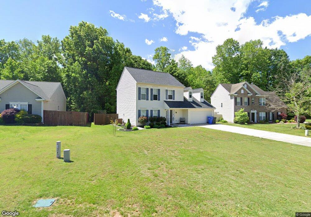
801 Trace Ct Troutman, NC 28166
Estimated Value: $312,000 - $417,000
3
Beds
3
Baths
2,279
Sq Ft
$157/Sq Ft
Est. Value
About This Home
This home is located at 801 Trace Ct, Troutman, NC 28166 and is currently estimated at $357,756, approximately $156 per square foot. 801 Trace Ct is a home located in Iredell County with nearby schools including Troutman Elementary School, Troutman Middle School, and South Iredell High School.
Ownership History
Date
Name
Owned For
Owner Type
Purchase Details
Closed on
May 13, 2013
Sold by
Howard David M and Howard Tonya R
Bought by
Burleyson Leslie D and Burleyson Anthony M
Current Estimated Value
Home Financials for this Owner
Home Financials are based on the most recent Mortgage that was taken out on this home.
Original Mortgage
$148,500
Outstanding Balance
$108,786
Interest Rate
4.25%
Mortgage Type
Adjustable Rate Mortgage/ARM
Estimated Equity
$248,970
Create a Home Valuation Report for This Property
The Home Valuation Report is an in-depth analysis detailing your home's value as well as a comparison with similar homes in the area
Home Values in the Area
Average Home Value in this Area
Purchase History
| Date | Buyer | Sale Price | Title Company |
|---|---|---|---|
| Burleyson Leslie D | $148,500 | None Available |
Source: Public Records
Mortgage History
| Date | Status | Borrower | Loan Amount |
|---|---|---|---|
| Open | Burleyson Leslie D | $148,500 |
Source: Public Records
Tax History Compared to Growth
Tax History
| Year | Tax Paid | Tax Assessment Tax Assessment Total Assessment is a certain percentage of the fair market value that is determined by local assessors to be the total taxable value of land and additions on the property. | Land | Improvement |
|---|---|---|---|---|
| 2024 | $3,128 | $278,940 | $45,000 | $233,940 |
| 2023 | $3,128 | $278,940 | $45,000 | $233,940 |
| 2022 | $2,185 | $183,560 | $31,000 | $152,560 |
| 2021 | $2,162 | $183,560 | $31,000 | $152,560 |
| 2020 | $2,162 | $183,560 | $31,000 | $152,560 |
| 2019 | $2,116 | $183,560 | $31,000 | $152,560 |
| 2018 | $1,866 | $162,340 | $25,500 | $136,840 |
| 2017 | $1,866 | $162,340 | $25,500 | $136,840 |
| 2016 | $1,866 | $162,340 | $25,500 | $136,840 |
| 2015 | $1,785 | $162,340 | $25,500 | $136,840 |
| 2014 | $1,786 | $170,000 | $25,500 | $144,500 |
Source: Public Records
Map
Nearby Homes
- Bristol Plan at Brookside
- Arlington Plan at Brookside
- Clifton Plan at Brookside
- Claiborne Plan at Brookside
- Azalea Plan at Brookside
- 505 York Rd
- 502 York Rd
- 678 Wagner St
- 121 S Shayna Rd
- 119 S Shayna Rd
- 130 S Shayna Rd
- 132 Quail Haven Dr
- 131 Quail Haven Dr
- 145 Quail Haven Dr
- 125 Noah Ln
- 118 N Hill Ln
- 124 N Shayna Rd
- 124 Ari Ave
- 126 Ari Ave
- Hanover Plan at Calvin Creek
- 751 Georgie St
- 805 Trace Ct
- 747 Georgie St
- 809 Trace Ct
- 736 Georgie St
- 743 Georgie St
- 743 Georgie St Unit 35
- 812 Trace Ct
- 759 Georgie St
- 759 Georgie St Unit 28
- 732 Georgie St
- 740 Georgie St
- 728 Georgie St
- 763 Georgie St
- 744 Georgie St
- 742 Perth Rd
- 746 Perth Rd
- 752 Perth Rd
- 724 Georgie St
- 735 Georgie St