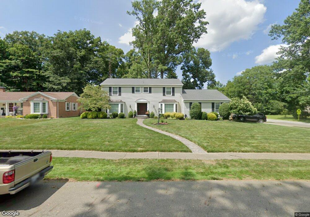
801 W Milton St Alliance, OH 44601
Estimated Value: $302,000 - $368,000
4
Beds
3
Baths
2,691
Sq Ft
$121/Sq Ft
Est. Value
About This Home
This home is located at 801 W Milton St, Alliance, OH 44601 and is currently estimated at $324,565, approximately $120 per square foot. 801 W Milton St is a home located in Stark County with nearby schools including Alliance Elementary School at Rockhill, Alliance Intermediate School at Northside, and Alliance Middle School.
Ownership History
Date
Name
Owned For
Owner Type
Purchase Details
Closed on
Aug 20, 2004
Sold by
Grove Carol Jean and Grove Charles David
Bought by
Heddleston Patrick D and Heddleston Lori L
Current Estimated Value
Home Financials for this Owner
Home Financials are based on the most recent Mortgage that was taken out on this home.
Original Mortgage
$175,750
Interest Rate
6.08%
Mortgage Type
Credit Line Revolving
Create a Home Valuation Report for This Property
The Home Valuation Report is an in-depth analysis detailing your home's value as well as a comparison with similar homes in the area
Home Values in the Area
Average Home Value in this Area
Purchase History
| Date | Buyer | Sale Price | Title Company |
|---|---|---|---|
| Heddleston Patrick D | $185,000 | Union Title Co |
Source: Public Records
Mortgage History
| Date | Status | Borrower | Loan Amount |
|---|---|---|---|
| Closed | Heddleston Patrick D | $175,750 |
Source: Public Records
Tax History Compared to Growth
Tax History
| Year | Tax Paid | Tax Assessment Tax Assessment Total Assessment is a certain percentage of the fair market value that is determined by local assessors to be the total taxable value of land and additions on the property. | Land | Improvement |
|---|---|---|---|---|
| 2025 | -- | $96,540 | $25,730 | $70,810 |
| 2024 | -- | $96,540 | $25,730 | $70,810 |
| 2023 | $3,086 | $76,790 | $20,160 | $56,630 |
| 2022 | $3,106 | $76,790 | $20,160 | $56,630 |
| 2021 | $3,082 | $76,790 | $20,160 | $56,630 |
| 2020 | $2,851 | $65,770 | $17,540 | $48,230 |
| 2019 | $2,811 | $65,770 | $17,540 | $48,230 |
| 2018 | $2,824 | $65,770 | $17,540 | $48,230 |
| 2017 | $2,621 | $60,070 | $14,670 | $45,400 |
| 2016 | $2,643 | $60,070 | $14,670 | $45,400 |
| 2015 | $2,666 | $60,070 | $14,670 | $45,400 |
| 2014 | $630 | $56,420 | $13,790 | $42,630 |
| 2013 | $1,312 | $56,420 | $13,790 | $42,630 |
Source: Public Records
Map
Nearby Homes
- 2839 S Rockhill Ave
- 1059 Oakwood Dr
- 3101 Ridgehill Ave
- 2112 Blenheim Ave
- 884 W College Rd
- 2220 Western Ave
- 2050 Federal Ave
- 1515 S Rockhill Ave
- 236 E Milton St
- 1325 W Beech St
- 277 W Carol St
- 112 E College St
- 0 Winchester St
- 0 Winchester St Unit 5162877
- 317 E State St
- 1321 Parkway Blvd
- 2218 S Freedom Ave
- 555 E Milton St
- 1475 Chatauqua Ct
- 1201 Overlook Dr
- 821 W Milton St
- 800 W Milton St
- 820 W Milton St
- 861 W Milton St
- 2708 S Rockhill Ave
- 840 W Milton St
- 2611 Ridgewood Ave
- 2557 Ridgewood Ave
- 2629 Ridgewood Ave
- 2541 Ridgewood Ave
- 2639 Ridgewood Ave
- 2525 Ridgewood Ave
- 921 W Milton St
- 860 W Milton St
- 2705 Ridgewood Ave
- 801 Oakwood Dr
- 2505 Ridgewood Ave
- 2717 Ridgewood Ave
- 811 Oakwood Dr
- 821 Oakwood Dr