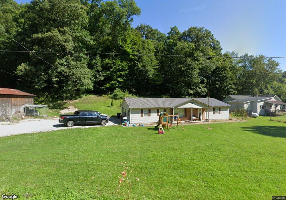
8012 State Route 78 Glouster, OH 45732
Estimated Value: $201,834 - $280,000
2
Beds
2
Baths
1,848
Sq Ft
$131/Sq Ft
Est. Value
About This Home
This home is located at 8012 State Route 78, Glouster, OH 45732 and is currently estimated at $242,959, approximately $131 per square foot. 8012 State Route 78 is a home located in Athens County with nearby schools including Trimble Elementary School, Trimble Middle School, and Trimble High School.
Ownership History
Date
Name
Owned For
Owner Type
Purchase Details
Closed on
Jan 8, 2015
Sold by
Richmond Jesse Ryan and Richmond Brooke A
Bought by
Russell Taylor L
Current Estimated Value
Home Financials for this Owner
Home Financials are based on the most recent Mortgage that was taken out on this home.
Original Mortgage
$77,330
Outstanding Balance
$59,231
Interest Rate
3.84%
Mortgage Type
FHA
Estimated Equity
$183,728
Purchase Details
Closed on
Jan 22, 2010
Sold by
Waldeck Gilbert Andrew and Estate Of Drema R Waldeck
Bought by
Richmond Jesse Ryan
Home Financials for this Owner
Home Financials are based on the most recent Mortgage that was taken out on this home.
Original Mortgage
$54,985
Interest Rate
4.87%
Mortgage Type
FHA
Create a Home Valuation Report for This Property
The Home Valuation Report is an in-depth analysis detailing your home's value as well as a comparison with similar homes in the area
Home Values in the Area
Average Home Value in this Area
Purchase History
| Date | Buyer | Sale Price | Title Company |
|---|---|---|---|
| Russell Taylor L | $80,000 | Secure Title Services | |
| Richmond Jesse Ryan | $56,000 | Secure Title Agency | |
| Richmond Jesse Ryan | $56,000 | Secure Title Services |
Source: Public Records
Mortgage History
| Date | Status | Borrower | Loan Amount |
|---|---|---|---|
| Open | Russell Taylor L | $77,330 | |
| Previous Owner | Richmond Jesse Ryan | $54,985 |
Source: Public Records
Tax History Compared to Growth
Tax History
| Year | Tax Paid | Tax Assessment Tax Assessment Total Assessment is a certain percentage of the fair market value that is determined by local assessors to be the total taxable value of land and additions on the property. | Land | Improvement |
|---|---|---|---|---|
| 2024 | $1,868 | $45,030 | $5,930 | $39,100 |
| 2023 | $1,834 | $45,030 | $5,930 | $39,100 |
| 2022 | $1,526 | $36,030 | $4,940 | $31,090 |
| 2021 | $1,563 | $36,030 | $4,940 | $31,090 |
| 2020 | $1,564 | $36,030 | $4,940 | $31,090 |
| 2019 | $1,431 | $32,950 | $4,230 | $28,720 |
| 2018 | $1,580 | $32,950 | $4,230 | $28,720 |
| 2017 | $2,197 | $32,950 | $4,230 | $28,720 |
| 2016 | $1,552 | $32,520 | $3,840 | $28,680 |
| 2015 | $2,350 | $35,540 | $4,400 | $31,140 |
| 2014 | $2,350 | $35,540 | $4,400 | $31,140 |
| 2013 | $2,101 | $36,310 | $3,770 | $32,540 |
Source: Public Records
Map
Nearby Homes
- 31 Locust St
- 140 Sycamore St
- 13899 Locust St
- 45747 Long St
- 33 S High St
- 0 Greens Run Rd
- 10271 Antle Orchard Rd
- 93 Main St
- 88 Front St
- 19477 Center
- 19500 Lake Dr
- 6 E Main St
- 0 Red Rock Rd
- 18242 Ohio 13
- 0 Oregon Ridge Rd Unit 23564746
- 11789 Congress Run Rd
- 0 Marietta Ave
- 17795 N Akron Ave
- 44438 Carbon Hill Buchtel Rd
- Lambert Rd
- 21121 Dean Rd
- 7975 State Route 78
- 21185 Dean Rd
- 21133 Dean Rd
- 8087 Hunterdon Rd
- 8144 Hunterdon Rd
- 8182 State Route 78
- 8072 Hunterdon Rd
- 8196 State Route 78
- 7810 Ohio 78
- 8219 Hunterdon Rd
- 8057 Hunterdon Rd
- 8221 Hunterdon Rd
- 8234 Ohio 78
- 8234 State Route 78
- 8045 Hunterdon Rd
- 8062 Hunterdon Rd
- 8250 Hunterdon Rd
- 8315 Hunterdon Rd
- 8320 Hunterdon Rd