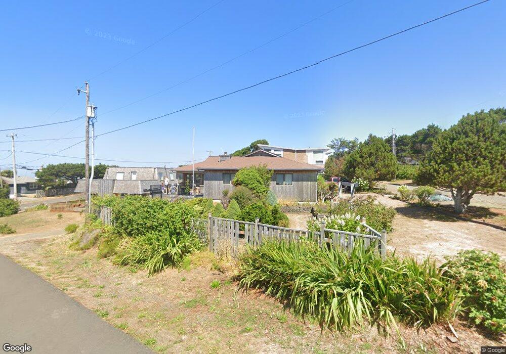
80146 Kent Rd Arch Cape, OR 97102
Estimated Value: $917,000 - $1,304,000
3
Beds
2
Baths
1,656
Sq Ft
$658/Sq Ft
Est. Value
About This Home
This home is located at 80146 Kent Rd, Arch Cape, OR 97102 and is currently estimated at $1,090,408, approximately $658 per square foot. 80146 Kent Rd is a home located in Clatsop County with nearby schools including Seaside High School, The Cannon Beach Academy, and Fire Mountain School.
Ownership History
Date
Name
Owned For
Owner Type
Purchase Details
Closed on
Feb 17, 2021
Sold by
Hieronimus Henry M and Hieronimus Rlt Henry M
Bought by
Hieronimus Henry M and Manning Loreli Susan
Current Estimated Value
Purchase Details
Closed on
Sep 16, 2016
Sold by
Rice William C
Bought by
William C Rice Trust
Purchase Details
Closed on
Feb 3, 2016
Sold by
Hieronimus Henry M
Bought by
Hieronimus Henry M and Henry M Hieronimus Revocable Living Trus
Create a Home Valuation Report for This Property
The Home Valuation Report is an in-depth analysis detailing your home's value as well as a comparison with similar homes in the area
Home Values in the Area
Average Home Value in this Area
Purchase History
| Date | Buyer | Sale Price | Title Company |
|---|---|---|---|
| Hieronimus Henry M | -- | None Available | |
| William C Rice Trust | -- | None Available | |
| Hieronimus Henry M | -- | None Available |
Source: Public Records
Tax History Compared to Growth
Tax History
| Year | Tax Paid | Tax Assessment Tax Assessment Total Assessment is a certain percentage of the fair market value that is determined by local assessors to be the total taxable value of land and additions on the property. | Land | Improvement |
|---|---|---|---|---|
| 2024 | $6,610 | $480,255 | -- | -- |
| 2023 | $6,007 | $466,268 | $0 | $0 |
| 2022 | $5,866 | $452,688 | $0 | $0 |
| 2021 | $5,764 | $439,504 | $0 | $0 |
| 2020 | $5,629 | $426,704 | $0 | $0 |
| 2019 | $5,312 | $414,277 | $0 | $0 |
| 2018 | $5,073 | $402,212 | $0 | $0 |
| 2017 | $4,911 | $390,498 | $0 | $0 |
| 2016 | $4,239 | $379,125 | $159,949 | $219,176 |
| 2015 | $4,142 | $368,084 | $155,291 | $212,793 |
| 2014 | $4,056 | $357,364 | $0 | $0 |
| 2013 | -- | $346,956 | $0 | $0 |
Source: Public Records
Map
Nearby Homes
- 0 Big Cedar Ct Unit Lot 13 25-380
- 0 Big Cedar Ct Unit 25-710
- 0 Big Cedar Ct Unit Lot 13 422540938
- 79906 Greenleaf Rd
- 0 Greenleaf Rd
- 0 Tide Ave
- 80444 Carnahan Rd
- 79519 Ray Brown Rd
- 31911 Clatsop Ln
- 0 Clatsop Ln Unit 25-693
- 0 Clatsop Ln Unit Lot 408 662114611
- 79274 Ray Brown Rd
- 32796 Picture Windows Ln
- 4463 Pacific Ave
- 116 W Watts Way
- 223 W Kenai St
- 286 W Kenai St
- 4072 S Hemlock St
- 80152 Kent Rd
- 80149 Pacific Rd
- 80157 Pacific Rd
- 80147 Kent Rd
- 31965 Donlon Ln
- 80153 Kent Rd
- 31946 Donlon Ln
- 31952 Donlon Ln
- 31970 Shanks Ln
- 80131 Pacific Rd
- 31948 Shanks Ln
- 31975 Donlon Ln
- 80156 Pacific Rd
- 80142 Pacific Rd
- 31962 Donlon Ln
- 31968 Shanks Ln
- 80162 Pacific Rd
- 80150 Pacific Rd
- 80132 Pacific Rd
- 80166 Pacific Rd