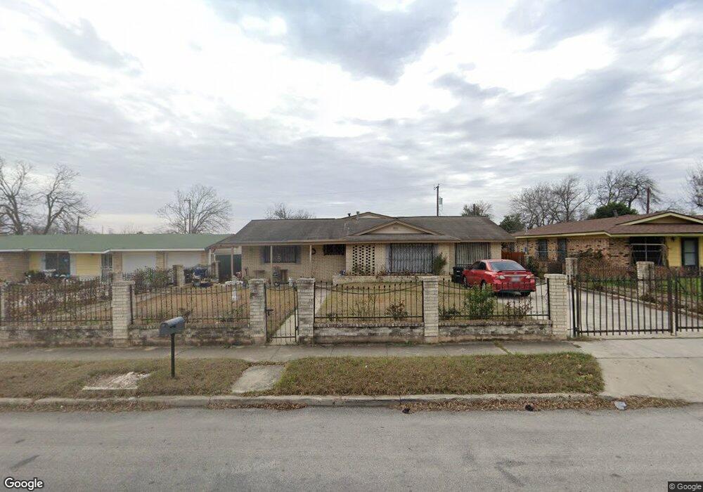
8018 Bronco Ln San Antonio, TX 78227
Lackland Terrace NeighborhoodEstimated Value: $222,000 - $242,000
3
Beds
2
Baths
1,912
Sq Ft
$121/Sq Ft
Est. Value
About This Home
This home is located at 8018 Bronco Ln, San Antonio, TX 78227 and is currently estimated at $230,721, approximately $120 per square foot. 8018 Bronco Ln is a home located in Bexar County with nearby schools including Westwood Terrace Elementary School, Jones Middle School, and Jay High School.
Ownership History
Date
Name
Owned For
Owner Type
Purchase Details
Closed on
Aug 19, 2015
Sold by
Carillo Irene C
Bought by
Carrillo Irene C
Current Estimated Value
Home Financials for this Owner
Home Financials are based on the most recent Mortgage that was taken out on this home.
Original Mortgage
$65,000
Interest Rate
4.12%
Mortgage Type
New Conventional
Purchase Details
Closed on
Sep 1, 1993
Sold by
Delgado Linda Theresa
Bought by
Carrillo Manuel
Create a Home Valuation Report for This Property
The Home Valuation Report is an in-depth analysis detailing your home's value as well as a comparison with similar homes in the area
Home Values in the Area
Average Home Value in this Area
Purchase History
| Date | Buyer | Sale Price | Title Company |
|---|---|---|---|
| Carrillo Irene C | -- | Title 365 | |
| Carrillo Manuel | -- | -- |
Source: Public Records
Mortgage History
| Date | Status | Borrower | Loan Amount |
|---|---|---|---|
| Closed | Carrillo Irene C | $65,000 |
Source: Public Records
Tax History Compared to Growth
Tax History
| Year | Tax Paid | Tax Assessment Tax Assessment Total Assessment is a certain percentage of the fair market value that is determined by local assessors to be the total taxable value of land and additions on the property. | Land | Improvement |
|---|---|---|---|---|
| 2025 | $1,072 | $227,000 | $43,140 | $183,860 |
| 2024 | $1,072 | $227,000 | $43,140 | $183,860 |
| 2023 | $1,072 | $220,000 | $43,140 | $176,860 |
| 2022 | $4,951 | $200,000 | $35,980 | $164,020 |
| 2021 | $4,796 | $187,077 | $32,710 | $159,450 |
| 2020 | $4,437 | $170,070 | $22,540 | $161,370 |
| 2019 | $4,142 | $154,609 | $17,450 | $161,370 |
| 2018 | $3,768 | $140,554 | $17,450 | $132,800 |
| 2017 | $3,431 | $127,776 | $17,450 | $127,820 |
| 2016 | $3,119 | $116,160 | $17,450 | $107,070 |
| 2015 | $1,506 | $105,600 | $17,450 | $113,140 |
| 2014 | $1,506 | $96,000 | $0 | $0 |
Source: Public Records
Map
Nearby Homes
- 8007 Rimfire Dr
- 8019 Riata Ave
- 218 Stimmel St
- 7919 Riata Ave
- 7903 Quirt St
- 2507 Spur Dr
- 8438 Adams Hill Dr
- 7626 Westfield Blvd
- 7518 Westshire Dr
- 7526 Gallop Dr
- 7618 Stagecoach Dr
- 323 Stimmel St
- 7518 Buckskin
- 7810 Hobble St
- 7431 Westshire Dr
- 302 Zabra St
- 303 Revlon Dr
- 241 Altitude St
- 7430 Stagecoach Ln
- 7406 Westville Dr
- 8022 Bronco Ln
- 8014 Bronco Ln
- 8015 Pistol Ln
- 8010 Bronco Ln
- 8026 Bronco Ln
- 8017 Pistol Ln
- 8013 Pistol Ln
- 8019 Bronco Ln
- 8006 Bronco Ln
- 2123 Harness Ln
- 8015 Bronco Ln
- 8011 Pistol Ln
- 8002 Bronco Ln
- 8019 Pistol Ln
- 8011 Bronco Ln
- 8007 Bronco Ln
- 8023 Pistol Ln
- 7927 Campfire Ln
- 8027 Campfire Ln
- 2119 Harness Ln