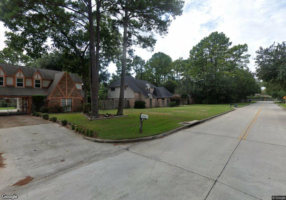
8019 Theisswood Rd Spring, TX 77379
Estimated Value: $337,000 - $348,926
4
Beds
3
Baths
2,561
Sq Ft
$134/Sq Ft
Est. Value
About This Home
This home is located at 8019 Theisswood Rd, Spring, TX 77379 and is currently estimated at $342,982, approximately $133 per square foot. 8019 Theisswood Rd is a home located in Harris County with nearby schools including Theiss Elementary School, Doerre Intermediate School, and Klein High School.
Ownership History
Date
Name
Owned For
Owner Type
Purchase Details
Closed on
Aug 13, 2003
Sold by
Jenner Michael Anthony and Williamson Elaine
Bought by
Edmiston Baron K
Current Estimated Value
Home Financials for this Owner
Home Financials are based on the most recent Mortgage that was taken out on this home.
Original Mortgage
$137,700
Outstanding Balance
$59,444
Interest Rate
5.35%
Mortgage Type
Purchase Money Mortgage
Estimated Equity
$283,538
Purchase Details
Closed on
Apr 21, 1997
Sold by
Finch Dennis Edward and Finch Huguette Marie
Bought by
Stabenau Jenner Michael A and Stabenau Jenner Rose
Home Financials for this Owner
Home Financials are based on the most recent Mortgage that was taken out on this home.
Original Mortgage
$95,600
Interest Rate
7.82%
Create a Home Valuation Report for This Property
The Home Valuation Report is an in-depth analysis detailing your home's value as well as a comparison with similar homes in the area
Home Values in the Area
Average Home Value in this Area
Purchase History
| Date | Buyer | Sale Price | Title Company |
|---|---|---|---|
| Edmiston Baron K | -- | Commonwealth Land Title Co | |
| Stabenau Jenner Michael A | -- | Charter Title Company |
Source: Public Records
Mortgage History
| Date | Status | Borrower | Loan Amount |
|---|---|---|---|
| Open | Edmiston Baron K | $137,700 | |
| Previous Owner | Stabenau Jenner Michael A | $95,600 |
Source: Public Records
Tax History Compared to Growth
Tax History
| Year | Tax Paid | Tax Assessment Tax Assessment Total Assessment is a certain percentage of the fair market value that is determined by local assessors to be the total taxable value of land and additions on the property. | Land | Improvement |
|---|---|---|---|---|
| 2025 | $3,866 | $322,600 | $26,842 | $295,758 |
| 2024 | $3,866 | $322,600 | $26,842 | $295,758 |
| 2023 | $3,866 | $293,453 | $26,842 | $266,611 |
| 2022 | $4,646 | $213,200 | $26,842 | $186,358 |
| 2021 | $4,804 | $206,932 | $26,842 | $180,090 |
| 2020 | $4,571 | $189,000 | $26,842 | $162,158 |
| 2019 | $4,741 | $189,000 | $26,842 | $162,158 |
| 2018 | $2,345 | $189,000 | $26,842 | $162,158 |
| 2017 | $4,414 | $202,557 | $26,842 | $175,715 |
| 2016 | $4,013 | $159,697 | $16,776 | $142,921 |
| 2015 | $3,617 | $159,697 | $16,776 | $142,921 |
| 2014 | $3,617 | $159,697 | $16,776 | $142,921 |
Source: Public Records
Map
Nearby Homes
- 8014 Beaufort Dr
- 8019 Beaufort Dr
- 8011 Beaufort Dr
- 17811 Running Brook Ln
- 7906 Beaufort Dr
- 7907 Aleta Dr
- 7803 Theisswood Rd
- 8131 Theisswood Rd
- 8002 Oxfordshire Dr
- 7607 Theisswood Rd
- 7614 Theisswood Rd
- 7610 Theisswood Rd
- 17902 Fernbluff Dr
- 7711 Oxfordshire Dr
- 8114 Hidden Trail Ln
- 18014 Hampton Oak Dr
- 7930 Tizerton Ct
- 7531 Ralick Ct
- 8035 White Marsh Ct
- 8011 Liberty Elm Ct
- 8015 Theisswood Rd
- 8023 Theisswood Rd
- 8010 Beaufort Dr
- 17803 Running Brook Ln
- 8011 Theisswood Rd
- 8022 Theisswood Rd
- 8006 Beaufort Dr
- 17807 Running Brook Ln
- 17802 Running Brook Ln
- 17726 Theiss Mail Route Rd
- 8007 Theisswood Rd
- 17722 Theiss Mail Route Rd
- 8002 Beaufort Dr
- 17806 Running Brook Ln
- 17730 Theiss Mail Route Rd
- 8015 Beaufort Dr
- 17718 Theiss Mail Route Rd
- 8007 Beaufort Dr
- 17714 Theiss Mail Route Rd
- 17803 Comoro Ln