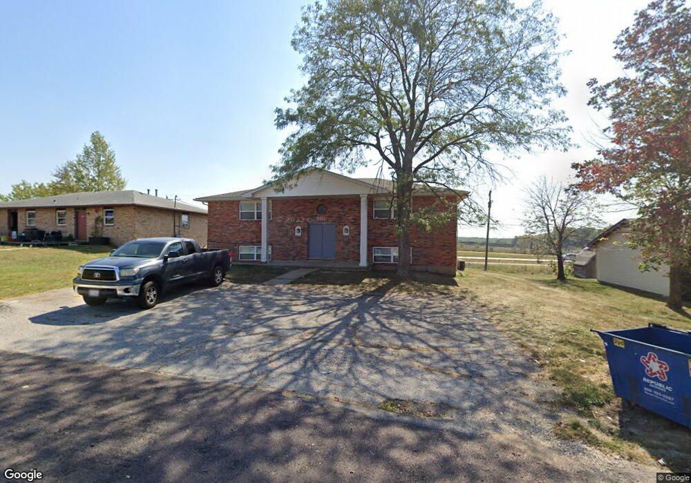
802 Demaret Dr Unit A,B,C,D Columbia, MO 65202
Estimated Value: $222,000 - $321,000
8
Beds
4
Baths
3,200
Sq Ft
$82/Sq Ft
Est. Value
About This Home
This home is located at 802 Demaret Dr Unit A,B,C,D, Columbia, MO 65202 and is currently estimated at $263,000, approximately $82 per square foot. 802 Demaret Dr Unit A,B,C,D is a home located in Boone County with nearby schools including Eliot Battle Elementary School, John B. Lange Middle School, and Muriel W. Battle High School.
Ownership History
Date
Name
Owned For
Owner Type
Purchase Details
Closed on
Mar 1, 2017
Sold by
802 Demaret Llc
Bought by
A W P Properties Llc
Current Estimated Value
Purchase Details
Closed on
Jan 5, 2012
Sold by
Livingston Jon K
Bought by
802 Demaret Llc
Purchase Details
Closed on
Aug 16, 2011
Sold by
Decker David G and Decker Mariam A
Bought by
Livingston Jon
Create a Home Valuation Report for This Property
The Home Valuation Report is an in-depth analysis detailing your home's value as well as a comparison with similar homes in the area
Home Values in the Area
Average Home Value in this Area
Purchase History
| Date | Buyer | Sale Price | Title Company |
|---|---|---|---|
| A W P Properties Llc | -- | Boone Central Title Co | |
| 802 Demaret Llc | -- | None Available | |
| Livingston Jon | -- | Boone Central Title Company |
Source: Public Records
Tax History Compared to Growth
Tax History
| Year | Tax Paid | Tax Assessment Tax Assessment Total Assessment is a certain percentage of the fair market value that is determined by local assessors to be the total taxable value of land and additions on the property. | Land | Improvement |
|---|---|---|---|---|
| 2025 | $1,616 | $22,344 | $2,869 | $19,475 |
| 2024 | $1,616 | $22,344 | $2,869 | $19,475 |
| 2023 | $1,602 | $22,344 | $2,869 | $19,475 |
| 2022 | $1,601 | $22,344 | $2,869 | $19,475 |
| 2021 | $1,603 | $22,344 | $2,869 | $19,475 |
| 2020 | $1,573 | $20,691 | $2,869 | $17,822 |
| 2019 | $1,573 | $20,691 | $2,869 | $17,822 |
| 2018 | $1,583 | $0 | $0 | $0 |
| 2017 | $1,565 | $20,691 | $2,869 | $17,822 |
| 2016 | $1,562 | $20,691 | $2,869 | $17,822 |
| 2015 | $1,443 | $20,691 | $2,869 | $17,822 |
| 2014 | $1,446 | $20,691 | $2,869 | $17,822 |
Source: Public Records
Map
Nearby Homes
- 6007 E Saint Charles Rd
- 6003 E St Charles Rd
- 1312 N Lake of the Woods Rd
- 1312 N Lake of the Wood
- 1537 N Lake of the Woods Rd
- 300 Searsport Dr
- 5800 Oswago Cir
- 5802 Islip Dr
- 6077 E Locust Grove Dr
- 5904 Freeport Way
- 5607 Murfreesboro Dr
- 5806 Freeport Way
- LOT 22 Murfreesboro Dr
- 5506 Murfreesboro Dr
- 1887 Waterfront Dr N Unit F
- 5724 Black Gum Ct
- 1710 Kassem Dr
- 0 E Richland Rd
- 1999 Waterfront Dr N Unit G
- 1999 Waterfront Dr N Unit H
- 802 Demaret Dr
- 804 Demaret Dr
- 800 Demaret Dr
- 806 Demaret Dr
- 219 Snead Dr
- 219 Snead Dr Unit 4
- 758 Demaret Dr
- 765 Demaret Dr
- 215 Snead Dr
- 756 Demaret Dr
- 757 Demaret Dr
- 100 Sanders Ct
- 755 Demaret Dr
- 754 Demaret Dr
- 214 Snead Dr
- 211 Snead Dr
- 753 Demaret Dr
- 212 Snead Dr
- 752 Demaret Dr
- 752 Demaret Dr Unit 3