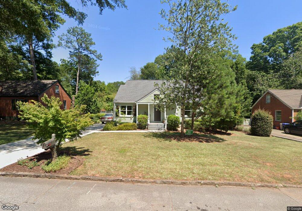
802 Derrydown Way Decatur, GA 30030
Winnona Park Historic District NeighborhoodEstimated Value: $565,292 - $664,000
3
Beds
2
Baths
1,973
Sq Ft
$321/Sq Ft
Est. Value
About This Home
This home is located at 802 Derrydown Way, Decatur, GA 30030 and is currently estimated at $632,573, approximately $320 per square foot. 802 Derrydown Way is a home located in DeKalb County with nearby schools including Winnona Park Elementary School, Talley Street Elementary School, and Beacon Hill Middle School.
Ownership History
Date
Name
Owned For
Owner Type
Purchase Details
Closed on
Aug 23, 2024
Sold by
Gibbons Scott P
Bought by
Gibbons Scott P and Gibbons Amy S
Current Estimated Value
Purchase Details
Closed on
Jul 28, 1999
Sold by
Sibert Olin D
Bought by
Gibbons Scott P and Gibbons Amy S
Home Financials for this Owner
Home Financials are based on the most recent Mortgage that was taken out on this home.
Original Mortgage
$122,050
Interest Rate
7%
Mortgage Type
New Conventional
Create a Home Valuation Report for This Property
The Home Valuation Report is an in-depth analysis detailing your home's value as well as a comparison with similar homes in the area
Home Values in the Area
Average Home Value in this Area
Purchase History
| Date | Buyer | Sale Price | Title Company |
|---|---|---|---|
| Gibbons Scott P | -- | -- | |
| Gibbons Scott P | $118,500 | -- |
Source: Public Records
Mortgage History
| Date | Status | Borrower | Loan Amount |
|---|---|---|---|
| Previous Owner | Gibbons Scott P | $122,050 |
Source: Public Records
Tax History
| Year | Tax Paid | Tax Assessment Tax Assessment Total Assessment is a certain percentage of the fair market value that is determined by local assessors to be the total taxable value of land and additions on the property. | Land | Improvement |
|---|---|---|---|---|
| 2025 | $27 | $222,800 | $98,032 | $124,768 |
| 2024 | $47 | $222,800 | $98,032 | $124,768 |
| 2023 | $47 | $222,800 | $98,032 | $124,768 |
Source: Public Records
Map
Nearby Homes
- 2630 Talley St Unit 326
- 2630 Talley St Unit 3
- 2630 Talley St Unit 106
- 2630 Talley St Unit 228
- 783 Livingstone Place
- 201 New St
- 762 Livingstone Place
- 762 Livingston Place
- 2841 Royal Bluff
- 221 Mountain View St
- 953 Forrest Blvd
- 357 Winnona Dr
- 1112 Ashbury Dr
- 237 Sycamore Place
- 221 Oak Ln
- 1044 N Carter Rd
- 102 Wilburn Ln
- 826 S Columbia Dr
- 130 Glendale Ave
- 223 Avery St
- 798 Derrydown Way
- 808 Derrydown Way
- 814 Derrydown Way
- 803 Derrydown Way
- 799 Derrydown Way
- 809 Derrydown Way
- 820 Derrydown Way
- 795 Derrydown Way
- 815 Derrydown Way
- 821 Derrydown Way
- 826 Derrydown Way
- 775 Arcadia Ave
- 2707 Craigie Ave
- 830 Derrydown Way
- 2717 Royal Bluff
- 769 Arcadia Ave
- 789 Hillmont Ave
- 831 Derrydown Way
- 2715 Craigie Ave
- 785 Hillmont Ave
Your Personal Tour Guide
Ask me questions while you tour the home.