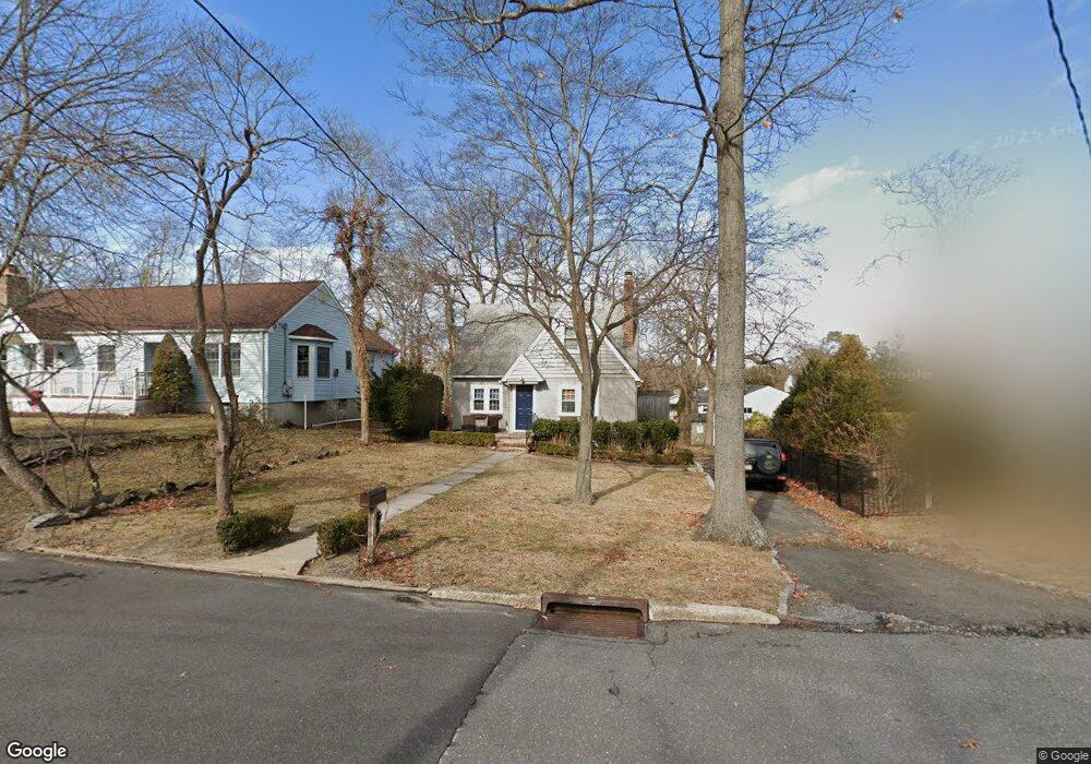
802 Laurel Rd Brielle, NJ 08730
Estimated Value: $702,000 - $874,000
3
Beds
2
Baths
1,075
Sq Ft
$741/Sq Ft
Est. Value
About This Home
This home is located at 802 Laurel Rd, Brielle, NJ 08730 and is currently estimated at $796,680, approximately $741 per square foot. 802 Laurel Rd is a home located in Monmouth County with nearby schools including Brielle Elementary School and The Brookside School.
Ownership History
Date
Name
Owned For
Owner Type
Purchase Details
Closed on
Jan 28, 2004
Sold by
Zipf Kathleen
Bought by
Mcdougald Matthew
Current Estimated Value
Home Financials for this Owner
Home Financials are based on the most recent Mortgage that was taken out on this home.
Original Mortgage
$289,750
Outstanding Balance
$133,907
Interest Rate
5.62%
Estimated Equity
$662,773
Create a Home Valuation Report for This Property
The Home Valuation Report is an in-depth analysis detailing your home's value as well as a comparison with similar homes in the area
Home Values in the Area
Average Home Value in this Area
Purchase History
| Date | Buyer | Sale Price | Title Company |
|---|---|---|---|
| Mcdougald Matthew | $305,000 | -- |
Source: Public Records
Mortgage History
| Date | Status | Borrower | Loan Amount |
|---|---|---|---|
| Open | Mcdougald Matthew | $289,750 |
Source: Public Records
Tax History
| Year | Tax Paid | Tax Assessment Tax Assessment Total Assessment is a certain percentage of the fair market value that is determined by local assessors to be the total taxable value of land and additions on the property. | Land | Improvement |
|---|---|---|---|---|
| 2025 | $7,352 | $631,400 | $482,600 | $148,800 |
| 2024 | $6,793 | $592,400 | $446,300 | $146,100 |
| 2023 | $6,793 | $528,600 | $386,000 | $142,600 |
| 2022 | $6,178 | $467,500 | $336,000 | $131,500 |
| 2021 | $6,178 | $403,000 | $286,000 | $117,000 |
| 2020 | $6,062 | $370,300 | $256,000 | $114,300 |
| 2019 | $5,802 | $359,700 | $246,000 | $113,700 |
| 2018 | $5,791 | $354,400 | $246,000 | $108,400 |
| 2017 | $5,724 | $346,100 | $241,000 | $105,100 |
| 2016 | $5,422 | $328,400 | $226,000 | $102,400 |
| 2015 | $5,551 | $333,800 | $236,000 | $97,800 |
| 2014 | $5,124 | $328,900 | $245,100 | $83,800 |
Source: Public Records
Map
Nearby Homes
- 14 Lebanon Dr
- 139 Lenape Trail
- 308 South St
- 610 Agnes Ave
- 432 Oval Rd
- 612 Union Ave
- 1215 Church St
- 130 Union Ave
- 642 Rankin Rd
- 1041 Oval Rd Unit 5
- 816 Rathjen Rd
- 51-53 Main St
- 323-325 Fisk Ave
- 11 Pearce Ave
- 846 William Dr
- 329 Fisk Ave
- 607 Cherokee Ln
- 65 Pearce Ave
- 2513 Morningstar Rd
- 1533 Harvest Ln
- 803 Holly Rd
- 1133 Bayberry Rd
- 1132 Ivy Rd
- 305 Lenape Trail
- 303 Lenape Trail
- 1139 Bayberry Rd
- 1134 Ivy Rd
- 401 Lenape Trail
- 1130 Bayberry Rd
- 301 Lenape Trail
- 1132 Bayberry Rd
- 1128 Bayberry Rd
- 308 Lenape Trail
- 310 Lenape Trail
- 1134 Bayberry Rd
- 1137 Ivy Rd
- 403 Lenape Trail
- 1140 Ivy Rd
- 304 Lenape Trail
- 2554 Algonkin Trail
Your Personal Tour Guide
Ask me questions while you tour the home.