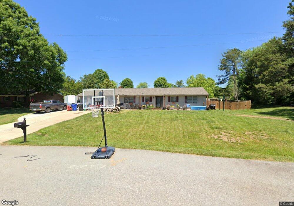
802 Matt Rd Kernersville, NC 27284
Kerners Mill NeighborhoodEstimated Value: $279,000 - $294,000
3
Beds
2
Baths
1,624
Sq Ft
$176/Sq Ft
Est. Value
About This Home
This home is located at 802 Matt Rd, Kernersville, NC 27284 and is currently estimated at $286,595, approximately $176 per square foot. 802 Matt Rd is a home located in Forsyth County with nearby schools including Kernersville Elementary School, Kernersville Middle, and East Forsyth High School.
Ownership History
Date
Name
Owned For
Owner Type
Purchase Details
Closed on
Jun 21, 2017
Sold by
Nosnibor Financial Solution Llc
Bought by
Walker Robert D and Walker Michelle R
Current Estimated Value
Home Financials for this Owner
Home Financials are based on the most recent Mortgage that was taken out on this home.
Original Mortgage
$137,454
Outstanding Balance
$114,333
Interest Rate
4.02%
Mortgage Type
FHA
Estimated Equity
$172,262
Purchase Details
Closed on
Dec 16, 2011
Sold by
Reeves William M
Bought by
Nosnibor Financial Solutions Llc
Purchase Details
Closed on
Mar 1, 2011
Sold by
Reeves Tracy M
Bought by
Reeves William M
Create a Home Valuation Report for This Property
The Home Valuation Report is an in-depth analysis detailing your home's value as well as a comparison with similar homes in the area
Home Values in the Area
Average Home Value in this Area
Purchase History
| Date | Buyer | Sale Price | Title Company |
|---|---|---|---|
| Walker Robert D | $140,000 | None Available | |
| Nosnibor Financial Solutions Llc | $121,000 | None Available | |
| Reeves William M | -- | None Available |
Source: Public Records
Mortgage History
| Date | Status | Borrower | Loan Amount |
|---|---|---|---|
| Open | Walker Robert D | $137,454 |
Source: Public Records
Tax History Compared to Growth
Tax History
| Year | Tax Paid | Tax Assessment Tax Assessment Total Assessment is a certain percentage of the fair market value that is determined by local assessors to be the total taxable value of land and additions on the property. | Land | Improvement |
|---|---|---|---|---|
| 2024 | $2,286 | $176,600 | $44,600 | $132,000 |
| 2023 | $2,286 | $176,600 | $44,600 | $132,000 |
| 2022 | $2,276 | $176,600 | $44,600 | $132,000 |
| 2021 | $2,276 | $176,600 | $44,600 | $132,000 |
| 2020 | $1,993 | $144,800 | $34,100 | $110,700 |
| 2019 | $2,008 | $144,800 | $34,100 | $110,700 |
| 2018 | $1,965 | $144,800 | $34,100 | $110,700 |
| 2016 | $1,608 | $118,069 | $34,125 | $83,944 |
| 2015 | $1,576 | $118,069 | $34,125 | $83,944 |
| 2014 | $1,559 | $118,069 | $34,125 | $83,944 |
Source: Public Records
Map
Nearby Homes
- 420 Sunset Dr
- 304 Irving Park Dr
- 223 Beaucrest Rd
- 104 Tilley's Grove
- 912 Wimberly Way Ct
- 5985 Woodfield Dr
- 218 Westwood Dr
- 703 Oakhurst St
- 5112 Mcconnell Dr Unit 5112
- 206 Westwood Dr
- 112 Baxter St
- 6455 Littlewood Rd
- 6433 Lamshire Rd
- 429 Drayton Park Dr
- 6416 Lamshire Rd
- 1504 Cabot Place
- 1505 Cabot Place
- 311 Salisbury St Unit 46
- 311 Salisbury St Unit 41
- 311 Salisbury St Unit 58