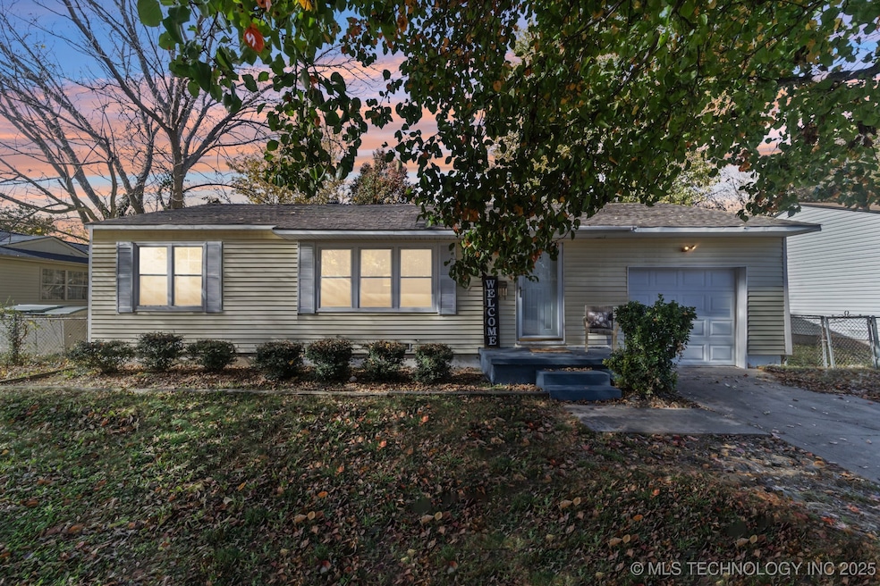
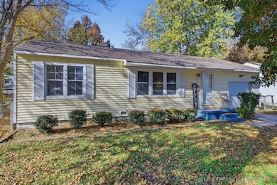
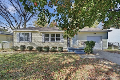
802 N Birch St Owasso, OK 74055
Estimated payment $1,052/month
Highlights
- Mature Trees
- Quartz Countertops
- Covered Patio or Porch
- Barnes Elementary School Rated A-
- No HOA
- 1 Car Attached Garage
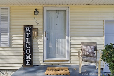
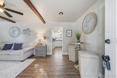
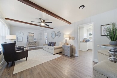
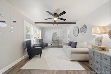
About This Home
Darling Bungalow within walking distance of the Redbud district, Rayola Park, prime dining, future library and many other things that Owasso has to offer! Functional floor plan offers fabulously spacious living room w/beams, bright kitchen w/quartz counters, 3 bedrooms w/large closets! Attached garage! Large fenced backyard is perfect for any outdoor activities and welcomes your pets! Newer windows, new paint - move-in ready! This is also a fantastic investment opportunity!
Listing Agent
Coldwell Banker Select License #150492 Listed on: 11/19/2025

Home Details
Home Type
- Single Family
Est. Annual Taxes
- $1,344
Year Built
- Built in 1956
Lot Details
- 8,370 Sq Ft Lot
- East Facing Home
- Property is Fully Fenced
- Mature Trees
Parking
- 1 Car Attached Garage
Home Design
- Bungalow
- Wood Frame Construction
- Fiberglass Roof
- Vinyl Siding
- Asphalt
Interior Spaces
- 900 Sq Ft Home
- 1-Story Property
- Wired For Data
- Ceiling Fan
- Vinyl Clad Windows
- Insulated Windows
- Vinyl Flooring
- Crawl Space
- Washer and Electric Dryer Hookup
Kitchen
- Oven
- Stove
- Range
- Microwave
- Dishwasher
- Quartz Countertops
- Disposal
Bedrooms and Bathrooms
- 3 Bedrooms
- 1 Full Bathroom
Home Security
- Storm Doors
- Fire and Smoke Detector
Eco-Friendly Details
- Energy-Efficient Windows
Outdoor Features
- Covered Patio or Porch
- Rain Gutters
Schools
- Ator Elementary School
- Owasso High School
Utilities
- Zoned Heating and Cooling
- Heating System Uses Gas
- Gas Water Heater
- High Speed Internet
- Phone Available
- Cable TV Available
Community Details
- No Home Owners Association
- Nichols Heights Subdivision
Map
Home Values in the Area
Average Home Value in this Area
Tax History
| Year | Tax Paid | Tax Assessment Tax Assessment Total Assessment is a certain percentage of the fair market value that is determined by local assessors to be the total taxable value of land and additions on the property. | Land | Improvement |
|---|---|---|---|---|
| 2024 | $1,257 | $12,128 | $2,348 | $9,780 |
| 2023 | $1,257 | $11,550 | $2,432 | $9,118 |
| 2022 | $1,250 | $11,000 | $2,774 | $8,226 |
| 2021 | $1,083 | $9,625 | $2,774 | $6,851 |
| 2020 | $1,083 | $9,625 | $2,774 | $6,851 |
| 2019 | $651 | $5,809 | $1,674 | $4,135 |
| 2018 | $600 | $5,532 | $1,594 | $3,938 |
| 2017 | $356 | $5,269 | $2,009 | $3,260 |
| 2016 | $357 | $5,269 | $2,009 | $3,260 |
| 2015 | $360 | $6,538 | $2,493 | $4,045 |
| 2014 | $363 | $6,538 | $2,493 | $4,045 |
Property History
| Date | Event | Price | List to Sale | Price per Sq Ft |
|---|---|---|---|---|
| 11/19/2025 11/19/25 | For Sale | $178,000 | -- | $198 / Sq Ft |
Purchase History
| Date | Type | Sale Price | Title Company |
|---|---|---|---|
| Warranty Deed | $100,000 | First American Title Ins Co | |
| Warranty Deed | $70,000 | Apex Title & Closing Llc | |
| Warranty Deed | $53,000 | Apex Ttl 7 Closing Svcs Llc | |
| Interfamily Deed Transfer | -- | None Available | |
| Interfamily Deed Transfer | -- | None Available |
Source: MLS Technology
MLS Number: 2547764
APN: 61175-14-30-03160
Disclaimer: Certain information contained herein is derived from information provided by parties other than Homes.com. All information provided is deemed reliable, but is not guaranteed to be accurate and should be independently verified.
![]() IDX information is provided exclusively for personal, non-commercial use, and may not be used for any purpose other than to identify prospective properties consumers may be interested in purchasing.
IDX information is provided exclusively for personal, non-commercial use, and may not be used for any purpose other than to identify prospective properties consumers may be interested in purchasing.
Information is deemed reliable but not guaranteed.
- 801 N Birch St
- 1004 N Ash St
- 1007 N Cedar St
- 104 W 11th St
- 601 N Atlanta St
- 105 W 5th St
- 608 N Carlsbad St
- 8306 N 101st East Ave
- 8402 N 100th East Ave
- 508 N Carlsbad St
- 320 N Cedar St
- 8406 N 100th East Ave
- 1402 N Elm St
- 1408 N Dogwood St
- 1410 N Dogwood St
- 8315 N 99th East Ave
- 11607 E 84th Place N
- 308 N Beaumont St
- 8418 N 117th East Ave
- 408 E 3rd St
- 504 N Dogwood St
- 501-603 N Carlsbad St
- 207 E 3rd St Unit B
- 108 W 2nd St Unit C
- 108 W 2nd St Unit E
- 112 W 2nd St Unit D
- 112 W 2nd St Unit F
- 107 N Atlanta St Unit A
- 105 N Atlanta St Unit A
- 101 N Atlanta St Unit A
- 103 N Atlanta St Unit B
- 103 N Atlanta St Unit A
- 8751 N 97th Ave E
- 11611 E 80th St
- 201 S Main St
- 8748 N Mingo Rd
- 10301 E 92nd St N
- 7903 N 122nd East Ave
- 9715 E 92nd St N
- 7922 N 125th East Ave