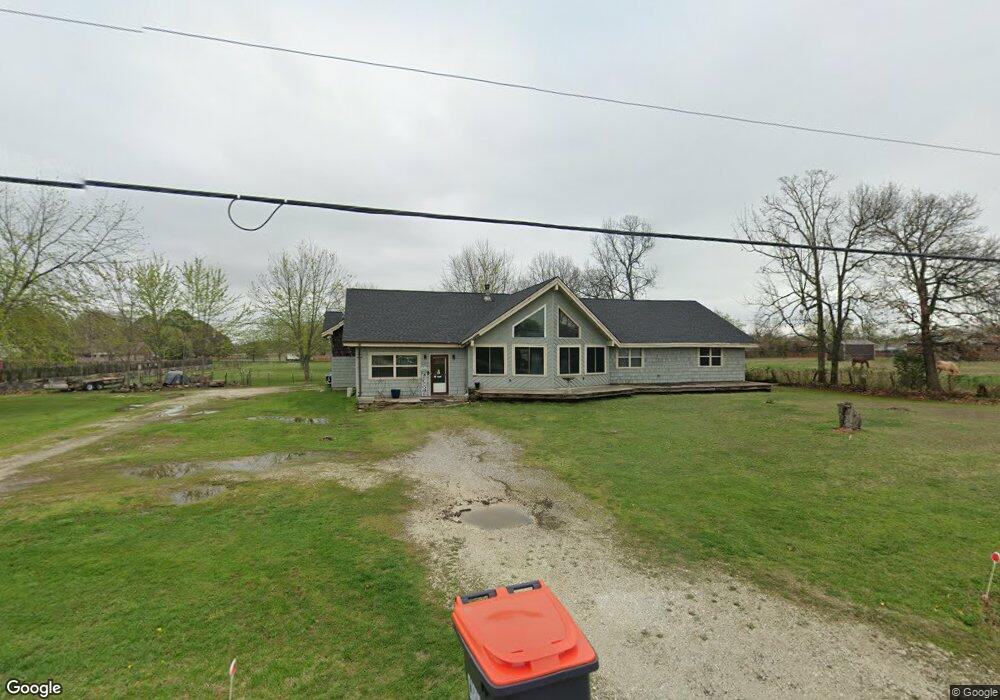
802 N West Ave Lincoln, AR 72744
Estimated Value: $252,000 - $470,000
3
Beds
4
Baths
2,866
Sq Ft
$123/Sq Ft
Est. Value
About This Home
This home is located at 802 N West Ave, Lincoln, AR 72744 and is currently estimated at $353,049, approximately $123 per square foot. 802 N West Ave is a home located in Washington County with nearby schools including Lincoln Elementary School and Lincoln High School.
Ownership History
Date
Name
Owned For
Owner Type
Purchase Details
Closed on
Jul 15, 2004
Sold by
Wilson Charles and Wilson Ruby
Bought by
Graham Carl D and Graham Debra A
Current Estimated Value
Home Financials for this Owner
Home Financials are based on the most recent Mortgage that was taken out on this home.
Original Mortgage
$70,750
Outstanding Balance
$35,187
Interest Rate
6.26%
Mortgage Type
VA
Estimated Equity
$317,862
Purchase Details
Closed on
Jan 31, 1986
Bought by
Wilson Charles and Wilson Ruby
Create a Home Valuation Report for This Property
The Home Valuation Report is an in-depth analysis detailing your home's value as well as a comparison with similar homes in the area
Home Values in the Area
Average Home Value in this Area
Purchase History
| Date | Buyer | Sale Price | Title Company |
|---|---|---|---|
| Graham Carl D | $69,000 | Waco Title Company | |
| Wilson Charles | -- | -- |
Source: Public Records
Mortgage History
| Date | Status | Borrower | Loan Amount |
|---|---|---|---|
| Open | Graham Carl D | $70,750 |
Source: Public Records
Tax History Compared to Growth
Tax History
| Year | Tax Paid | Tax Assessment Tax Assessment Total Assessment is a certain percentage of the fair market value that is determined by local assessors to be the total taxable value of land and additions on the property. | Land | Improvement |
|---|---|---|---|---|
| 2025 | $1,391 | $59,530 | $11,130 | $48,400 |
| 2024 | $1,491 | $59,530 | $11,130 | $48,400 |
| 2023 | $1,506 | $59,530 | $11,130 | $48,400 |
| 2022 | $1,433 | $36,710 | $4,050 | $32,660 |
| 2021 | $1,356 | $36,710 | $4,050 | $32,660 |
| 2020 | $1,278 | $36,710 | $4,050 | $32,660 |
| 2019 | $1,200 | $29,060 | $3,380 | $25,680 |
| 2018 | $1,225 | $29,060 | $3,380 | $25,680 |
| 2017 | $1,211 | $29,060 | $3,380 | $25,680 |
| 2016 | $527 | $16,330 | $3,380 | $12,950 |
| 2015 | $527 | $16,330 | $3,380 | $12,950 |
| 2014 | $487 | $15,580 | $4,030 | $11,550 |
Source: Public Records
Map
Nearby Homes
- 608 W Holt Rd
- 924 West Ave
- 733 Applegate Ln
- 724 Applegate Ln
- 711 Applegate Ln
- 0 Shady St
- 304 Shady St
- 210 N Main Ave
- 204 N Starr Ave
- 511 W North St
- 508 E Holt Rd
- 116 N West Ave
- 523 & 525 W North St
- 108 Short Ave
- 108 N Main Ave
- 313 E North St
- 301 W Bean St
- 0 W Bean St
- 394 E North St
- 17948 W Highway 62
- 808 N West Ave
- 704 N West Ave
- 206 W Holt Rd
- 761 Applegate Ln
- 757 Applegate Ln
- 705 N West Ave
- 767 Applegate Ln
- 753 Applegate Ln
- 749 Applegate Ln
- 897 N Main Ave
- 745 Applegate Ln
- 773 Applegate Ln
- 758 Applegate Ln
- 741 Applegate Ln
- 750 Applegate Ln
- 905 N Main Ave
- 737 Applegate Ln
- 606 N West Ave
- 746 Applegate Ln
- 712 N Main Ave