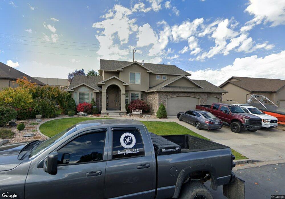
802 S 1100 W Spanish Fork, UT 84660
Estimated Value: $735,000 - $789,899
4
Beds
4
Baths
4,080
Sq Ft
$190/Sq Ft
Est. Value
About This Home
This home is located at 802 S 1100 W, Spanish Fork, UT 84660 and is currently estimated at $774,725, approximately $189 per square foot. 802 S 1100 W is a home located in Utah County with nearby schools including Riverview Elementary School, Spanish Fork Jr High School, and Spanish Fork High School.
Ownership History
Date
Name
Owned For
Owner Type
Purchase Details
Closed on
Dec 10, 2009
Sold by
M & T Bank
Bought by
Rumfield David and Rumfield Rebecca
Current Estimated Value
Home Financials for this Owner
Home Financials are based on the most recent Mortgage that was taken out on this home.
Original Mortgage
$260,101
Outstanding Balance
$170,608
Interest Rate
5.01%
Mortgage Type
FHA
Estimated Equity
$604,117
Purchase Details
Closed on
Jan 22, 2009
Sold by
Christensen Michael L
Bought by
M & T Bank
Purchase Details
Closed on
Jul 19, 2007
Sold by
J C Consulting Llc
Bought by
Christensen Michael L
Home Financials for this Owner
Home Financials are based on the most recent Mortgage that was taken out on this home.
Original Mortgage
$54,000
Interest Rate
6.66%
Mortgage Type
Unknown
Create a Home Valuation Report for This Property
The Home Valuation Report is an in-depth analysis detailing your home's value as well as a comparison with similar homes in the area
Home Values in the Area
Average Home Value in this Area
Purchase History
| Date | Buyer | Sale Price | Title Company |
|---|---|---|---|
| Rumfield David | -- | Provo Land Title Company | |
| M & T Bank | -- | None Available | |
| Christensen Michael L | -- | Merrill Title Company |
Source: Public Records
Mortgage History
| Date | Status | Borrower | Loan Amount |
|---|---|---|---|
| Open | Rumfield David | $260,101 | |
| Previous Owner | Christensen Michael L | $54,000 | |
| Previous Owner | Christensen Michael L | $453,380 |
Source: Public Records
Tax History Compared to Growth
Tax History
| Year | Tax Paid | Tax Assessment Tax Assessment Total Assessment is a certain percentage of the fair market value that is determined by local assessors to be the total taxable value of land and additions on the property. | Land | Improvement |
|---|---|---|---|---|
| 2025 | $3,532 | $393,525 | $204,000 | $511,500 |
| 2024 | $3,532 | $364,045 | $0 | $0 |
| 2023 | $3,621 | $373,615 | $0 | $0 |
| 2022 | $3,640 | $368,390 | $0 | $0 |
| 2021 | $3,358 | $543,700 | $148,000 | $395,700 |
| 2020 | $3,089 | $486,200 | $134,500 | $351,700 |
| 2019 | $2,871 | $475,400 | $134,500 | $340,900 |
| 2018 | $2,689 | $430,400 | $120,300 | $310,100 |
| 2017 | $2,448 | $210,595 | $0 | $0 |
| 2016 | $2,333 | $198,110 | $0 | $0 |
| 2015 | $2,339 | $196,185 | $0 | $0 |
| 2014 | $2,168 | $182,545 | $0 | $0 |
Source: Public Records
Map
Nearby Homes
- 1171 W 800 S Unit 38
- 1076 River Hill Dr
- 1256 W 800 S Unit 25
- 1256 W 800 S
- 1336 W 800 S Unit 22
- Aspen Plan at River Point
- Solitude Plan at River Point
- Snowbasin Plan at River Point
- Telluride Plan at River Point
- Breckenridge Plan at River Point
- Sundance Plan at River Point
- Vail Plan at River Point
- Brighton Plan at River Point
- Powder Mountain Plan at River Point
- Alta Plan at River Point
- Snowbird Plan at River Point
- 1701 Del Monte Rd Unit 21
- 429 S 1280 W
- 501 S 880 W
- 1377 W 450 S
- 786 S 1100 W
- 786 S 1100 W Unit 62
- 824 S 1100 W
- 764 S 1100 W
- 829 S 1100 W
- 779 S 1100 W
- 793 S 1100 W
- 742 S 1100 W
- 1069 River Hill Dr
- 847 S 1100 W
- 848 S 1100 W
- 848 S 1100 W Unit 58
- 1092 River Hill Dr
- 737 S 1100 W
- 1149 W River Ridge Ln Unit 12
- 1167 W River Ridge Ln Unit 11
- 1041 River Hill Dr
- 1041 S River Ln
- 852 S 1100 W
- 1201 W 800 S Unit 39