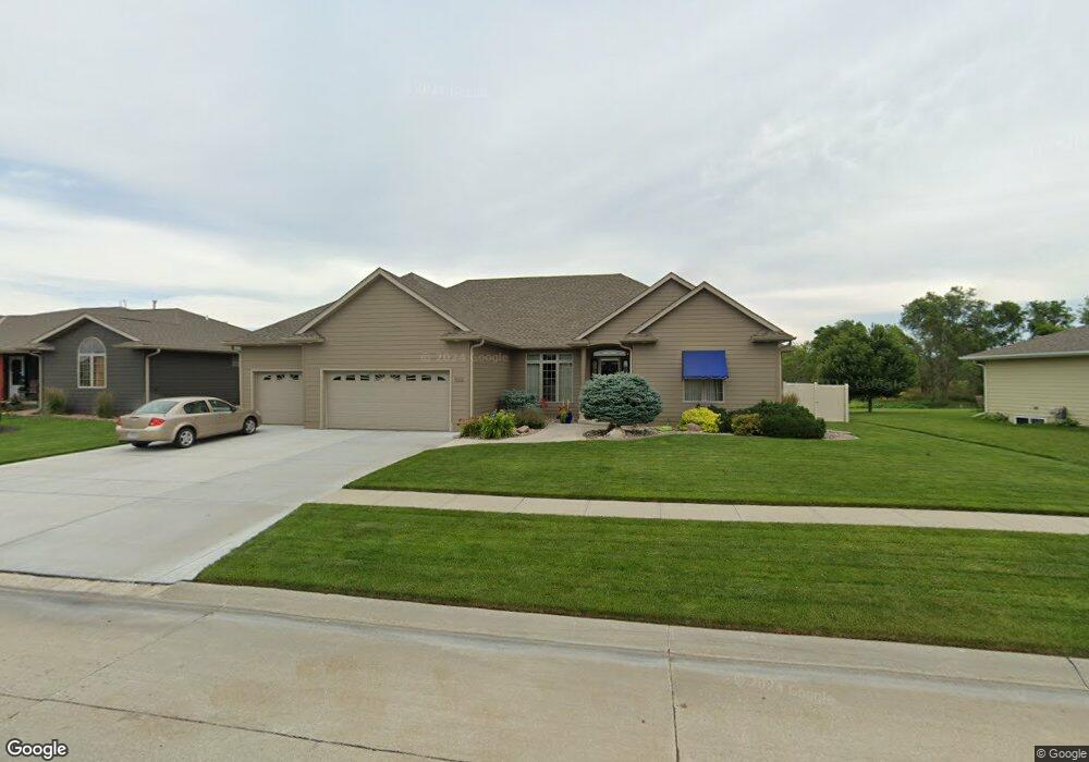
802 Westbrook Dr Norfolk, NE 68701
Estimated Value: $408,630 - $502,000
3
Beds
3
Baths
2,320
Sq Ft
$194/Sq Ft
Est. Value
About This Home
This home is located at 802 Westbrook Dr, Norfolk, NE 68701 and is currently estimated at $449,658, approximately $193 per square foot. 802 Westbrook Dr is a home located in Madison County with nearby schools including Norfolk Senior High School, Keystone Christian Academy, and Park Avenue Christian School.
Ownership History
Date
Name
Owned For
Owner Type
Purchase Details
Closed on
Sep 30, 2005
Sold by
Walters Wayne L
Bought by
Devall Rodney R and Devall Vickie L
Current Estimated Value
Home Financials for this Owner
Home Financials are based on the most recent Mortgage that was taken out on this home.
Original Mortgage
$36,800
Outstanding Balance
$27,575
Interest Rate
5.65%
Mortgage Type
Credit Line Revolving
Estimated Equity
$422,083
Purchase Details
Closed on
Sep 29, 2005
Sold by
Walters Wayne L and Walters Bernice T
Bought by
Devall Rodney R and Devall Vickie L
Home Financials for this Owner
Home Financials are based on the most recent Mortgage that was taken out on this home.
Original Mortgage
$36,800
Outstanding Balance
$27,575
Interest Rate
5.65%
Mortgage Type
Credit Line Revolving
Estimated Equity
$422,083
Create a Home Valuation Report for This Property
The Home Valuation Report is an in-depth analysis detailing your home's value as well as a comparison with similar homes in the area
Home Values in the Area
Average Home Value in this Area
Purchase History
| Date | Buyer | Sale Price | Title Company |
|---|---|---|---|
| Devall Rodney R | $184,000 | -- | |
| Devall Rodney R | $184,000 | Rels Title |
Source: Public Records
Mortgage History
| Date | Status | Borrower | Loan Amount |
|---|---|---|---|
| Open | Devall Rodney R | $36,800 | |
| Open | Devall Rodney R | $147,200 |
Source: Public Records
Tax History
| Year | Tax Paid | Tax Assessment Tax Assessment Total Assessment is a certain percentage of the fair market value that is determined by local assessors to be the total taxable value of land and additions on the property. | Land | Improvement |
|---|---|---|---|---|
| 2025 | $4,445 | $352,377 | $41,519 | $310,858 |
| 2024 | $4,445 | $359,320 | $41,519 | $317,801 |
| 2023 | $6,234 | $337,208 | $26,945 | $310,263 |
| 2022 | $5,824 | $314,226 | $26,945 | $287,281 |
| 2021 | $5,466 | $295,432 | $26,945 | $268,487 |
| 2020 | $5,449 | $295,432 | $26,945 | $268,487 |
| 2019 | $5,263 | $275,544 | $26,945 | $248,599 |
| 2018 | $4,961 | $264,114 | $26,945 | $237,169 |
| 2017 | $4,645 | $246,969 | $26,945 | $220,024 |
| 2016 | $4,493 | $238,394 | $26,945 | $211,449 |
| 2015 | $4,494 | $238,394 | $26,945 | $211,449 |
| 2014 | $4,628 | $238,394 | $26,945 | $211,449 |
| 2013 | $4,777 | $238,394 | $26,945 | $211,449 |
Source: Public Records
Map
Nearby Homes
- 1605 E Sycamore Ave
- 1310 E Maple Ave
- 110 Suburban Dr
- 704 Blue Stem Cir
- 1102 Sunrise Dr
- 1160 Sunrise Dr
- 1105 Sunrise Dr
- 605 Blue Stem Cir
- 717 Blue Stem Cir
- 602 David Cir
- 513 David Cir
- 605 David St
- 603 David St
- 604 David St
- 508 David Cir
- 509 David Cir
- 511 David Cir
- 506 David Cir
- 702 Rief St
- 604 Rief St
- 804 Westbrook Dr
- 800 Westbrook Dr
- 806 Westbrook Dr
- 803 Westbrook Dr
- 805 Westbrook Dr
- 809 Wildwood St
- 1603 E Maple Ave
- 900 Westbrook Dr
- 1706 E Maple Ave
- 902 Westbrook Dr
- 802 Woodcrest Dr
- 1704 E Maple Ave
- 902 Wildwood St
- 804 Woodcrest Dr
- 800 Woodcrest Dr
- 900 Woodcrest Dr
- 1702 E Maple Ave
- 903 Wildwood St
- 904 Westbrook Dr
- 401 Woodcrest Place
Your Personal Tour Guide
Ask me questions while you tour the home.