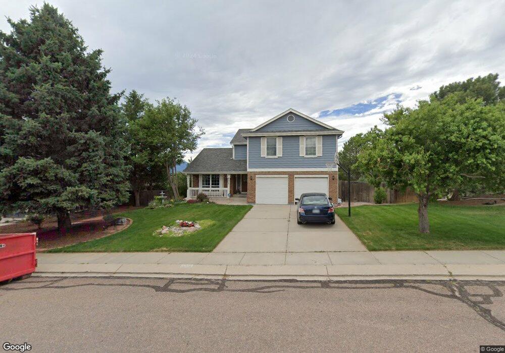
8020 Butterweed Dr Colorado Springs, CO 80920
Briargate NeighborhoodEstimated Value: $505,417 - $562,000
4
Beds
3
Baths
2,026
Sq Ft
$262/Sq Ft
Est. Value
About This Home
This home is located at 8020 Butterweed Dr, Colorado Springs, CO 80920 and is currently estimated at $531,354, approximately $262 per square foot. 8020 Butterweed Dr is a home located in El Paso County with nearby schools including Frontier Elementary School, Timberview Middle School, and Liberty High School.
Ownership History
Date
Name
Owned For
Owner Type
Purchase Details
Closed on
Apr 27, 2023
Sold by
Terry Mark A and Terry Patricia A
Bought by
Terry Family Revocable Living Trust
Current Estimated Value
Purchase Details
Closed on
Jun 29, 1998
Sold by
Romoth Raymond W and Romoth Diane E
Bought by
Terry Mark A and Terry Patricia A
Home Financials for this Owner
Home Financials are based on the most recent Mortgage that was taken out on this home.
Original Mortgage
$140,500
Interest Rate
7.13%
Purchase Details
Closed on
Jul 20, 1994
Sold by
Butler Gregory W and Butler Helen E
Bought by
Romoth Raymond W and Romoth Diane E
Home Financials for this Owner
Home Financials are based on the most recent Mortgage that was taken out on this home.
Original Mortgage
$146,300
Interest Rate
8.3%
Purchase Details
Closed on
Sep 12, 1988
Bought by
Terry Mark A and Terry Patricia A
Create a Home Valuation Report for This Property
The Home Valuation Report is an in-depth analysis detailing your home's value as well as a comparison with similar homes in the area
Home Values in the Area
Average Home Value in this Area
Purchase History
| Date | Buyer | Sale Price | Title Company |
|---|---|---|---|
| Terry Family Revocable Living Trust | -- | None Listed On Document | |
| Terry Mark A | $175,685 | First American | |
| Romoth Raymond W | $154,000 | -- | |
| Terry Mark A | -- | -- |
Source: Public Records
Mortgage History
| Date | Status | Borrower | Loan Amount |
|---|---|---|---|
| Previous Owner | Terry Mark A | $140,500 | |
| Previous Owner | Romoth Raymond W | $146,300 |
Source: Public Records
Tax History Compared to Growth
Tax History
| Year | Tax Paid | Tax Assessment Tax Assessment Total Assessment is a certain percentage of the fair market value that is determined by local assessors to be the total taxable value of land and additions on the property. | Land | Improvement |
|---|---|---|---|---|
| 2025 | $2,110 | $35,170 | -- | -- |
| 2024 | $1,624 | $36,620 | $5,360 | $31,260 |
| 2023 | $1,624 | $36,620 | $5,360 | $31,260 |
| 2022 | $1,302 | $25,400 | $4,340 | $21,060 |
| 2021 | $1,982 | $26,120 | $4,460 | $21,660 |
| 2020 | $1,922 | $23,610 | $3,720 | $19,890 |
| 2019 | $1,902 | $23,610 | $3,720 | $19,890 |
| 2018 | $1,575 | $19,230 | $2,880 | $16,350 |
| 2017 | $1,570 | $19,230 | $2,880 | $16,350 |
| 2016 | $1,509 | $18,460 | $2,930 | $15,530 |
| 2015 | $1,506 | $18,460 | $2,930 | $15,530 |
| 2014 | $1,408 | $17,250 | $2,930 | $14,320 |
Source: Public Records
Map
Nearby Homes
- 3895 Beltana Dr
- 7866 Brandy Cir
- 4255 Scotch Pine Dr
- 3855 Beltana Dr
- 3845 Beltana Dr
- 4035 Scotch Pine Dr
- 8110 Lythrum Dr
- 8261 Cooper River Dr
- 4955 Ramblewood Dr
- 8330 Pepperridge Dr
- 8685 Boxelder Dr
- 4120 Limberwood Ct
- 4030 Thundercloud Dr
- 8118 Ravenel Dr
- 8335 Saint Helena Dr
- 7870 Chimney Terrace
- 3920 Smoke Tree Dr
- 3906 Smoke Tree Dr
- 3690 Amelia Island St
- 8020 Cooper River Dr
- 8555 Avens Cir
- 8030 Butterweed Dr
- 8645 Avens Cir
- 8575 Avens Cir
- 8655 Avens Cir
- 8040 Butterweed Dr
- 8535 Avens Cir
- 8665 Avens Cir
- 8025 Butterweed Dr
- 8035 Butterweed Dr
- 8050 Butterweed Dr
- 8675 Avens Cir
- 8560 Avens Cir
- 8550 Avens Cir
- 8570 Avens Cir
- 8685 Avens Cir
- 8540 Avens Cir
- 8045 Butterweed Dr
- 8580 Avens Cir
- 8030 Nectar Dr