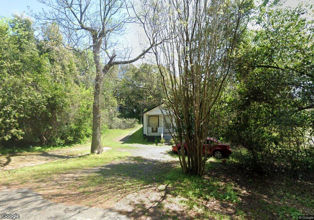
8020 Railroad Ave Columbia, SC 29203
Dentsville NeighborhoodEstimated Value: $95,000 - $108,778
2
Beds
1
Bath
936
Sq Ft
$109/Sq Ft
Est. Value
About This Home
This home is located at 8020 Railroad Ave, Columbia, SC 29203 and is currently estimated at $102,195, approximately $109 per square foot. 8020 Railroad Ave is a home located in Richland County with nearby schools including Joseph Keels Elementary School, Dent Middle School, and Westwood High School.
Ownership History
Date
Name
Owned For
Owner Type
Purchase Details
Closed on
Feb 18, 2003
Sold by
Metts Tommy L
Bought by
Eddy Monica E
Current Estimated Value
Home Financials for this Owner
Home Financials are based on the most recent Mortgage that was taken out on this home.
Original Mortgage
$24,578
Outstanding Balance
$10,511
Interest Rate
5.93%
Mortgage Type
Credit Line Revolving
Estimated Equity
$91,684
Purchase Details
Closed on
Dec 23, 1998
Sold by
Nichols Richard S
Bought by
Metts Tommy L
Create a Home Valuation Report for This Property
The Home Valuation Report is an in-depth analysis detailing your home's value as well as a comparison with similar homes in the area
Home Values in the Area
Average Home Value in this Area
Purchase History
| Date | Buyer | Sale Price | Title Company |
|---|---|---|---|
| Eddy Monica E | $22,774 | -- | |
| Metts Tommy L | $5,000 | -- |
Source: Public Records
Mortgage History
| Date | Status | Borrower | Loan Amount |
|---|---|---|---|
| Open | Eddy Monica E | $24,578 |
Source: Public Records
Tax History Compared to Growth
Tax History
| Year | Tax Paid | Tax Assessment Tax Assessment Total Assessment is a certain percentage of the fair market value that is determined by local assessors to be the total taxable value of land and additions on the property. | Land | Improvement |
|---|---|---|---|---|
| 2024 | $1,473 | $34,400 | $0 | $0 |
| 2023 | $1,473 | $1,196 | $0 | $0 |
| 2022 | $1,337 | $29,900 | $700 | $29,200 |
| 2021 | $1,316 | $1,790 | $0 | $0 |
| 2020 | $1,320 | $1,790 | $0 | $0 |
| 2019 | $1,287 | $1,790 | $0 | $0 |
| 2018 | $1,131 | $1,560 | $0 | $0 |
| 2017 | $1,107 | $1,560 | $0 | $0 |
| 2016 | $1,103 | $1,560 | $0 | $0 |
| 2015 | $1,080 | $1,560 | $0 | $0 |
| 2014 | $1,158 | $26,000 | $0 | $0 |
| 2013 | -- | $1,730 | $0 | $0 |
Source: Public Records
Map
Nearby Homes
- 3101 Farrow Rd
- 7711 Crestbrook Rd
- 207 Weddell St Unit 1H
- 207 Weddell St Unit 1-B
- 7222 Parkview Dr
- 0 Nx Hearn Dr
- 7611 Edgewater Dr
- 60 Moonglo Cir
- 8206 Bayfield Rd
- 7117 Cornelius Dr
- 2300 Old Legrand Rd
- 7128 Sprott St
- 1718 Horseshoe Dr
- 1901 Roof St
- 2115 Tammy Dr
- 904 E Campanella Dr
- 149 Leila Ln
- 00 Legrand Rd
- 131 Leila Ln
- 1844 Horseshoe Dr
- 8028 Railroad Ave
- 8012 Railroad Ave
- 8019 Brookmont Ln
- 8021 Brookmont Ln
- 8025 Brookmont Ln
- 8029 Brookmont Ln
- 8013 Brookmont Ln
- 600 Anders Dr
- 8024 Brookmont Ln
- 8020 Brookmont Ln
- 8040 Railroad Ave
- 8028 Brookmont Ln
- 8005 Brookmont Ln
- 8032 Brookmont Ln
- 8035 Brookmont Ln
- 8012 Brookmont Ln
- 8044 Railroad Ave
- 8008 Brookmont Ln
- 8001 Brookmont Ln
- 8016 Brookmont Ln