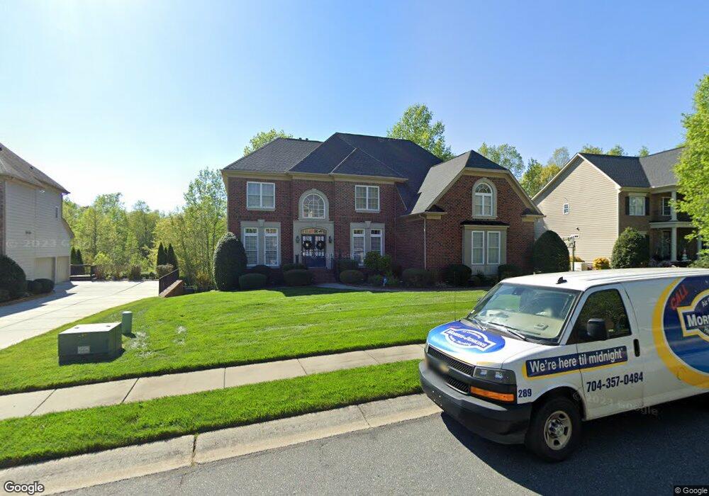
8020 S Dorchester Trace Fort Mill, SC 29707
Estimated Value: $890,000 - $1,025,000
5
Beds
5
Baths
5,172
Sq Ft
$191/Sq Ft
Est. Value
About This Home
This home is located at 8020 S Dorchester Trace, Fort Mill, SC 29707 and is currently estimated at $986,054, approximately $190 per square foot. 8020 S Dorchester Trace is a home located in Lancaster County with nearby schools including Harrisburg Elementary School, Indian Land Middle School, and Indian Land High School.
Ownership History
Date
Name
Owned For
Owner Type
Purchase Details
Closed on
Dec 20, 2013
Sold by
Merritt Ronald C and Merritt Kimberly
Bought by
Walker Kemba
Current Estimated Value
Home Financials for this Owner
Home Financials are based on the most recent Mortgage that was taken out on this home.
Original Mortgage
$400,000
Outstanding Balance
$282,476
Interest Rate
2.87%
Mortgage Type
Adjustable Rate Mortgage/ARM
Estimated Equity
$703,578
Purchase Details
Closed on
Mar 21, 2007
Sold by
John Wieland Homes & Neighborhoods Of Th
Bought by
Merritt Ronald C and Merritt Kimberly
Home Financials for this Owner
Home Financials are based on the most recent Mortgage that was taken out on this home.
Original Mortgage
$180,000
Interest Rate
6.18%
Mortgage Type
Stand Alone Second
Create a Home Valuation Report for This Property
The Home Valuation Report is an in-depth analysis detailing your home's value as well as a comparison with similar homes in the area
Home Values in the Area
Average Home Value in this Area
Purchase History
| Date | Buyer | Sale Price | Title Company |
|---|---|---|---|
| Walker Kemba | $500,000 | -- | |
| Merritt Ronald C | $607,135 | None Available |
Source: Public Records
Mortgage History
| Date | Status | Borrower | Loan Amount |
|---|---|---|---|
| Open | Walker Kemba | $400,000 | |
| Previous Owner | Merritt Ronald C | $180,000 | |
| Previous Owner | Merritt Ronald C | $270,000 |
Source: Public Records
Tax History Compared to Growth
Tax History
| Year | Tax Paid | Tax Assessment Tax Assessment Total Assessment is a certain percentage of the fair market value that is determined by local assessors to be the total taxable value of land and additions on the property. | Land | Improvement |
|---|---|---|---|---|
| 2024 | $11,567 | $33,990 | $4,500 | $29,490 |
| 2023 | $11,463 | $33,990 | $4,500 | $29,490 |
| 2022 | $11,361 | $33,990 | $4,500 | $29,490 |
| 2021 | $11,191 | $33,990 | $4,500 | $29,490 |
| 2020 | $10,325 | $31,404 | $4,500 | $26,904 |
| 2019 | $10,618 | $31,404 | $4,500 | $26,904 |
| 2018 | $9,905 | $30,438 | $4,500 | $25,938 |
| 2017 | $9,446 | $0 | $0 | $0 |
| 2016 | $9,249 | $0 | $0 | $0 |
| 2015 | $2,698 | $0 | $0 | $0 |
| 2014 | $2,698 | $0 | $0 | $0 |
| 2013 | $2,698 | $0 | $0 | $0 |
Source: Public Records
Map
Nearby Homes
- 9142 Drayton Ln
- 8513 Ulster Ct
- 7162 Harcourt Crossing
- 7146 Harcourt Crossing
- 6458 Chadwell Ct
- 5125 Longbrooke Ct
- 6086 Arundale Ln
- 5157 Longbrooke Ct
- 5128 Longbrooke Ct
- 8737 Whippoorwill Ln
- 5152 Longbrooke Ct
- 3161 Hartson Pointe Dr
- 3159 Hartson Pointe Dr
- 2012 Donaldson St
- 7311 Barrington Ridge Dr
- 5248 Winding Grove Way Unit 61
- 6029 Kimbrell Heights Dr
- 6006 Cadence Ln
- 6061 Kimbrell Heights Dr
- 6069 Kimbrell Heights Dr
- 8014 S Dorchester Trace
- 8026 S Dorchester Trace
- 8017 S Dorchester Trace
- 8008 S Dorchester Trace
- 8032 S Dorchester Trace
- 8023 S Dorchester Trace
- 8005 S Dorchester Trace
- 8035 S Dorchester Trace
- 8029 S Dorchester Trace
- 8905 N Dorchester Trace
- 7236 Harcourt Crossing
- 9012 Brantley Ct
- 7236 Harcourt Crossing
- 7230 Harcourt Crossing
- 8913 N Dorchester Trace
- 9016 Brantley Ct Unit 105
- 9004 Brantley Ct Unit 103
- 9004 Brantley Ct
- 8926 N Dorchester Trace
- 7271 Harcourt Crossing