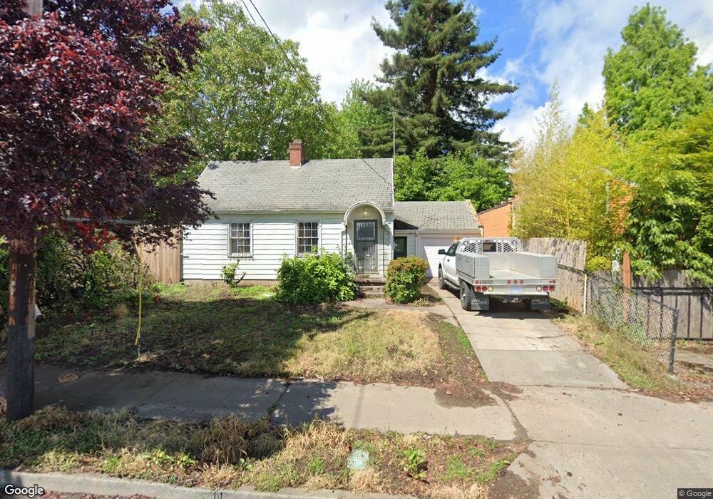
8021 N Interstate Ave Portland, OR 97217
Kenton NeighborhoodEstimated Value: $251,000 - $440,000
2
Beds
1
Bath
942
Sq Ft
$357/Sq Ft
Est. Value
About This Home
This home is located at 8021 N Interstate Ave, Portland, OR 97217 and is currently estimated at $336,653, approximately $357 per square foot. 8021 N Interstate Ave is a home located in Multnomah County with nearby schools including Peninsula Elementary School, Ockley Green, and Jefferson High School.
Ownership History
Date
Name
Owned For
Owner Type
Purchase Details
Closed on
Feb 20, 2025
Sold by
Hunt Brian
Bought by
Blue Eyes Redwood Skies Llc
Current Estimated Value
Home Financials for this Owner
Home Financials are based on the most recent Mortgage that was taken out on this home.
Original Mortgage
$150,000
Outstanding Balance
$127,247
Interest Rate
6.93%
Mortgage Type
Seller Take Back
Estimated Equity
$209,406
Purchase Details
Closed on
Sep 25, 2020
Sold by
Johnson Don G
Bought by
Hunt Brian
Create a Home Valuation Report for This Property
The Home Valuation Report is an in-depth analysis detailing your home's value as well as a comparison with similar homes in the area
Home Values in the Area
Average Home Value in this Area
Purchase History
| Date | Buyer | Sale Price | Title Company |
|---|---|---|---|
| Blue Eyes Redwood Skies Llc | $250,000 | First American Title | |
| Hunt Brian | -- | None Available |
Source: Public Records
Mortgage History
| Date | Status | Borrower | Loan Amount |
|---|---|---|---|
| Open | Blue Eyes Redwood Skies Llc | $150,000 |
Source: Public Records
Tax History Compared to Growth
Tax History
| Year | Tax Paid | Tax Assessment Tax Assessment Total Assessment is a certain percentage of the fair market value that is determined by local assessors to be the total taxable value of land and additions on the property. | Land | Improvement |
|---|---|---|---|---|
| 2025 | $3,911 | $145,150 | -- | -- |
| 2024 | $3,771 | $140,930 | -- | -- |
| 2023 | $3,771 | $136,830 | $0 | $0 |
| 2022 | $3,547 | $132,850 | $0 | $0 |
| 2021 | $3,488 | $128,990 | $0 | $0 |
| 2020 | $3,200 | $125,240 | $0 | $0 |
| 2019 | $3,082 | $121,600 | $0 | $0 |
| 2018 | $2,991 | $118,060 | $0 | $0 |
| 2017 | $2,867 | $114,630 | $0 | $0 |
| 2016 | $2,624 | $111,300 | $0 | $0 |
| 2015 | $2,555 | $108,060 | $0 | $0 |
| 2014 | $2,517 | $104,920 | $0 | $0 |
Source: Public Records
Map
Nearby Homes
- 1312 N Farragut St
- 1307 N Kilpatrick St
- 1593 N Mcclellan St Unit 3
- 1597 N Mcclellan St Unit 5
- 1315 N Russet St
- 1024 N Farragut St
- 7622 N Brandon Ave
- 854 N Baldwin St
- 7525 N Albina Ave
- 7058 N Greenwich Ave
- 7070 N Montana Ave
- 7387 N Mobile Ave
- 7383 N Mobile Ave
- 7379 N Mobile Ave
- 7385 N Mobile Ave
- 1311 N Bryant St
- 1428 N Bryant St Unit 2
- 7817 N Delaware Ave
- 2515 N Winchell St
- 6949 N Montana Ave
- 1507 N Watts St
- 1508 N Schofield St
- 1518 N Schofield St
- 1517 N Watts St
- 1522 N Schofield St
- 1535 N Watts St
- 1536 N Schofield St
- 1605 N Watts St
- 8018 N Interstate Ave
- 8000 N Interstate Ave
- 8004 N Interstate Ave
- 8000 N Interstate Ave Unit 8004
- 1526 N Watts St
- 8012 N Interstate Ave
- 1612 N Schofield St
- 1504 N Watts St Unit 1506
- 1518 N Watts St
- 8036 N Interstate Ave
- 1525 N Schofield St
- 1524 N Watts St