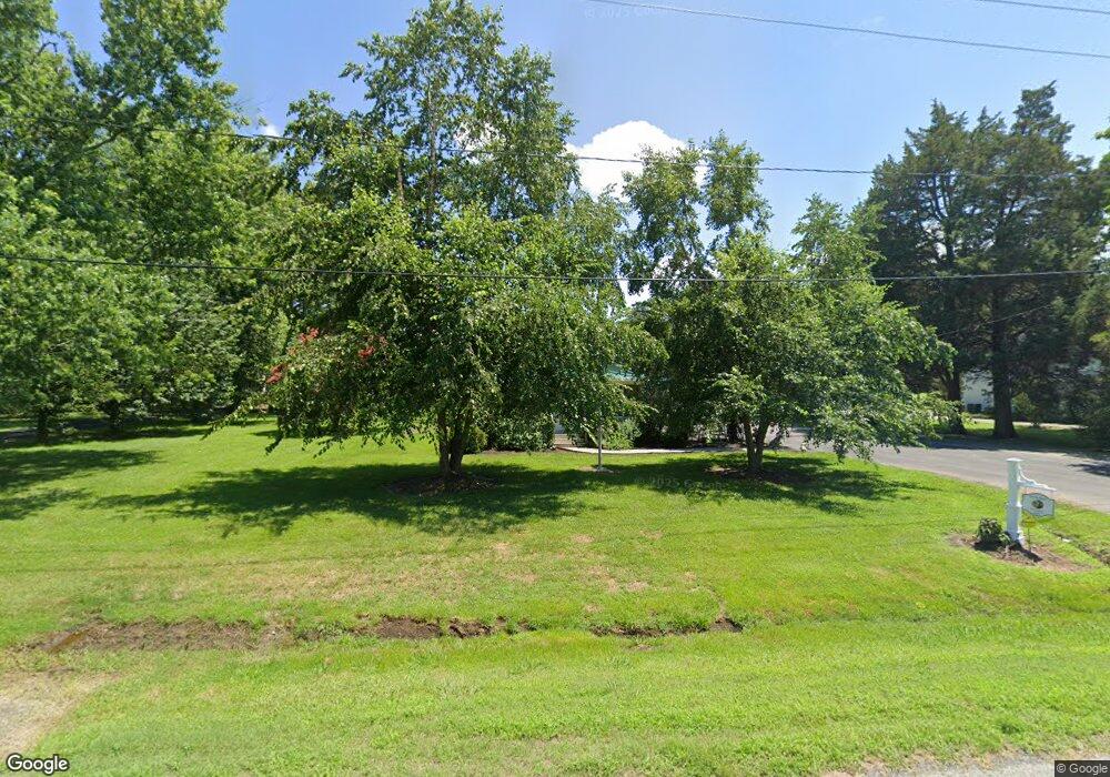
8025 Bozman Rd Bozman, MD 21612
Estimated Value: $224,847 - $391,000
Studio
--
Bath
1,010
Sq Ft
$278/Sq Ft
Est. Value
About This Home
This home is located at 8025 Bozman Rd, Bozman, MD 21612 and is currently estimated at $280,962, approximately $278 per square foot. 8025 Bozman Rd is a home with nearby schools including St. Michaels Elementary School, St. Michaels Middle/High School, and Easton High School.
Ownership History
Date
Name
Owned For
Owner Type
Purchase Details
Closed on
Feb 26, 2014
Sold by
Poore Timothy W and Poore Molly S
Bought by
Poore Timothy W
Current Estimated Value
Home Financials for this Owner
Home Financials are based on the most recent Mortgage that was taken out on this home.
Original Mortgage
$120,000
Outstanding Balance
$90,887
Interest Rate
4.32%
Mortgage Type
Credit Line Revolving
Estimated Equity
$190,075
Purchase Details
Closed on
Oct 1, 2007
Sold by
Poore Timothy W
Bought by
Poore Timothy W
Purchase Details
Closed on
Sep 27, 2007
Sold by
Poore Timothy W
Bought by
Poore Timothy W
Purchase Details
Closed on
Aug 10, 1999
Sold by
Oore Timothy W
Bought by
Poore Timothy W and Poore Molly S
Purchase Details
Closed on
Jan 31, 1995
Sold by
Poore William G and Poore Hilda J
Bought by
Poore Timothy W
Create a Home Valuation Report for This Property
The Home Valuation Report is an in-depth analysis detailing your home's value as well as a comparison with similar homes in the area
Purchase History
| Date | Buyer | Sale Price | Title Company |
|---|---|---|---|
| Poore Timothy W | -- | Venture Title Company | |
| Poore Timothy W | -- | -- | |
| Poore Timothy W | -- | -- | |
| Poore Timothy W | -- | -- | |
| Poore Timothy W | $20,000 | -- |
Source: Public Records
Mortgage History
| Date | Status | Borrower | Loan Amount |
|---|---|---|---|
| Open | Poore Timothy W | $120,000 |
Source: Public Records
Tax History
| Year | Tax Paid | Tax Assessment Tax Assessment Total Assessment is a certain percentage of the fair market value that is determined by local assessors to be the total taxable value of land and additions on the property. | Land | Improvement |
|---|---|---|---|---|
| 2025 | $700 | $159,800 | $84,600 | $75,200 |
| 2024 | $687 | $155,000 | $0 | $0 |
| 2023 | $599 | $150,200 | $0 | $0 |
| 2022 | $1,154 | $145,400 | $84,600 | $60,800 |
| 2021 | $1,313 | $143,067 | $0 | $0 |
| 2020 | $587 | $140,733 | $0 | $0 |
| 2019 | $580 | $138,400 | $78,500 | $59,900 |
| 2018 | $563 | $138,400 | $78,500 | $59,900 |
| 2017 | $537 | $138,400 | $0 | $0 |
| 2016 | $527 | $142,500 | $0 | $0 |
| 2015 | $469 | $142,500 | $0 | $0 |
| 2014 | $469 | $142,500 | $0 | $0 |
Source: Public Records
Map
Nearby Homes
- 8034 Bozman Neavitt Rd
- 7508 Cooper Point Rd
- 8620 Bozman Neavitt Rd
- 23961 Lynnewood Dr
- 23869 Mount Misery Rd
- 22707 Marshall Ln
- 7090 Cooper Point Rd
- 24318 Oakwood Park Rd
- 8805 Cummings Rd
- 24390 Oakwood Park Rd
- 9262 Macks Ln
- 117 Chesapeake Ave
- 216 Brooks Ln
- 111 Gloria Ave
- 102 Gloria Ave
- 300 Perry St
- 107 W Chestnut St
- 100 Grace St
- 22381 Cooper Ln
- 209 Webb Ln
- 8017 Bozman Neavitt Rd
- 8043 Bozman Neavitt Rd
- 8031 Bozman Neavitt Rd
- 8021 Bozman Neavitt Rd
- 8000 Bozman Neavitt Rd
- 8023 Main Rd
- 8038 Bozman Neavitt Rd
- 8060 Bozman Neavitt Rd
- 7967 Quaker Neck Rd
- 7971 Quaker Neck Rd
- 7979 Quaker Neck Rd
- 7968 Quaker Neck Rd
- 8049 Ruby Harrison Rd
- 7952 Quaker Neck Rd
- 8049 Ruby Harrison Rd
- 7944 Quaker Neck Rd
- 7984 Bozman Neavitt Rd
- 8085 Bozman Neavitt Rd
- 7951 Quaker Neck Rd
- 8036 Ruby Harrison Rd
