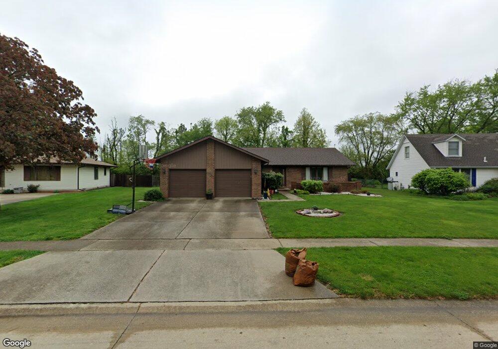
8029 Hunt Rd Springfield, IL 62712
Estimated Value: $236,445 - $286,000
3
Beds
2
Baths
1,710
Sq Ft
$152/Sq Ft
Est. Value
About This Home
This home is located at 8029 Hunt Rd, Springfield, IL 62712 and is currently estimated at $260,361, approximately $152 per square foot. 8029 Hunt Rd is a home located in Sangamon County with nearby schools including Ball Elementary School, Glenwood Intermediate School, and Glenwood Middle School.
Ownership History
Date
Name
Owned For
Owner Type
Purchase Details
Closed on
Apr 3, 2008
Current Estimated Value
Purchase Details
Closed on
Nov 28, 2007
Purchase Details
Closed on
Apr 6, 2007
Purchase Details
Closed on
Oct 31, 2002
Create a Home Valuation Report for This Property
The Home Valuation Report is an in-depth analysis detailing your home's value as well as a comparison with similar homes in the area
Purchase History
| Date | Buyer | Sale Price | Title Company |
|---|---|---|---|
| -- | -- | -- | |
| -- | -- | -- | |
| -- | $141,000 | -- | |
| -- | $115,000 | -- |
Source: Public Records
Tax History
| Year | Tax Paid | Tax Assessment Tax Assessment Total Assessment is a certain percentage of the fair market value that is determined by local assessors to be the total taxable value of land and additions on the property. | Land | Improvement |
|---|---|---|---|---|
| 2024 | $4,164 | $63,454 | $9,790 | $53,664 |
| 2023 | $3,921 | $57,959 | $8,942 | $49,017 |
| 2022 | $3,763 | $54,979 | $8,482 | $46,497 |
| 2021 | $3,641 | $52,920 | $8,164 | $44,756 |
| 2020 | $3,625 | $52,999 | $8,176 | $44,823 |
| 2019 | $3,564 | $52,814 | $8,147 | $44,667 |
| 2018 | $3,417 | $51,601 | $8,107 | $43,494 |
| 2017 | $3,342 | $50,934 | $8,002 | $42,932 |
| 2016 | $3,281 | $50,191 | $7,885 | $42,306 |
| 2015 | $3,265 | $49,591 | $7,791 | $41,800 |
| 2014 | $3,214 | $49,271 | $7,741 | $41,530 |
| 2013 | $3,150 | $48,797 | $7,741 | $41,056 |
Source: Public Records
Map
Nearby Homes
- 8033 Wilson Terrace
- 8117 Tack Ln
- 6712 Phlox Dr
- 106 Maple Grove St
- 6501 Winterberry Ln
- 1112 Christopher Ln
- 110 Maple Grove St
- 114 Maple Grove St
- 112 Maple Grove St
- 108 Maple Grove St
- 116 Maple Grove St
- 6214 Hayley Ct
- 33 Green Trail Dr Unit 1
- Spartan Woodland Trail Dr
- 2311 Chesapeake Landing
- 2315 Chesapeake Landing
- 0 Toronto Rd
- 6200 Wind Tree Rd
- 6401 Raintree Place
- Lot 60 Spartan Dr
Your Personal Tour Guide
Ask me questions while you tour the home.