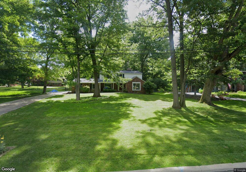
8029 Robin Ln Brecksville, OH 44141
Estimated Value: $431,752 - $511,000
4
Beds
3
Baths
2,209
Sq Ft
$212/Sq Ft
Est. Value
About This Home
This home is located at 8029 Robin Ln, Brecksville, OH 44141 and is currently estimated at $468,438, approximately $212 per square foot. 8029 Robin Ln is a home located in Cuyahoga County with nearby schools including Brecksville-Broadview Heights Middle School, Brecksville-Broadview Heights High School, and St. Michael School.
Ownership History
Date
Name
Owned For
Owner Type
Purchase Details
Closed on
May 5, 1997
Sold by
Supik James F
Bought by
Wilson Steven D and Wilson Diane E
Current Estimated Value
Home Financials for this Owner
Home Financials are based on the most recent Mortgage that was taken out on this home.
Original Mortgage
$176,000
Interest Rate
7.54%
Mortgage Type
New Conventional
Purchase Details
Closed on
May 11, 1985
Sold by
Supik James F and Supik Lilli
Bought by
Supik James and Supik Lilli
Purchase Details
Closed on
Jan 1, 1975
Bought by
Supik James F and Supik Lilli
Create a Home Valuation Report for This Property
The Home Valuation Report is an in-depth analysis detailing your home's value as well as a comparison with similar homes in the area
Home Values in the Area
Average Home Value in this Area
Purchase History
| Date | Buyer | Sale Price | Title Company |
|---|---|---|---|
| Wilson Steven D | $220,100 | -- | |
| Supik James | -- | -- | |
| Supik James F | -- | -- |
Source: Public Records
Mortgage History
| Date | Status | Borrower | Loan Amount |
|---|---|---|---|
| Closed | Wilson Steven D | $176,000 |
Source: Public Records
Tax History Compared to Growth
Tax History
| Year | Tax Paid | Tax Assessment Tax Assessment Total Assessment is a certain percentage of the fair market value that is determined by local assessors to be the total taxable value of land and additions on the property. | Land | Improvement |
|---|---|---|---|---|
| 2024 | $7,453 | $131,390 | $23,975 | $107,415 |
| 2023 | $6,606 | $101,820 | $24,610 | $77,210 |
| 2022 | $6,819 | $101,820 | $24,610 | $77,210 |
| 2021 | $6,758 | $101,820 | $24,610 | $77,210 |
| 2020 | $5,997 | $80,820 | $19,530 | $61,290 |
| 2019 | $5,802 | $230,900 | $55,800 | $175,100 |
| 2018 | $5,762 | $80,820 | $19,530 | $61,290 |
| 2017 | $5,601 | $75,150 | $16,210 | $58,940 |
| 2016 | $5,114 | $75,150 | $16,210 | $58,940 |
| 2015 | $5,155 | $75,150 | $16,210 | $58,940 |
| 2014 | $5,155 | $74,410 | $16,030 | $58,380 |
Source: Public Records
Map
Nearby Homes
- 8001 Robin Ln
- 10612 Cardinal Ln
- 7963 Seth Payne St
- 10403 Greenhaven Pkwy
- 10303 Tanager Trail
- 7823 Oakhurst Cir
- 11004 Greenhaven Pkwy
- 10585 Whitewood Rd
- 8560 Timber Trail
- 8435 Wiese Rd
- 8304 Montello Rd
- 6752 Rivercrest Dr
- 8630 Hollis Ln
- 8223 Montello Rd
- 7608 Dalebrook Rd
- 8604 Ottawa Dr
- 7030 Carriage Hill Dr Unit 202
- 7972 Brecksville Rd
- 0 Old Quarry Ln
- 6850 Carriage Hill Dr Unit D54
- 8037 Robin Ln
- 8015 Robin Ln
- 8049 Robin Ln
- 8022 Robin Ln
- 8056 Tanager Oval
- 10734 Laurel Ln
- 8058 Tanager Oval
- 8055 Robin Ln
- 10904 Cardinal Ln
- 8054 Tanager Oval
- 10918 Cardinal Ln
- 10814 Cardinal Ln
- 10719 Laurel Ln
- 10726 Laurel Ln
- 10978 Cardinal Ln
- 10806 Cardinal Ln
- 11014 Cardinal Ln
- 10718 Laurel Ln
- 10815 Tanager Trail
- 10724 Cardinal Ln