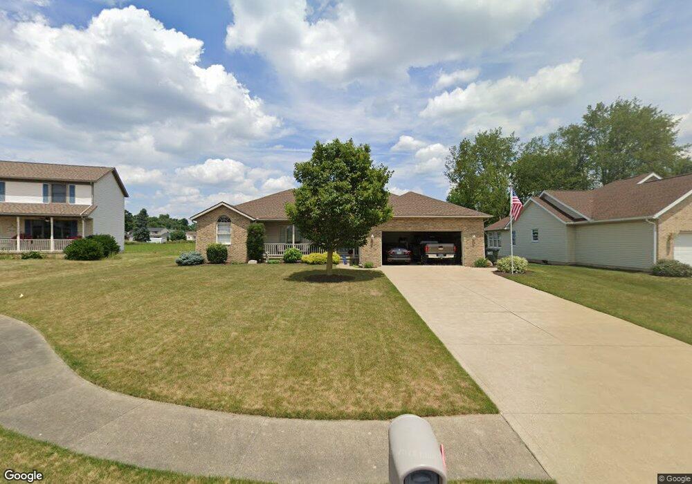
803 Joel Cir Louisville, OH 44641
Estimated Value: $251,971 - $291,000
3
Beds
2
Baths
1,568
Sq Ft
$171/Sq Ft
Est. Value
About This Home
This home is located at 803 Joel Cir, Louisville, OH 44641 and is currently estimated at $268,243, approximately $171 per square foot. 803 Joel Cir is a home located in Stark County with nearby schools including Louisville High School and St. Thomas Aquinas High School & Middle School.
Ownership History
Date
Name
Owned For
Owner Type
Purchase Details
Closed on
Sep 16, 1996
Sold by
Constitution Dev
Bought by
Garnick Thomas A and Garnick Deborah
Current Estimated Value
Home Financials for this Owner
Home Financials are based on the most recent Mortgage that was taken out on this home.
Original Mortgage
$103,200
Outstanding Balance
$8,511
Interest Rate
7.75%
Mortgage Type
New Conventional
Estimated Equity
$259,732
Create a Home Valuation Report for This Property
The Home Valuation Report is an in-depth analysis detailing your home's value as well as a comparison with similar homes in the area
Home Values in the Area
Average Home Value in this Area
Purchase History
| Date | Buyer | Sale Price | Title Company |
|---|---|---|---|
| Garnick Thomas A | $24,000 | -- |
Source: Public Records
Mortgage History
| Date | Status | Borrower | Loan Amount |
|---|---|---|---|
| Open | Garnick Thomas A | $103,200 |
Source: Public Records
Tax History Compared to Growth
Tax History
| Year | Tax Paid | Tax Assessment Tax Assessment Total Assessment is a certain percentage of the fair market value that is determined by local assessors to be the total taxable value of land and additions on the property. | Land | Improvement |
|---|---|---|---|---|
| 2025 | -- | $72,250 | $14,250 | $58,000 |
| 2024 | -- | $72,250 | $14,250 | $58,000 |
| 2023 | $2,216 | $60,730 | $11,760 | $48,970 |
| 2022 | $1,120 | $60,730 | $11,760 | $48,970 |
| 2021 | $2,623 | $60,730 | $11,760 | $48,970 |
| 2020 | $2,167 | $54,500 | $10,610 | $43,890 |
| 2019 | $2,176 | $55,020 | $11,130 | $43,890 |
| 2018 | $2,189 | $55,020 | $11,130 | $43,890 |
| 2017 | $2,063 | $50,050 | $9,310 | $40,740 |
| 2016 | $2,106 | $50,050 | $9,310 | $40,740 |
| 2015 | $2,112 | $50,050 | $9,310 | $40,740 |
| 2014 | $14 | $44,380 | $8,260 | $36,120 |
| 2013 | $1,011 | $44,380 | $8,260 | $36,120 |
Source: Public Records
Map
Nearby Homes
- 300 Kennedy St
- 1175 Sturbridge Dr
- 1149 Sturbridge Dr
- 614 Reno Dr
- 524 Glenbar St
- 0 Brookridge Ave
- 0 Glenbar St
- 428 Honeycrisp Dr NE
- 3047 Mcintosh Dr NE
- 432 Honeycrisp Dr NE
- 2962 Mcintosh Dr NE
- 2963 Mcintosh Dr NE
- 430 Honeycrisp Dr NE
- 2957 Mcintosh Dr NE
- 3580 Brookridge Ave Lot 15
- 5474 Ravenna Ave
- 316 E Reno Dr
- 325 Lincoln Ave
- 248 Menegay Rd
- 201 Indiana Ave