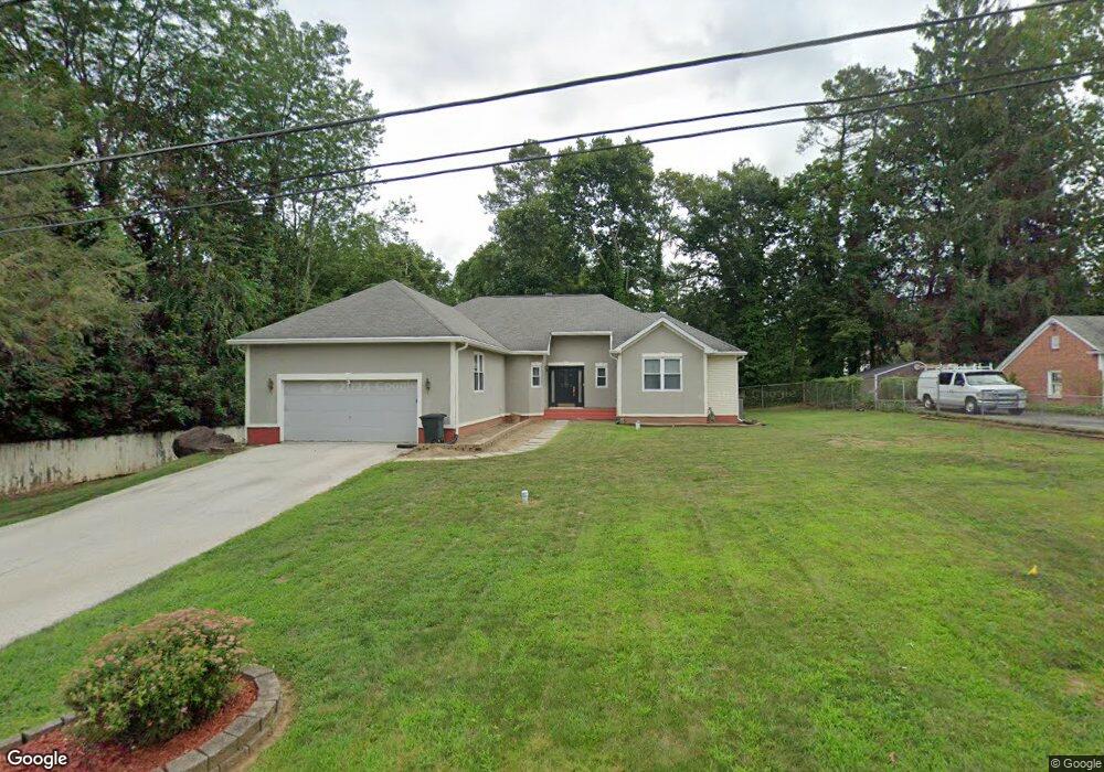
803 Locust Ln E West Chester, PA 19380
Estimated Value: $677,000 - $779,000
3
Beds
3
Baths
1,853
Sq Ft
$404/Sq Ft
Est. Value
About This Home
This home is located at 803 Locust Ln E, West Chester, PA 19380 and is currently estimated at $748,932, approximately $404 per square foot. 803 Locust Ln E is a home located in Chester County with nearby schools including Hillsdale Elementary School, E.N. Peirce Middle School, and Henderson High School.
Ownership History
Date
Name
Owned For
Owner Type
Purchase Details
Closed on
Jun 30, 1995
Sold by
Ashbridge Construction Inc
Bought by
Brown Aaron W and Baker Brown Frances G
Current Estimated Value
Home Financials for this Owner
Home Financials are based on the most recent Mortgage that was taken out on this home.
Original Mortgage
$185,850
Interest Rate
7.84%
Create a Home Valuation Report for This Property
The Home Valuation Report is an in-depth analysis detailing your home's value as well as a comparison with similar homes in the area
Home Values in the Area
Average Home Value in this Area
Purchase History
| Date | Buyer | Sale Price | Title Company |
|---|---|---|---|
| Brown Aaron W | $206,500 | -- |
Source: Public Records
Mortgage History
| Date | Status | Borrower | Loan Amount |
|---|---|---|---|
| Closed | Brown Aaron W | $185,850 |
Source: Public Records
Tax History Compared to Growth
Tax History
| Year | Tax Paid | Tax Assessment Tax Assessment Total Assessment is a certain percentage of the fair market value that is determined by local assessors to be the total taxable value of land and additions on the property. | Land | Improvement |
|---|---|---|---|---|
| 2025 | $6,972 | $198,760 | $51,770 | $146,990 |
| 2024 | $6,972 | $198,760 | $51,770 | $146,990 |
| 2023 | $6,894 | $198,760 | $51,770 | $146,990 |
| 2022 | $6,820 | $198,760 | $51,770 | $146,990 |
| 2021 | $6,681 | $198,760 | $51,770 | $146,990 |
| 2020 | $6,557 | $198,760 | $51,770 | $146,990 |
| 2019 | $6,480 | $198,760 | $51,770 | $146,990 |
| 2018 | $6,363 | $198,760 | $51,770 | $146,990 |
| 2017 | $5,793 | $184,320 | $51,770 | $132,550 |
| 2016 | $3,976 | $184,320 | $51,770 | $132,550 |
| 2015 | $3,976 | $184,320 | $51,770 | $132,550 |
| 2014 | $3,976 | $184,320 | $51,770 | $132,550 |
Source: Public Records
Map
Nearby Homes
- 314 Mayfield Ave
- 505 S Maryland Ave
- 959 Garlington Cir
- 751 Mccardle Dr Unit 27
- 744 Mccardle Dr Unit 35
- 324 Star Tavern Ln
- 303 W Washington St
- 303 Star Tavern Ln
- 345 Star Tavern Ln
- 532 N Walnut St
- 368 Star Tavern Ln
- 418 Hannum Ave
- 626 N Matlack St
- 333 Hannum Ave
- 765 Bradford Terrace Unit 238
- 525 Raymond Dr Unit 45
- 523 Raymond Dr Unit 46
- 433 W Gay St
- 443 W Gay St
- 616 W Chestnut St
- 805 Locust Ln E
- 801 Locust Ln E
- 401 Locust Ln S
- 400 Locust Ln S
- 807 Locust Ln E
- 806 Locust Ln E
- 401 W Ashbridge St
- 407 W Ashbridge St
- 405 W Ashbridge St
- 405 Locust Ln S
- 811 Locust Ln E
- 404 Locust Ln S
- 400 Locust Ln N
- 409 W Ashbridge St
- 312 Parke Hollow Ln
- 805 Hoopes Park Ln
- 310 Parke Hollow Ln
- 738 N New St
- 738 N New St
- 736 N New St