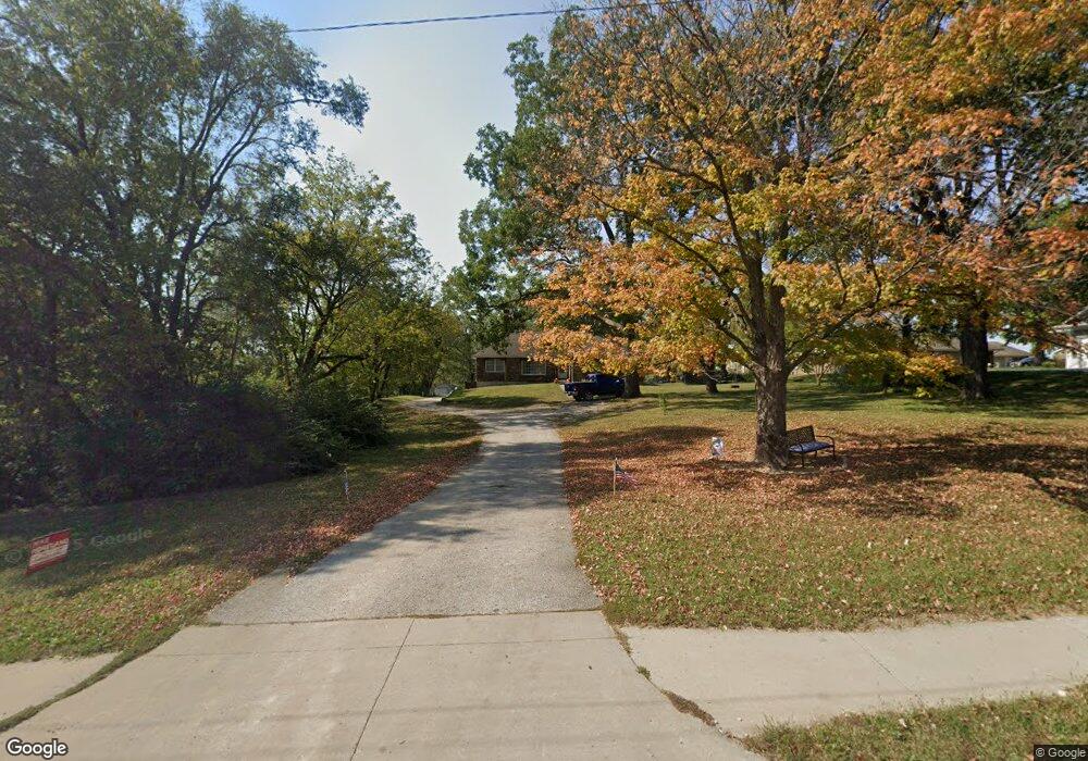
803 N State Route 7 Pleasant Hill, MO 64080
Estimated Value: $277,997 - $296,000
4
Beds
2
Baths
1,553
Sq Ft
$186/Sq Ft
Est. Value
About This Home
This home is located at 803 N State Route 7, Pleasant Hill, MO 64080 and is currently estimated at $288,249, approximately $185 per square foot. 803 N State Route 7 is a home located in Cass County with nearby schools including Pleasant Hill Primary School, Pleasant Hill Elementary School, and Pleasant Hill Middle School.
Ownership History
Date
Name
Owned For
Owner Type
Purchase Details
Closed on
Feb 23, 2023
Sold by
Alli Onadjefe and Alli Akinkunmi
Bought by
Tierra Dorada Llc
Current Estimated Value
Purchase Details
Closed on
May 17, 2019
Sold by
Church C Wayne and Chruch Donna C
Bought by
Foley Kevin M and Hall Emily A
Home Financials for this Owner
Home Financials are based on the most recent Mortgage that was taken out on this home.
Original Mortgage
$181,649
Interest Rate
4.1%
Mortgage Type
FHA
Create a Home Valuation Report for This Property
The Home Valuation Report is an in-depth analysis detailing your home's value as well as a comparison with similar homes in the area
Home Values in the Area
Average Home Value in this Area
Purchase History
| Date | Buyer | Sale Price | Title Company |
|---|---|---|---|
| Tierra Dorada Llc | -- | Kansas City Title | |
| Foley Kevin M | -- | Clt |
Source: Public Records
Mortgage History
| Date | Status | Borrower | Loan Amount |
|---|---|---|---|
| Previous Owner | Foley Kevin M | $181,649 |
Source: Public Records
Tax History Compared to Growth
Tax History
| Year | Tax Paid | Tax Assessment Tax Assessment Total Assessment is a certain percentage of the fair market value that is determined by local assessors to be the total taxable value of land and additions on the property. | Land | Improvement |
|---|---|---|---|---|
| 2024 | $2,300 | $31,900 | $4,320 | $27,580 |
| 2023 | $2,284 | $31,900 | $4,320 | $27,580 |
| 2022 | $2,062 | $28,270 | $4,320 | $23,950 |
| 2021 | $2,006 | $28,270 | $4,320 | $23,950 |
| 2020 | $1,905 | $27,490 | $4,320 | $23,170 |
| 2019 | $1,879 | $27,490 | $4,320 | $23,170 |
| 2018 | $1,697 | $24,490 | $3,460 | $21,030 |
| 2017 | $1,626 | $24,490 | $3,460 | $21,030 |
| 2016 | $1,626 | $23,380 | $3,460 | $19,920 |
| 2015 | $1,647 | $23,380 | $3,460 | $19,920 |
| 2014 | $1,654 | $23,380 | $3,460 | $19,920 |
| 2013 | -- | $23,380 | $3,460 | $19,920 |
Source: Public Records
Map
Nearby Homes
- 1002 Lexington Rd
- 1206 Sycamore St
- 1003 Truman St
- 501 Lexington Rd
- 502 N Armstrong St
- 1004 Wright St
- 1209 Crest Dr
- 601 Hillcrest St
- 1413 Country Club Dr
- 207 Lexington Rd
- 1704 Mulberry St
- 1700 Mulberry St
- 1504 Hawthorne Cir
- 204 Lexington Rd
- 0 Route 7
- 418 N Taylor St
- 1512 Country Club Dr
- 1307 Deena St
- 1521 Lexington Rd
- 122 N Taylor St
- 1011 Renee Lynde Dr
- 1013 Renee Lynde Dr
- 1009 Renee Lynde Dr
- 1007 Renee Lynde Dr
- 1005 Renee Lynde Dr
- 808 Riffle Dr
- 806 N State Route 7
- 808 N State Route 7
- 903 N State Route 7
- 804 N State Route 7
- 810 Riffle Dr
- 1010 Renee Lynde Dr
- 1008 Renee Lynde Dr
- 1003 Renee Lynde Dr
- 900 N State Route 7
- 1006 Renee Lynde Dr
- 806 Riffle Dr
- 802 N State Route 7
- 904 Riffle Dr
- 1010 Renee Lynde Dr Unit D
