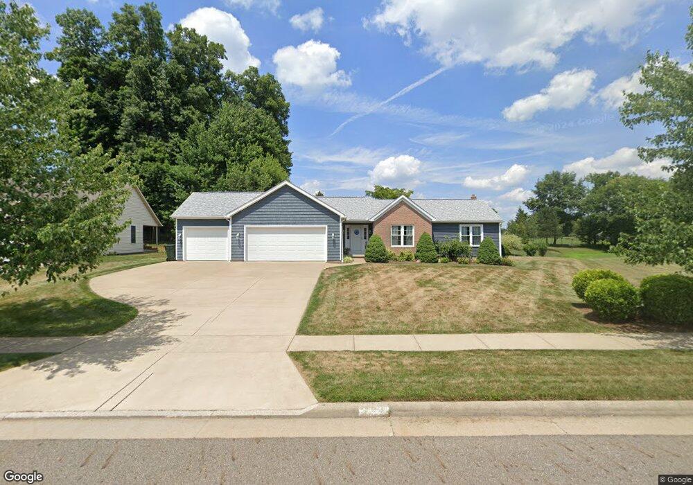
803 Reno Dr Louisville, OH 44641
Estimated Value: $295,000 - $334,000
3
Beds
2
Baths
1,766
Sq Ft
$178/Sq Ft
Est. Value
About This Home
This home is located at 803 Reno Dr, Louisville, OH 44641 and is currently estimated at $313,486, approximately $177 per square foot. 803 Reno Dr is a home located in Stark County with nearby schools including Louisville High School and St. Thomas Aquinas High School & Middle School.
Ownership History
Date
Name
Owned For
Owner Type
Purchase Details
Closed on
Jul 1, 2003
Sold by
Mckinley Development Co
Bought by
Dehoff Thomas W and Dehoff Tina M
Current Estimated Value
Home Financials for this Owner
Home Financials are based on the most recent Mortgage that was taken out on this home.
Original Mortgage
$182,256
Outstanding Balance
$84,480
Interest Rate
5.4%
Mortgage Type
Purchase Money Mortgage
Estimated Equity
$229,006
Create a Home Valuation Report for This Property
The Home Valuation Report is an in-depth analysis detailing your home's value as well as a comparison with similar homes in the area
Home Values in the Area
Average Home Value in this Area
Purchase History
| Date | Buyer | Sale Price | Title Company |
|---|---|---|---|
| Dehoff Thomas W | $35,900 | -- |
Source: Public Records
Mortgage History
| Date | Status | Borrower | Loan Amount |
|---|---|---|---|
| Open | Dehoff Thomas W | $182,256 |
Source: Public Records
Tax History Compared to Growth
Tax History
| Year | Tax Paid | Tax Assessment Tax Assessment Total Assessment is a certain percentage of the fair market value that is determined by local assessors to be the total taxable value of land and additions on the property. | Land | Improvement |
|---|---|---|---|---|
| 2025 | -- | $105,350 | $39,900 | $65,450 |
| 2024 | -- | $105,350 | $39,900 | $65,450 |
| 2023 | $3,373 | $78,510 | $23,630 | $54,880 |
| 2022 | $3,380 | $78,510 | $23,630 | $54,880 |
| 2021 | $3,389 | $78,510 | $23,630 | $54,880 |
| 2020 | $2,796 | $70,350 | $21,280 | $49,070 |
| 2019 | $2,808 | $71,790 | $21,980 | $49,810 |
| 2018 | $2,854 | $71,790 | $21,980 | $49,810 |
| 2017 | $2,534 | $61,500 | $17,220 | $44,280 |
| 2016 | $2,586 | $61,500 | $17,220 | $44,280 |
| 2015 | $2,594 | $61,500 | $17,220 | $44,280 |
| 2014 | $523 | $55,620 | $15,580 | $40,040 |
| 2013 | $1,265 | $55,620 | $15,580 | $40,040 |
Source: Public Records
Map
Nearby Homes
- 0 Brookridge Ave
- 0 Glenbar St
- 614 Reno Dr
- 524 Glenbar St
- 3580 Brookridge Ave Lot 15
- 300 Kennedy St
- 1175 Sturbridge Dr
- 5474 Ravenna Ave
- 428 Honeycrisp Dr NE
- 3047 Mcintosh Dr NE
- 432 Honeycrisp Dr NE
- 2962 Mcintosh Dr NE
- 2963 Mcintosh Dr NE
- 430 Honeycrisp Dr NE
- 2957 Mcintosh Dr NE
- 1149 Sturbridge Dr
- 316 E Reno Dr
- 910 Crosswyck Cir
- 1170 Winding Ridge Ave
- 325 Lincoln Ave
- 813 Reno Dr
- 1426 Brookridge Ave
- 1446 Brookridge Ave
- 716 Glenbar St
- 3578 Brookridge Ave Lot 13 NW
- 3575 Glenbar St Lot 10
- 3571 Glenbar St Lot 6
- 724 Glenbar St
- 0 W Reno Dr
- 906 Reno Dr
- 1312 Baier Ave
- 626 Glenbar St
- 732 Glenbar St
- 1453 Brookridge Ave
- 1457 Brookridge Ave
- 1304 Baier Ave
- 614 Glenbar St
- 830 Glenbar St
- 1459 Brookridge Ave
- 725 Glenbar St