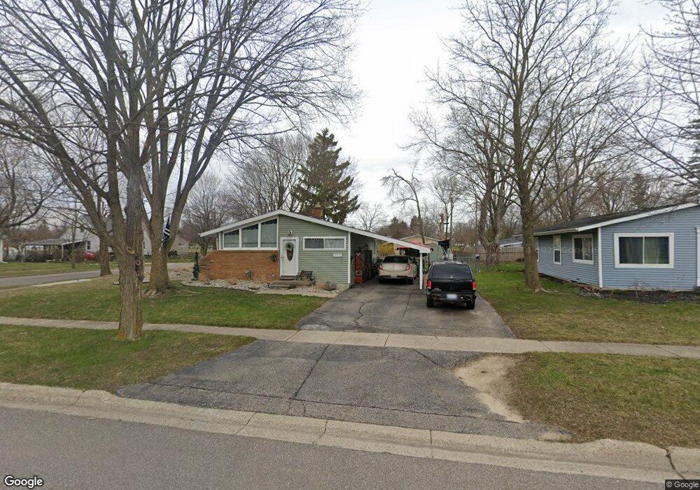
803 Thomas St Flushing, MI 48433
Estimated Value: $151,000 - $182,000
3
Beds
1
Bath
864
Sq Ft
$191/Sq Ft
Est. Value
About This Home
This home is located at 803 Thomas St, Flushing, MI 48433 and is currently estimated at $164,720, approximately $190 per square foot. 803 Thomas St is a home located in Genesee County with nearby schools including Central Elementary School, Flushing Middle School, and Flushing High School.
Ownership History
Date
Name
Owned For
Owner Type
Purchase Details
Closed on
Oct 17, 2023
Sold by
Monsod Elliot
Bought by
Monsod Elliot and Monsod Kimberly Kaplan
Current Estimated Value
Home Financials for this Owner
Home Financials are based on the most recent Mortgage that was taken out on this home.
Original Mortgage
$126,400
Outstanding Balance
$123,485
Interest Rate
7.19%
Mortgage Type
New Conventional
Estimated Equity
$41,235
Purchase Details
Closed on
Mar 9, 2023
Sold by
Cooney Michael E and Cooney Janice M
Bought by
Annette M Lloyd Revocable Trust
Purchase Details
Closed on
Mar 23, 2007
Sold by
Cooney Michael E and Cooney Janice M
Bought by
Annette M Lloyd Revocable Trust
Purchase Details
Closed on
Feb 7, 2007
Sold by
Bode William Harry
Bought by
Cooney Michael E and Cooney Janice M
Create a Home Valuation Report for This Property
The Home Valuation Report is an in-depth analysis detailing your home's value as well as a comparison with similar homes in the area
Home Values in the Area
Average Home Value in this Area
Purchase History
| Date | Buyer | Sale Price | Title Company |
|---|---|---|---|
| Monsod Elliot | -- | Crossroads Title | |
| Monsod Elliot Osio | $160,000 | Crossroads Title | |
| Monsod Elliot Osio | $160,000 | Crossroads Title | |
| Annette M Lloyd Revocable Trust | $68,000 | Cislo Title Company | |
| Annette M Lloyd Revocable Trust | -- | None Available | |
| Cooney Michael E | -- | None Available |
Source: Public Records
Mortgage History
| Date | Status | Borrower | Loan Amount |
|---|---|---|---|
| Open | Monsod Elliot Osio | $126,400 | |
| Closed | Monsod Elliot Osio | $126,400 |
Source: Public Records
Tax History
| Year | Tax Paid | Tax Assessment Tax Assessment Total Assessment is a certain percentage of the fair market value that is determined by local assessors to be the total taxable value of land and additions on the property. | Land | Improvement |
|---|---|---|---|---|
| 2025 | $4,282 | $69,900 | $0 | $0 |
| 2024 | $3,695 | $64,300 | $0 | $0 |
| 2023 | $2,034 | $59,300 | $0 | $0 |
| 2022 | $2,119 | $55,400 | $0 | $0 |
| 2021 | $2,119 | $50,600 | $0 | $0 |
| 2020 | $1,800 | $42,800 | $0 | $0 |
| 2019 | $1,771 | $39,900 | $0 | $0 |
| 2018 | $1,955 | $37,600 | $0 | $0 |
| 2017 | $1,862 | $37,100 | $0 | $0 |
| 2016 | $1,847 | $27,850 | $0 | $0 |
| 2015 | $1,943 | $0 | $0 | $0 |
| 2012 | -- | $26,900 | $26,900 | $0 |
Source: Public Records
Map
Nearby Homes
- 200 Boman St
- 507 Dale St
- 120 Boman St
- 530 Coutant St
- 0 Double Tree Estates
- 515 Chestnut St
- 588 Oakbrook Cir
- 433 Dutch Mill Dr
- 527 Oakbrook Cir Unit 14
- 621 Ashwood Dr
- 1252 Beatrice St
- 418 Windmill Point Dr
- 620 Carpenter Rd
- 1216 Pleasantview Dr
- 314 Myrtle St
- 1014 Birchwood Dr
- 6106 E River Rd
- 433 Crestview St
- 113 N Mckinley Rd
- 748 Bending Ct
Your Personal Tour Guide
Ask me questions while you tour the home.