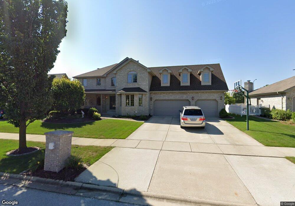
8031 Abbey Rd Tinley Park, IL 60477
Central Tinley Park NeighborhoodEstimated Value: $599,000 - $640,000
4
Beds
3
Baths
3,483
Sq Ft
$177/Sq Ft
Est. Value
About This Home
This home is located at 8031 Abbey Rd, Tinley Park, IL 60477 and is currently estimated at $616,498, approximately $177 per square foot. 8031 Abbey Rd is a home located in Cook County with nearby schools including Millennium Elementary School, Virgil I Grissom Middle School, and Victor J Andrew High School.
Ownership History
Date
Name
Owned For
Owner Type
Purchase Details
Closed on
Nov 22, 2002
Sold by
State Bank Of Countryside
Bought by
George Kenneth A and George Mary Ellen
Current Estimated Value
Home Financials for this Owner
Home Financials are based on the most recent Mortgage that was taken out on this home.
Original Mortgage
$120,000
Interest Rate
6.38%
Create a Home Valuation Report for This Property
The Home Valuation Report is an in-depth analysis detailing your home's value as well as a comparison with similar homes in the area
Home Values in the Area
Average Home Value in this Area
Purchase History
| Date | Buyer | Sale Price | Title Company |
|---|---|---|---|
| George Kenneth A | $323,000 | Enterprise Land Title Ltd |
Source: Public Records
Mortgage History
| Date | Status | Borrower | Loan Amount |
|---|---|---|---|
| Closed | George Kenneth A | $120,000 |
Source: Public Records
Tax History Compared to Growth
Tax History
| Year | Tax Paid | Tax Assessment Tax Assessment Total Assessment is a certain percentage of the fair market value that is determined by local assessors to be the total taxable value of land and additions on the property. | Land | Improvement |
|---|---|---|---|---|
| 2024 | $13,239 | $51,000 | $14,631 | $36,369 |
| 2023 | $11,344 | $51,000 | $14,631 | $36,369 |
| 2022 | $11,344 | $35,239 | $6,311 | $28,928 |
| 2021 | $11,010 | $35,239 | $6,311 | $28,928 |
| 2020 | $10,800 | $35,239 | $6,311 | $28,928 |
| 2019 | $12,124 | $40,811 | $5,737 | $35,074 |
| 2018 | $12,886 | $44,037 | $5,737 | $38,300 |
| 2017 | $12,561 | $44,037 | $5,737 | $38,300 |
| 2016 | $11,527 | $37,203 | $5,163 | $32,040 |
| 2015 | $11,362 | $37,203 | $5,163 | $32,040 |
| 2014 | $11,584 | $38,129 | $5,163 | $32,966 |
| 2013 | $10,832 | $38,495 | $5,163 | $33,332 |
Source: Public Records
Map
Nearby Homes
- 8036 Blarney Rd
- 17908 Iroquois Trace
- 8416 Stratford Dr Unit 8416
- 8423 Stratford Dr Unit 8423
- 18261 Kirby Dr Unit 2918261
- 7783 Bristol Park Dr Unit 1-SW
- 7755 Bristol Park Dr Unit 1NE
- 7727 Bristol Park Dr
- 8313 Aster Ln
- 7925 Belle Rive Ct
- 17631 Dover Ct
- Fremont Plan at Radcliffe Place
- Calysta Plan at Radcliffe Place
- Danbury Plan at Radcliffe Place
- Briarcliffe Plan at Radcliffe Place
- Eden Plan at Radcliffe Place
- Amberwood Plan at Radcliffe Place
- 18145 Harlem Ave
- 8030 Valley View Dr
- 7517 175th St Unit 331