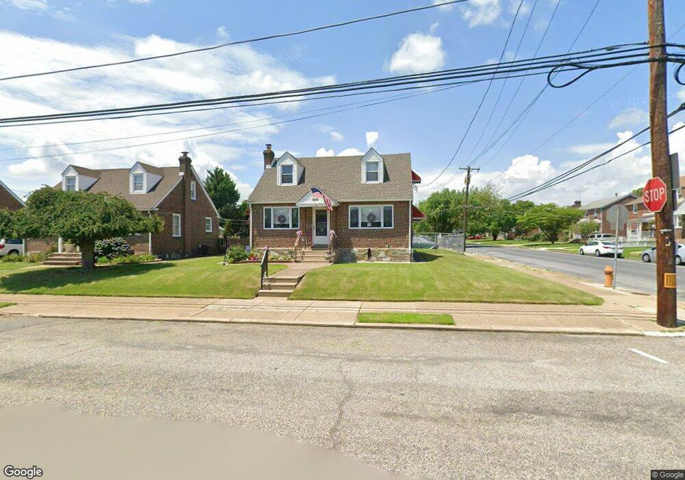
8032 Large St Philadelphia, PA 19152
Rhawnhurst NeighborhoodEstimated Value: $348,000 - $391,000
--
Bed
--
Bath
1,860
Sq Ft
$197/Sq Ft
Est. Value
About This Home
This home is located at 8032 Large St, Philadelphia, PA 19152 and is currently estimated at $365,658, approximately $196 per square foot. 8032 Large St is a home located in Philadelphia County with nearby schools including Farrell Louis H School, Northeast High School, and Tacony Academy Charter School.
Ownership History
Date
Name
Owned For
Owner Type
Purchase Details
Closed on
Oct 30, 2002
Sold by
Mikula Gregory J
Bought by
Mikula Gregory J and Mikula Tracy L
Current Estimated Value
Home Financials for this Owner
Home Financials are based on the most recent Mortgage that was taken out on this home.
Original Mortgage
$158,000
Interest Rate
6.34%
Mortgage Type
Balloon
Purchase Details
Closed on
Oct 27, 1994
Sold by
Keen Michael J and Keen Lisa M
Bought by
Mikula Gregory J
Create a Home Valuation Report for This Property
The Home Valuation Report is an in-depth analysis detailing your home's value as well as a comparison with similar homes in the area
Home Values in the Area
Average Home Value in this Area
Purchase History
| Date | Buyer | Sale Price | Title Company |
|---|---|---|---|
| Mikula Gregory J | $115,000 | Fidelity National Title Ins | |
| Mikula Gregory J | $115,000 | -- |
Source: Public Records
Mortgage History
| Date | Status | Borrower | Loan Amount |
|---|---|---|---|
| Closed | Mikula Gregory J | $158,000 | |
| Closed | Mikula Gregory J | $25,000 |
Source: Public Records
Tax History Compared to Growth
Tax History
| Year | Tax Paid | Tax Assessment Tax Assessment Total Assessment is a certain percentage of the fair market value that is determined by local assessors to be the total taxable value of land and additions on the property. | Land | Improvement |
|---|---|---|---|---|
| 2025 | $4,124 | $381,600 | $76,320 | $305,280 |
| 2024 | $4,124 | $381,600 | $76,320 | $305,280 |
| 2023 | $4,124 | $294,600 | $58,920 | $235,680 |
| 2022 | $3,235 | $294,600 | $58,920 | $235,680 |
| 2021 | $3,235 | $0 | $0 | $0 |
| 2020 | $3,235 | $0 | $0 | $0 |
| 2019 | $3,133 | $0 | $0 | $0 |
| 2018 | $3,005 | $0 | $0 | $0 |
| 2017 | $3,005 | $0 | $0 | $0 |
| 2016 | $3,005 | $0 | $0 | $0 |
| 2015 | $2,877 | $0 | $0 | $0 |
| 2014 | -- | $214,700 | $91,690 | $123,010 |
| 2012 | -- | $27,040 | $3,811 | $23,229 |
Source: Public Records
Map
Nearby Homes
- 2013 Fuller St
- 2232 Stanwood St
- 1931 33 Rhawn St
- 2123 Loney St
- 2029 Loney St
- 2230 Emerson St
- 2223 Emerson St
- 2155 Benson St
- 2302 Rhawn St
- 2162 Strahle St
- 2306 Griffith St
- 2345 Ripley St
- 2201 Strahle St Unit C302
- 7912 14 Loretto Ave
- 2023 Hartel Ave
- 1718 Rhawn St
- 7815 Horrocks St
- 1702 Arthur St
- 1704 Stanwood St
- 1719 Loney St
- 8028 Large St
- 2034 Stanwood St
- 8024 Large St
- 2039 Stanwood St
- 2043 Stanwood St
- 2041 Stanwood St
- 2037 Stanwood St
- 2030 Stanwood St
- 2037 Fuller St
- 2035 Stanwood St
- 8020 Large St
- 2035 Fuller St
- 8033 Large St
- 2033 Fuller St
- 2026 Stanwood St
- 8029 Large St
- 8106 Large St
- 2031 Stanwood St
- 2031 Fuller St
- 8025 Large St