Estimated Value: $48,000 - $106,000
3
Beds
2
Baths
1,244
Sq Ft
$61/Sq Ft
Est. Value
About This Home
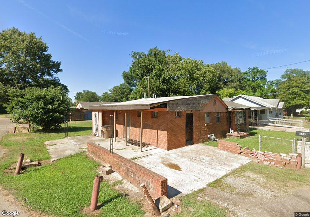
This home is located at 804 Forrest Ave W, Wynne, AR 72396 and is currently estimated at $75,953, approximately $61 per square foot. 804 Forrest Ave W is a home located in Cross County with nearby schools including Wynne Primary School, Wynne Intermediate School, and Wynne Junior High School.
Ownership History
Date
Name
Owned For
Owner Type
Purchase Details
Closed on
Nov 21, 2012
Sold by
Federal National Mortgage Association
Bought by
Ar Seven Llc
Current Estimated Value
Purchase Details
Closed on
May 31, 2006
Sold by
Brookins Solomon L
Bought by
First Home Mortgage Inc
Home Financials for this Owner
Home Financials are based on the most recent Mortgage that was taken out on this home.
Original Mortgage
$44,000
Interest Rate
6.58%
Mortgage Type
New Conventional
Purchase Details
Closed on
Dec 19, 2003
Bought by
Cross County Bank
Purchase Details
Closed on
Apr 24, 2000
Bought by
Bankston Phillip and Eva Mae
Purchase Details
Closed on
Jul 22, 1994
Bought by
Murff Anderson and Murff Jerald
Create a Home Valuation Report for This Property
The Home Valuation Report is an in-depth analysis detailing your home's value as well as a comparison with similar homes in the area
Home Values in the Area
Average Home Value in this Area
Purchase History
| Date | Buyer | Sale Price | Title Company |
|---|---|---|---|
| Ar Seven Llc | $7,055 | Chicago Title Insurance Comp | |
| First Home Mortgage Inc | -- | None Available | |
| Brookins Solomon L | $44,000 | None Available | |
| Cross County Bank | -- | -- | |
| Bankston Phillip | $35,000 | -- | |
| Murff Anderson | -- | -- |
Source: Public Records
Mortgage History
| Date | Status | Borrower | Loan Amount |
|---|---|---|---|
| Previous Owner | Brookins Solomon L | $44,000 |
Source: Public Records
Tax History Compared to Growth
Tax History
| Year | Tax Paid | Tax Assessment Tax Assessment Total Assessment is a certain percentage of the fair market value that is determined by local assessors to be the total taxable value of land and additions on the property. | Land | Improvement |
|---|---|---|---|---|
| 2024 | -- | $1,860 | $780 | $1,080 |
| 2023 | $0 | $1,910 | $780 | $1,130 |
| 2022 | $0 | $1,910 | $780 | $1,130 |
| 2021 | $177 | $1,910 | $780 | $1,130 |
| 2020 | $177 | $1,910 | $780 | $1,130 |
| 2019 | $177 | $3,570 | $740 | $2,830 |
| 2018 | $0 | $3,570 | $740 | $2,830 |
| 2017 | $0 | $3,570 | $740 | $2,830 |
| 2016 | $177 | $3,570 | $740 | $2,830 |
| 2015 | $177 | $3,570 | $740 | $2,830 |
| 2014 | $177 | $9,080 | $680 | $8,400 |
Source: Public Records
Map
Nearby Homes
- 813 Childress Dr
- 0 Cr 760
- 624 C St
- 1002 Brittney Cir
- 0 Brittney Cir Unit 43670
- 0 Brittney Cir Unit 25030957
- 714 Church St N
- 513 Forrest Ave E
- 514 Poplar Ave E
- 607 Bruce St N
- 810 Forrest Ave E
- 411 N Bruce St
- 704 Front St S
- 136 Matthew Addition Cove
- 106 Eldridge Ct
- 919 Hamilton Ave E
- 903 Levesque Ave E
- 1008 Languille Ave E
- 908 Block St S
- 1783 Hart