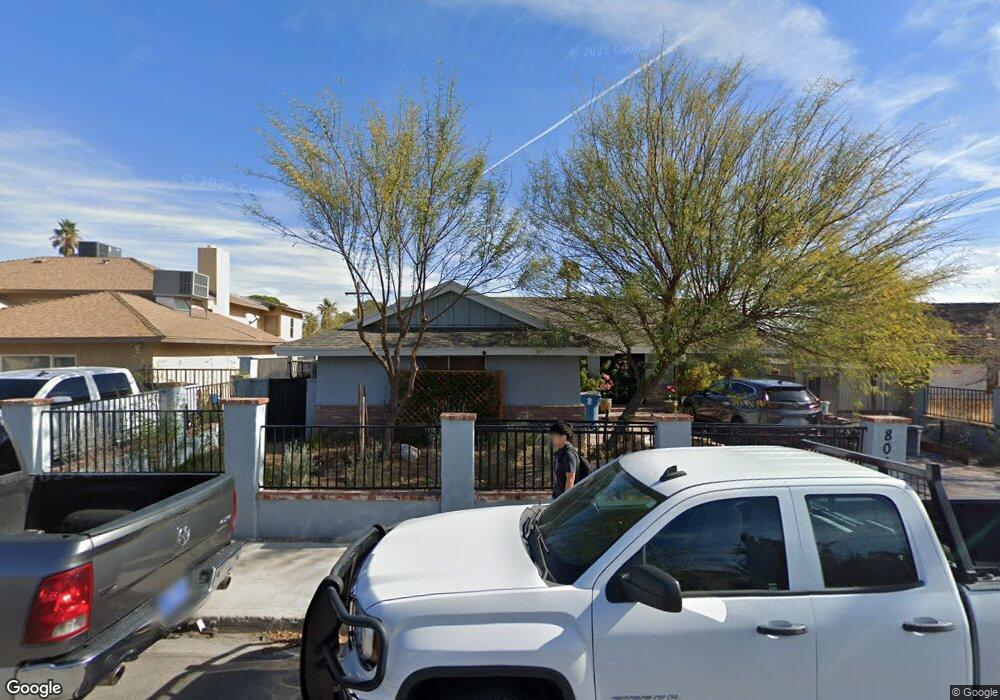
804 Langtry Dr Las Vegas, NV 89107
Twin Lakes NeighborhoodEstimated Value: $393,576 - $415,000
3
Beds
2
Baths
1,872
Sq Ft
$215/Sq Ft
Est. Value
About This Home
This home is located at 804 Langtry Dr, Las Vegas, NV 89107 and is currently estimated at $403,394, approximately $215 per square foot. 804 Langtry Dr is a home located in Clark County with nearby schools including E.W. Griffith Elementary School, Robert O Gibson Middle School, and Western High School.
Ownership History
Date
Name
Owned For
Owner Type
Purchase Details
Closed on
Jun 30, 1999
Sold by
Hud
Bought by
Avendano Ralph J and Avendano Linda L
Current Estimated Value
Home Financials for this Owner
Home Financials are based on the most recent Mortgage that was taken out on this home.
Original Mortgage
$103,841
Outstanding Balance
$28,260
Interest Rate
7.2%
Mortgage Type
FHA
Estimated Equity
$375,134
Purchase Details
Closed on
Nov 13, 1998
Sold by
Luna Evodio
Bought by
Countrywide Home Loans Inc
Purchase Details
Closed on
Nov 12, 1998
Sold by
Countrywide Home Loans Inc
Bought by
Hud
Purchase Details
Closed on
Jan 2, 1997
Sold by
Walo William E and Walo Magel I
Bought by
Luna Evodio
Home Financials for this Owner
Home Financials are based on the most recent Mortgage that was taken out on this home.
Original Mortgage
$115,491
Interest Rate
7.62%
Mortgage Type
FHA
Create a Home Valuation Report for This Property
The Home Valuation Report is an in-depth analysis detailing your home's value as well as a comparison with similar homes in the area
Home Values in the Area
Average Home Value in this Area
Purchase History
| Date | Buyer | Sale Price | Title Company |
|---|---|---|---|
| Avendano Ralph J | -- | Stewart Title Guaranty Compa | |
| Countrywide Home Loans Inc | $126,754 | Fidelity National Title | |
| Hud | -- | Fidelity National Title | |
| Luna Evodio | $117,000 | United Title |
Source: Public Records
Mortgage History
| Date | Status | Borrower | Loan Amount |
|---|---|---|---|
| Open | Avendano Ralph J | $103,841 | |
| Previous Owner | Luna Evodio | $115,491 |
Source: Public Records
Tax History Compared to Growth
Tax History
| Year | Tax Paid | Tax Assessment Tax Assessment Total Assessment is a certain percentage of the fair market value that is determined by local assessors to be the total taxable value of land and additions on the property. | Land | Improvement |
|---|---|---|---|---|
| 2025 | $1,233 | $65,496 | $32,200 | $33,296 |
| 2024 | $1,198 | $65,496 | $32,200 | $33,296 |
| 2023 | $1,198 | $63,909 | $33,950 | $29,959 |
| 2022 | $1,163 | $56,981 | $30,100 | $26,881 |
| 2021 | $1,129 | $50,532 | $25,550 | $24,982 |
| 2020 | $1,093 | $49,109 | $24,850 | $24,259 |
| 2019 | $1,061 | $44,744 | $21,350 | $23,394 |
| 2018 | $1,030 | $39,566 | $17,500 | $22,066 |
| 2017 | $1,293 | $39,443 | $17,500 | $21,943 |
| 2016 | $977 | $34,340 | $13,300 | $21,040 |
| 2015 | $974 | $30,726 | $9,100 | $21,626 |
| 2014 | $945 | $27,981 | $5,950 | $22,031 |
Source: Public Records
Map
Nearby Homes
- 800 Langtry Dr
- 821 Mar Jay Ct
- 4301 Fortune Ave
- 812 Pyramid Dr
- 812 Hogan Dr
- 4317 Hanford Ave
- 309 Estella Ave
- 4405 Hanford Ave
- 312 Estella Ave
- 1112 Hazard Ave
- 1317 Pyramid Dr
- 1300 Oak Tree Ln
- 1325 Pyramid Dr
- 3616 Roseglen Ct
- 1101 Silver Lake Dr
- 1313 Purple Sage Ave
- 3871 Mountain Trail
- 605 N Yale St
- 1225 Arrowhead Ave
- 1103 Arrowhead Ave
- 808 Langtry Dr
- 809 Starks Dr
- 812 Langtry Dr
- 724 Langtry Dr
- 813 Starks Dr
- 805 Langtry Dr
- 801 Langtry Dr
- 805 Starks Dr
- 816 Mar Jay Ct
- 809 Langtry Dr
- 725 Langtry Dr
- 816 Langtry Dr
- 720 Langtry Dr
- 813 Langtry Dr
- 801 Starks Dr
- 3816 Apache Ln Unit 3816
- 3816 Apache Ln
- 3816 Apache Ln Unit n
- 721 Langtry Dr
- 716 Langtry Dr