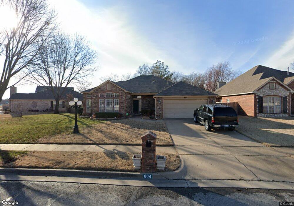
804 N Hemlock Ave Broken Arrow, OK 74012
Country Aire Estates NeighborhoodEstimated Value: $294,081 - $321,000
3
Beds
2
Baths
2,263
Sq Ft
$137/Sq Ft
Est. Value
About This Home
This home is located at 804 N Hemlock Ave, Broken Arrow, OK 74012 and is currently estimated at $309,020, approximately $136 per square foot. 804 N Hemlock Ave is a home located in Tulsa County with nearby schools including Peters Elementary School, Union 8th Grade Center, and Union 6th-7th Grade Center.
Ownership History
Date
Name
Owned For
Owner Type
Purchase Details
Closed on
Nov 1, 2017
Sold by
Hawk Sandra Lynn and Hawk Robert D
Bought by
Duke Donald J and Duke Shirley C
Current Estimated Value
Purchase Details
Closed on
Jan 24, 2007
Sold by
Winters Ruby and Winters Ruby A
Bought by
Winters Ruby A and The Ruby Winters Trust
Purchase Details
Closed on
Oct 10, 1997
Sold by
Romine Larry M and Romine Jaunita S
Bought by
Winters Lloyd R and Winters Ruby A
Purchase Details
Closed on
Jul 1, 1995
Purchase Details
Closed on
May 1, 1994
Create a Home Valuation Report for This Property
The Home Valuation Report is an in-depth analysis detailing your home's value as well as a comparison with similar homes in the area
Home Values in the Area
Average Home Value in this Area
Purchase History
| Date | Buyer | Sale Price | Title Company |
|---|---|---|---|
| Duke Donald J | $188,000 | First American Title | |
| Winters Ruby A | -- | None Available | |
| Winters Lloyd R | $134,000 | First Amer Title & Abstract | |
| -- | $135,000 | -- | |
| -- | $24,000 | -- |
Source: Public Records
Tax History Compared to Growth
Tax History
| Year | Tax Paid | Tax Assessment Tax Assessment Total Assessment is a certain percentage of the fair market value that is determined by local assessors to be the total taxable value of land and additions on the property. | Land | Improvement |
|---|---|---|---|---|
| 2025 | $3,016 | $22,974 | $2,710 | $20,264 |
| 2024 | $2,787 | $22,276 | $2,932 | $19,344 |
| 2023 | $2,787 | $22,598 | $2,869 | $19,729 |
| 2022 | $2,725 | $20,939 | $3,431 | $17,508 |
| 2021 | $2,650 | $20,301 | $3,327 | $16,974 |
| 2020 | $2,586 | $19,681 | $3,418 | $16,263 |
| 2019 | $2,582 | $19,681 | $3,418 | $16,263 |
| 2018 | $2,574 | $19,681 | $3,418 | $16,263 |
| 2017 | $2,135 | $17,105 | $3,068 | $14,037 |
| 2016 | $2,107 | $17,106 | $3,296 | $13,810 |
| 2015 | $2,108 | $17,470 | $3,366 | $14,104 |
| 2014 | $2,095 | $17,470 | $3,366 | $14,104 |
Source: Public Records
Map
Nearby Homes
- 3902 W Kenosha St
- 1218 N Elder Ave
- 2701 W Madison St
- 2909 W Oakland St
- 3033 W Oakland St
- 3309 W Freeport St
- 3108 W Norman Cir
- Lee II Plan at Bricktown East - Broken Arrow
- 1331 N Beech St
- Hampton III Plan at Bricktown East - Broken Arrow
- Walker FH Plan at Bricktown East - Broken Arrow
- Hamilton Plan at Bricktown East - Broken Arrow
- Dorsey V Plan at Bricktown East - Broken Arrow
- Hampton IV 3C Plan at Bricktown East - Broken Arrow
- Washington Plan at Bricktown East - Broken Arrow
- Brenda MG Plan at Bricktown East - Broken Arrow
- Walker ll Plan at Bricktown East - Broken Arrow
- Ridgway III Plan at Bricktown East - Broken Arrow
- Brenda Plan at Bricktown East - Broken Arrow
- Dorsey Farm House Plan at Bricktown East - Broken Arrow
- 800 N Hemlock Ave
- 808 N Hemlock Ave
- 709 N Indianwood Ave
- 801 N Hemlock Ave
- 805 N Hemlock Ave
- 904 N Hemlock Ave
- 713 N Indianwood Ave
- 901 N Hemlock Ave
- 908 N Hemlock West Ave
- 905 N Hemlock Ave
- 908 N Hemlock Ave
- 3000 W Hartford St
- 801 N Indianwood Ave
- 704 N Indianwood Ave
- 909 N Hemlock Ave
- 3004 W Hartford St
- 805 N Indianwood Ave
- 3008 W Hartford St
- 800 N Indianwood Ave
- 804 N Indianwood Ave
