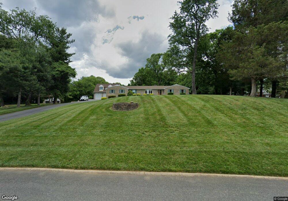
804 Shawnee Brooke Dr Havre de Grace, MD 21078
Estimated Value: $494,334 - $577,000
--
Bed
2
Baths
2,184
Sq Ft
$243/Sq Ft
Est. Value
About This Home
This home is located at 804 Shawnee Brooke Dr, Havre de Grace, MD 21078 and is currently estimated at $530,584, approximately $242 per square foot. 804 Shawnee Brooke Dr is a home located in Harford County with nearby schools including Meadowvale Elementary School, Havre de Grace Middle School, and Havre de Grace High School.
Ownership History
Date
Name
Owned For
Owner Type
Purchase Details
Closed on
Feb 12, 2003
Sold by
Vaughan Patricia
Bought by
Keithley Daniel W and Keithley Mary Ellen
Current Estimated Value
Purchase Details
Closed on
May 2, 2000
Sold by
Keithley Daniel W
Bought by
Vaughan Patricia and Townsend James
Purchase Details
Closed on
Oct 30, 1987
Sold by
Causey George Thorne
Bought by
Keithley Daniel W
Create a Home Valuation Report for This Property
The Home Valuation Report is an in-depth analysis detailing your home's value as well as a comparison with similar homes in the area
Home Values in the Area
Average Home Value in this Area
Purchase History
| Date | Buyer | Sale Price | Title Company |
|---|---|---|---|
| Keithley Daniel W | -- | -- | |
| Vaughan Patricia | -- | -- | |
| Keithley Daniel W | $24,900 | -- |
Source: Public Records
Tax History Compared to Growth
Tax History
| Year | Tax Paid | Tax Assessment Tax Assessment Total Assessment is a certain percentage of the fair market value that is determined by local assessors to be the total taxable value of land and additions on the property. | Land | Improvement |
|---|---|---|---|---|
| 2025 | $4,844 | $466,600 | $0 | $0 |
| 2024 | $4,844 | $438,900 | $98,200 | $340,700 |
| 2023 | $4,680 | $423,900 | $0 | $0 |
| 2022 | $4,517 | $408,900 | $0 | $0 |
| 2021 | $4,471 | $393,900 | $98,200 | $295,700 |
| 2020 | $4,471 | $382,200 | $0 | $0 |
| 2019 | $4,336 | $370,500 | $0 | $0 |
| 2018 | $4,163 | $358,800 | $108,500 | $250,300 |
| 2017 | $4,163 | $358,800 | $0 | $0 |
| 2016 | -- | $358,800 | $0 | $0 |
| 2015 | $4,613 | $367,700 | $0 | $0 |
| 2014 | $4,613 | $367,700 | $0 | $0 |
Source: Public Records
Map
Nearby Homes
- 400 Brant Ct
- 332 Pintail Dr
- 302 Goforth Dr
- 1514 Lyon St
- 146 Remington Cir
- 102 Tidewater Dr
- 221 War Admiral Way
- 311 Sunrise Ct
- 1514 Superior St
- 101 Susquehanna Ct
- 202 Man o War Place
- 1411 Chapel Rd
- 321 Friar Rock Cir
- 302 Friar Rock Cir
- 300 Friar Rock Cir
- Columbia Plan at Scenic Vista
- Hudson Plan at Scenic Vista
- Allegheny Plan at Scenic Vista
- Lehigh Plan at Scenic Vista
- Somerset II - Bulle Rock Plan at Bulle Rock - Single Family
- 806 Shawnee Brooke Dr
- 802 Shawnee Brooke Dr
- 214 Eider Ct
- 801 Shawnee Brooke Dr
- 714 Shawnee Brooke Dr
- 213 Eider Ct
- 420 Brant Ct
- 418 Brant Ct
- 800 Shawnee Brooke Dr
- 212 Eider Ct
- 416 Brant Ct
- 208 Drake Ct
- 206 Drake Ct
- 414 Brant Ct
- 419 Brant Ct
- 210 Eider Ct
- 1506 Iroquois Ct
- 211 Eider Ct
- 715 Shawnee Brooke Dr
- 412 Brant Ct