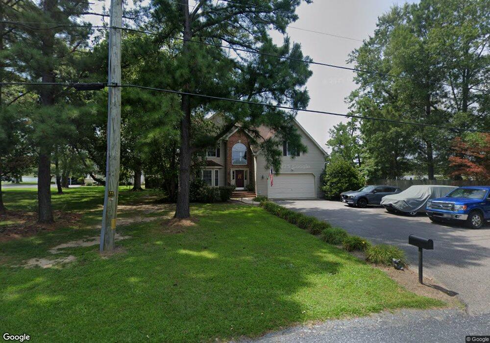
804 Thompson Creek Rd Stevensville, MD 21666
Estimated Value: $729,000 - $909,000
--
Bed
3
Baths
2,477
Sq Ft
$338/Sq Ft
Est. Value
About This Home
This home is located at 804 Thompson Creek Rd, Stevensville, MD 21666 and is currently estimated at $836,114, approximately $337 per square foot. 804 Thompson Creek Rd is a home located in Queen Anne's County with nearby schools including Kent Island Elementary School, Bayside Elementary School, and Matapeake Middle School.
Ownership History
Date
Name
Owned For
Owner Type
Purchase Details
Closed on
Apr 29, 2021
Sold by
Depol Kathleen M and De Pol Jay
Bought by
Depol Jay B and De Pol Kathleen
Current Estimated Value
Purchase Details
Closed on
Jul 2, 2001
Sold by
Weese Development Corporation
Bought by
Depol Kathleen M and Depol Jay B
Purchase Details
Closed on
Dec 15, 2000
Sold by
Scharnus Elaine P Trustee
Bought by
Weese Development Corporation
Create a Home Valuation Report for This Property
The Home Valuation Report is an in-depth analysis detailing your home's value as well as a comparison with similar homes in the area
Home Values in the Area
Average Home Value in this Area
Purchase History
| Date | Buyer | Sale Price | Title Company |
|---|---|---|---|
| Depol Jay B | -- | None Available | |
| Depol Kathleen M | $389,786 | -- | |
| Weese Development Corporation | $162,000 | -- |
Source: Public Records
Mortgage History
| Date | Status | Borrower | Loan Amount |
|---|---|---|---|
| Closed | Weese Development Corporation | -- |
Source: Public Records
Tax History Compared to Growth
Tax History
| Year | Tax Paid | Tax Assessment Tax Assessment Total Assessment is a certain percentage of the fair market value that is determined by local assessors to be the total taxable value of land and additions on the property. | Land | Improvement |
|---|---|---|---|---|
| 2025 | $6,527 | $722,433 | $0 | $0 |
| 2024 | $6,201 | $673,667 | $0 | $0 |
| 2023 | $5,887 | $624,900 | $345,800 | $279,100 |
| 2022 | $5,762 | $611,667 | $0 | $0 |
| 2021 | $5,613 | $598,433 | $0 | $0 |
| 2020 | $5,613 | $585,200 | $322,200 | $263,000 |
| 2019 | $5,418 | $564,933 | $0 | $0 |
| 2018 | $5,224 | $544,667 | $0 | $0 |
| 2017 | $5,030 | $524,400 | $0 | $0 |
| 2016 | -- | $524,400 | $0 | $0 |
| 2015 | $2,339 | $524,400 | $0 | $0 |
| 2014 | $2,339 | $527,700 | $0 | $0 |
Source: Public Records
Map
Nearby Homes
- 1 UNIT 2 Compass Cir
- 1757 Harbor Dr
- 736 Moorings Cir Unit 35
- 111 Keenan Way
- 119 Keenan Way
- 241 Jessica Lyn Ave
- 349 Topside Dr
- 858 Moorings Cir Unit 11
- 312 Topside Dr Unit 223
- 1839 Harbor Dr
- 0 Harbor Dr
- 0 Parks Rd
- 1870 Harbor Dr
- 122 E Main St
- 1906 Harbor Dr
- 123 Bentons Pleasure Rd
- 1916 Stevens Dr
- 103 Irene Way
- 515 Love Point Rd
- Lot 53 Woods Rd
- 808 Thompson Creek Rd
- 802 Thompson Creek Rd
- 816 Thompson Creek Rd
- 746 Thompson Creek Rd
- 822 Thompson Creek Rd
- 826 Thompson Creek Rd
- 740 Thompson Creek Rd
- 834 Thompson Creek Rd
- 736 Thompson Creek Rd
- 0 Thompson Creek Rd Unit QA7299840
- 734 Thompson Creek Rd
- 836 Thompson Creek Rd
- 732 Thompson Creek Rd
- 730 Thompson Creek Rd
- 730 Thompson Creek Rd Unit 25
- 728 Thompson Creek Rd
- 728 Thompson Creek Rd Unit 24
- 726 Thompson Creek Rd
- 838 Thompson Creek Rd
- 724 Thompson Creek Rd