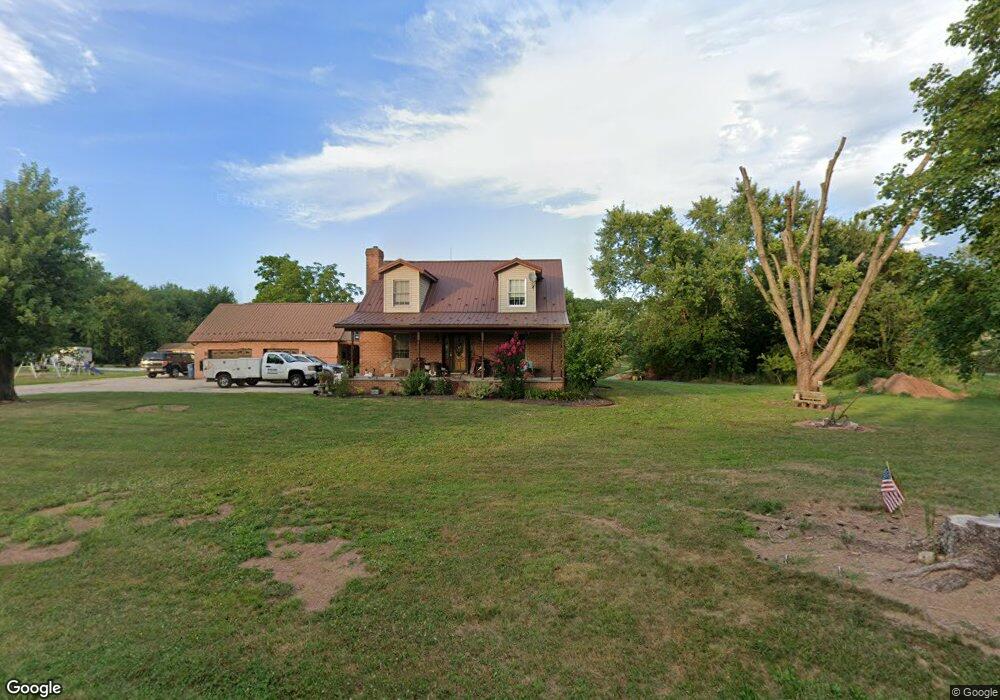
804 White Hall Rd Littlestown, PA 17340
Estimated Value: $402,000 - $678,883
2
Beds
1
Bath
1,699
Sq Ft
$323/Sq Ft
Est. Value
About This Home
This home is located at 804 White Hall Rd, Littlestown, PA 17340 and is currently estimated at $548,294, approximately $322 per square foot. 804 White Hall Rd is a home located in Adams County with nearby schools including Rolling Acres El School, Maple Avenue Middle School, and Littlestown Senior High School.
Ownership History
Date
Name
Owned For
Owner Type
Purchase Details
Closed on
Jul 31, 2023
Sold by
Shoop Iii Eugene and Marie Tina
Bought by
Shoop Eugene and Shoop Tina Marie
Current Estimated Value
Purchase Details
Closed on
Jul 28, 2023
Sold by
Shoop Eugene T and Shoop Tina Marie
Bought by
Shoop Eugene T and Shoop Tina Marie
Purchase Details
Closed on
Apr 30, 2014
Sold by
Shoop Eugene T and Shoop Tina Marie
Bought by
Shoop Eugene T and Shoop Tina Marie
Purchase Details
Closed on
Aug 25, 1994
Bought by
Shoop Eugene T
Create a Home Valuation Report for This Property
The Home Valuation Report is an in-depth analysis detailing your home's value as well as a comparison with similar homes in the area
Purchase History
| Date | Buyer | Sale Price | Title Company |
|---|---|---|---|
| Shoop Eugene | -- | Apple Leaf Abstracting & Settl | |
| Shoop Eugene T | -- | Apple Leaf Abstracting & Settl | |
| Shoop Eugene T | -- | Apple Leaf Abstracting & Settl | |
| Shoop Eugene T | -- | None Available | |
| Shoop Eugene T | -- | -- |
Source: Public Records
Tax History
| Year | Tax Paid | Tax Assessment Tax Assessment Total Assessment is a certain percentage of the fair market value that is determined by local assessors to be the total taxable value of land and additions on the property. | Land | Improvement |
|---|---|---|---|---|
| 2026 | $6,920 | $357,000 | $4,700 | $352,300 |
| 2025 | $6,778 | $349,700 | $4,700 | $345,000 |
| 2023 | $5,566 | $306,000 | $125,800 | $180,200 |
| 2022 | $5,527 | $306,000 | $125,800 | $180,200 |
| 2021 | $5,335 | $306,000 | $125,800 | $180,200 |
| 2020 | $5,260 | $306,000 | $125,800 | $180,200 |
| 2019 | $5,150 | $306,000 | $125,800 | $180,200 |
| 2018 | $5,040 | $306,000 | $125,800 | $180,200 |
| 2017 | $4,888 | $306,000 | $125,800 | $180,200 |
| 2016 | -- | $306,000 | $125,800 | $180,200 |
| 2015 | -- | $306,000 | $125,800 | $180,200 |
| 2014 | -- | $238,900 | $58,700 | $180,200 |
Source: Public Records
Map
Nearby Homes
- 780 White Hall Rd
- 464 Locust Ln
- 114 Maple St
- 678 Littlestown Rd Unit 1
- 38 Bonniefield Cir Unit 20
- 34 Bonniefield Cir Unit 22
- 28 E Hanover St
- 10 Homestead Dr Unit 88
- 9 Maple St
- 1 Winter Dr Unit 71
- 13 N Pine St
- 5 Sunset Dr
- 27 Bonneau Heights Rd
- 0 Locust Dr Unit PAAD2015910
- 345 Smoketown Rd
- 105 Saint Johns Rd W
- 162 Newark St
- 20 Union St Unit 190
- 65 W Crest View Ln
- 64 N Gala Unit 400
- 790 White Hall Rd
- 795 White Hall Rd
- 783 White Hall Rd
- 770 White Hall Rd
- 777 White Hall Rd
- 771 White Hall Rd
- 763 White Hall Rd
- 857 White Hall Rd Unit 3
- 760 White Hall Rd
- 867 White Hall Rd
- 1045 Locust Ln
- 881 White Hall Rd
- 745 White Hall Rd
- 744 White Hall Rd
- 1081 Locust Ln
- 735 White Hall Rd
- 893 White Hall Rd
- 724 White Hall Rd
- 1040 Locust Ln Unit 2
- 1070 Locust Ln
Your Personal Tour Guide
Ask me questions while you tour the home.