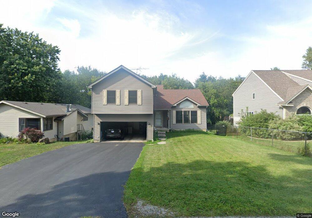
804 Wright Ave McHenry, IL 60051
West Island Lake NeighborhoodEstimated Value: $329,000 - $462,000
3
Beds
4
Baths
1,760
Sq Ft
$215/Sq Ft
Est. Value
About This Home
This home is located at 804 Wright Ave, McHenry, IL 60051 and is currently estimated at $378,705, approximately $215 per square foot. 804 Wright Ave is a home located in McHenry County with nearby schools including Cotton Creek School, Matthews Middle School, and Wauconda High School.
Ownership History
Date
Name
Owned For
Owner Type
Purchase Details
Closed on
Jul 26, 2002
Sold by
Hood Bill L and Hood Karen M
Bought by
Hanebuth John A and Hanebuth Raquel
Current Estimated Value
Home Financials for this Owner
Home Financials are based on the most recent Mortgage that was taken out on this home.
Original Mortgage
$185,200
Interest Rate
6.32%
Purchase Details
Closed on
Aug 25, 1995
Sold by
Mchenry State Bank
Bought by
Hood Bill L and Hood Karen M
Home Financials for this Owner
Home Financials are based on the most recent Mortgage that was taken out on this home.
Original Mortgage
$161,500
Interest Rate
7.81%
Create a Home Valuation Report for This Property
The Home Valuation Report is an in-depth analysis detailing your home's value as well as a comparison with similar homes in the area
Home Values in the Area
Average Home Value in this Area
Purchase History
| Date | Buyer | Sale Price | Title Company |
|---|---|---|---|
| Hanebuth John A | $231,500 | -- | |
| Hood Bill L | $170,000 | -- |
Source: Public Records
Mortgage History
| Date | Status | Borrower | Loan Amount |
|---|---|---|---|
| Previous Owner | Hanebuth John A | $185,200 | |
| Previous Owner | Hood Bill L | $161,500 |
Source: Public Records
Tax History
| Year | Tax Paid | Tax Assessment Tax Assessment Total Assessment is a certain percentage of the fair market value that is determined by local assessors to be the total taxable value of land and additions on the property. | Land | Improvement |
|---|---|---|---|---|
| 2024 | $7,692 | $113,882 | $15,782 | $98,100 |
| 2023 | $7,386 | $102,127 | $14,153 | $87,974 |
| 2022 | $8,093 | $93,395 | $12,943 | $80,452 |
| 2021 | $7,842 | $87,563 | $12,135 | $75,428 |
| 2020 | $7,426 | $84,938 | $11,771 | $73,167 |
| 2019 | $7,329 | $80,755 | $11,191 | $69,564 |
| 2018 | $6,897 | $75,855 | $10,512 | $65,343 |
| 2017 | $6,705 | $72,672 | $10,071 | $62,601 |
| 2016 | $6,517 | $69,337 | $9,609 | $59,728 |
| 2013 | -- | $65,988 | $9,145 | $56,843 |
Source: Public Records
Map
Nearby Homes
- 6 Lots Porten Rd
- 4505 Giant Oak Dr
- 4213 Hale Ln Unit 11
- 4400 Riverside Dr
- 1302 Autumn Ridge Ct
- 4024 Newport Dr
- Lot 0 S Pine St
- 29652 W Roberts Rd
- 742 Dartmouth Dr
- 4126 Wildwood Dr
- 3727 Hale Ln Unit 9
- 5220 Palm St
- Lot 9 -10 Louise St
- 120 W State Rd
- 1909 Louise St
- NEC Route 176 & Westridge Dr
- 27692 N Oak St
- 1102 Noble Pkwy
- 216 S Shore Dr Unit S
- 727 Nantucket Way Unit 1
- 716 Wright Ave
- 806 Wright Ave
- Lots 5 & 6 Wright Ave
- 0 Wright Ave
- 714 Wright Ave
- 803 Wright Ave
- 807 Wright Ave
- 810 Wright Ave
- 715 Wright Ave
- 809 Wright Ave
- 709 Wright Ave
- 4508 Vista Dr Unit 12
- 808 Paul St
- 800 Paul St
- 4506 Vista Dr Unit 12
- 706 Wright Ave
- 4510 Vista Dr Unit 12
- 816 Wright Ave
- 812 Paul St
- 0000 Paul St
Your Personal Tour Guide
Ask me questions while you tour the home.