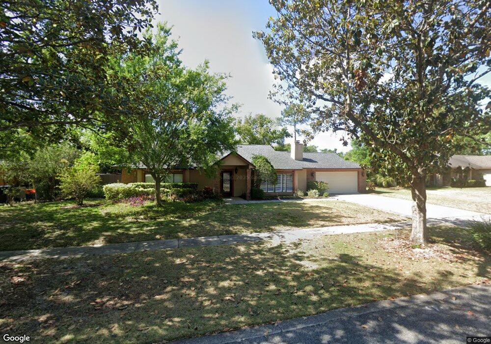
8041 Dunstable Cir Orlando, FL 32817
Estimated Value: $476,965 - $519,000
4
Beds
2
Baths
2,127
Sq Ft
$232/Sq Ft
Est. Value
About This Home
This home is located at 8041 Dunstable Cir, Orlando, FL 32817 and is currently estimated at $493,491, approximately $232 per square foot. 8041 Dunstable Cir is a home located in Orange County with nearby schools including Lakemont Elementary, Maitland Middle School, and Winter Park High.
Ownership History
Date
Name
Owned For
Owner Type
Purchase Details
Closed on
Apr 29, 2009
Sold by
Forman Jonathan L and Forman Peggy S
Bought by
Forman Jonathan L and Forman Peggy S
Current Estimated Value
Purchase Details
Closed on
Mar 1, 2000
Sold by
Davis Carol L
Bought by
Forman Jonathan L and Forman Peggy S
Home Financials for this Owner
Home Financials are based on the most recent Mortgage that was taken out on this home.
Original Mortgage
$155,000
Interest Rate
8.29%
Mortgage Type
New Conventional
Create a Home Valuation Report for This Property
The Home Valuation Report is an in-depth analysis detailing your home's value as well as a comparison with similar homes in the area
Home Values in the Area
Average Home Value in this Area
Purchase History
| Date | Buyer | Sale Price | Title Company |
|---|---|---|---|
| Forman Jonathan L | -- | Attorney | |
| Forman Jonathan L | $163,300 | -- |
Source: Public Records
Mortgage History
| Date | Status | Borrower | Loan Amount |
|---|---|---|---|
| Open | Forman Jonathan L | $154,000 | |
| Closed | Forman Jonathan L | $155,300 | |
| Closed | Forman Jonathan L | $155,000 |
Source: Public Records
Tax History
| Year | Tax Paid | Tax Assessment Tax Assessment Total Assessment is a certain percentage of the fair market value that is determined by local assessors to be the total taxable value of land and additions on the property. | Land | Improvement |
|---|---|---|---|---|
| 2025 | $2,688 | $179,285 | -- | -- |
| 2024 | $2,343 | $174,232 | -- | -- |
| 2023 | $2,343 | $164,390 | $0 | $0 |
| 2022 | $2,239 | $159,602 | $0 | $0 |
| 2021 | $2,194 | $154,953 | $0 | $0 |
| 2020 | $2,090 | $152,814 | $0 | $0 |
| 2019 | $2,140 | $149,378 | $0 | $0 |
| 2018 | $2,112 | $146,593 | $0 | $0 |
| 2017 | $2,071 | $208,893 | $50,500 | $158,393 |
| 2016 | $2,041 | $188,985 | $35,000 | $153,985 |
| 2015 | $2,072 | $178,455 | $35,000 | $143,455 |
| 2014 | $2,111 | $158,235 | $35,000 | $123,235 |
Source: Public Records
Map
Nearby Homes
- 7920 Dunstable Cir
- 7771 Country Place Unit 7
- 7733 Country Place Unit G2
- 7707 Country Place Unit 4
- 7706 Country Place Unit A8
- 5150 Old Howell Branch Rd
- 7474 Aloma Pines Ct
- 5180 Lazy Oaks Dr
- 5130 Lazy Oaks Dr
- 8407 Roanne Dr
- 4190 Bear Gully Rd
- 7796 Fernbrook Way
- 5220 N Lake Burkett Ln
- 8213 Lost Lake Dr
- 5473 Bracken Ct
- 4923 N Magnolia Ave
- 7618 Waunatta Ct
- 5039 Shorewood Landing Ln
- 3009 Ashford Park Place
- 2825 Cliffe Ct
- 8045 Dunstable Cir
- 8037 Dunstable Cir
- 7923 Nashua Ln
- 7931 Nashua Ln
- 7915 Nashua Ln
- 8046 Dunstable Cir
- 8042 Dunstable Cir
- 8033 Dunstable Cir
- 8053 Dunstable Cir
- 8050 Dunstable Cir
- 7939 Nashua Ln
- 8034 Dunstable Cir
- 7907 Nashua Ln
- 7924 Nashua Ln
- 8029 Dunstable Cir
- 8054 Dunstable Cir
- 7932 Nashua Ln
- 8038 Dunstable Cir
- 8005 Nashua Ln
- 7916 Nashua Ln
Your Personal Tour Guide
Ask me questions while you tour the home.