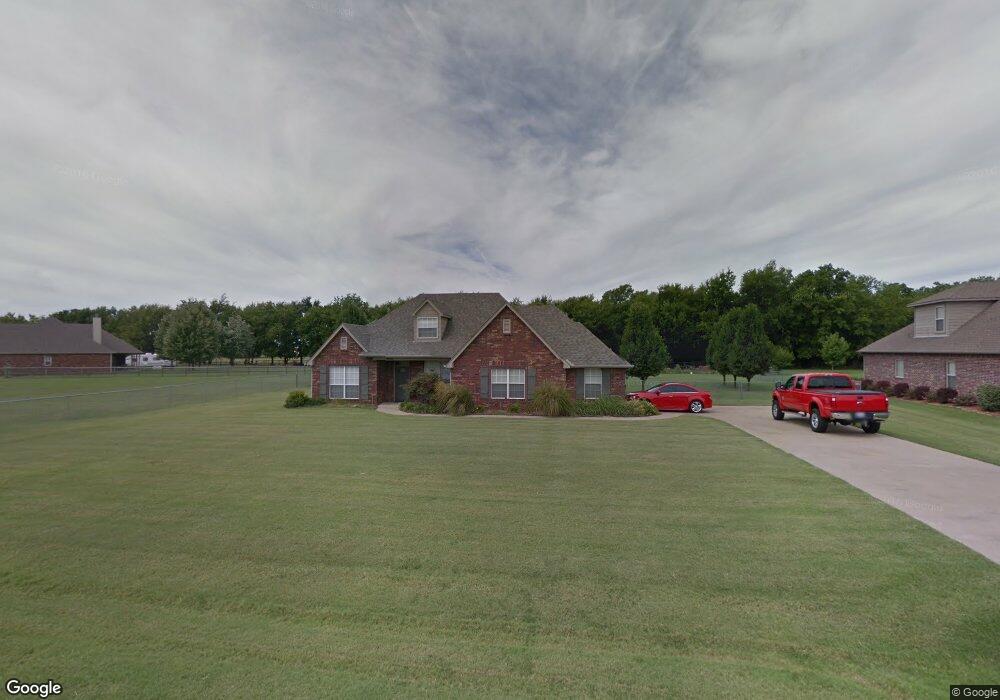
8042 N 187th East Ave Owasso, OK 74055
Estimated Value: $397,000 - $419,000
3
Beds
2
Baths
1,817
Sq Ft
$225/Sq Ft
Est. Value
About This Home
This home is located at 8042 N 187th East Ave, Owasso, OK 74055 and is currently estimated at $408,531, approximately $224 per square foot. 8042 N 187th East Ave is a home located in Rogers County with nearby schools including Stone Canyon Elementary School, Owasso 6th Grade Center, and Owasso 8th Grade Center.
Ownership History
Date
Name
Owned For
Owner Type
Purchase Details
Closed on
Jul 21, 2006
Sold by
Carrigan Craig M and Carrigan Teffonie L
Bought by
Ingram Gregory L
Current Estimated Value
Home Financials for this Owner
Home Financials are based on the most recent Mortgage that was taken out on this home.
Original Mortgage
$39,300
Interest Rate
6.62%
Mortgage Type
Stand Alone Second
Purchase Details
Closed on
Aug 4, 2005
Sold by
Strategic Builders Inc
Bought by
Carrigan Craig M and Carrigan Teffonie L
Home Financials for this Owner
Home Financials are based on the most recent Mortgage that was taken out on this home.
Original Mortgage
$151,760
Interest Rate
5.55%
Mortgage Type
New Conventional
Create a Home Valuation Report for This Property
The Home Valuation Report is an in-depth analysis detailing your home's value as well as a comparison with similar homes in the area
Home Values in the Area
Average Home Value in this Area
Purchase History
| Date | Buyer | Sale Price | Title Company |
|---|---|---|---|
| Ingram Gregory L | $199,000 | None Available | |
| Carrigan Craig M | $190,000 | None Available |
Source: Public Records
Mortgage History
| Date | Status | Borrower | Loan Amount |
|---|---|---|---|
| Closed | Ingram Gregory L | $39,300 | |
| Previous Owner | Carrigan Craig M | $151,760 |
Source: Public Records
Tax History Compared to Growth
Tax History
| Year | Tax Paid | Tax Assessment Tax Assessment Total Assessment is a certain percentage of the fair market value that is determined by local assessors to be the total taxable value of land and additions on the property. | Land | Improvement |
|---|---|---|---|---|
| 2025 | $3,597 | $34,468 | $5,861 | $28,607 |
| 2024 | $3,597 | $33,463 | $5,690 | $27,773 |
| 2023 | $3,597 | $32,489 | $5,406 | $27,083 |
| 2022 | $3,442 | $31,543 | $4,950 | $26,593 |
| 2021 | $3,303 | $30,624 | $4,950 | $25,674 |
| 2020 | $3,203 | $30,138 | $4,950 | $25,188 |
| 2019 | $3,110 | $28,894 | $4,950 | $23,944 |
| 2018 | $3,066 | $29,736 | $4,950 | $24,786 |
| 2017 | $2,568 | $24,567 | $4,902 | $19,665 |
| 2016 | $2,493 | $23,852 | $4,862 | $18,990 |
| 2015 | $2,437 | $23,156 | $4,798 | $18,358 |
| 2014 | $2,377 | $22,482 | $4,690 | $17,792 |
Source: Public Records
Map
Nearby Homes
- 17798 E Anthem Ridge Rd
- 18894 E 80th St N
- 8219 N 175th East Ave
- 17401 E 78th St N
- 19433 E 73rd Place N
- 18934 Chickadee Ct
- 17834 E 93rd St N
- 6940 N Garden Stone Ln
- 19425 E 69th St N
- 7397 N 201st East Ave
- 18533 E Crooked Oak Dr
- 7221 N 200th East Ave
- 19460 E Boulder Dr
- 7311 N 202nd East Ave
- 9101 N 165th East Ave
- 6568 N Blue Sage Dr
- 18420 E Persimmon Ln
- 15919 E 79th St N
- Laredo Plan at Stone Creek
- Dean Plan at Stone Creek
- 8060 N 187th East Ave
- 18641 E 80th St N
- 8078 N 187th East Ave
- 8061 N 187th East Ave
- 18673 E 80th St N
- 8015 N 187th East Ave
- 18607 E 80th St N
- 18711 E 81st St N
- 7993 N 187th East Ave
- 18668 E 80th St N
- 18746 E 81st St N
- 18602 E 80th St N
- 18741 E 81st St N
- 7971 N 187th East Ave
- 18768 E 81st St N
- 7968 N 187th Ave E
- 7968 N 187th East Ave
- 18763 E 81st St N
- 7949 N 187th East Ave