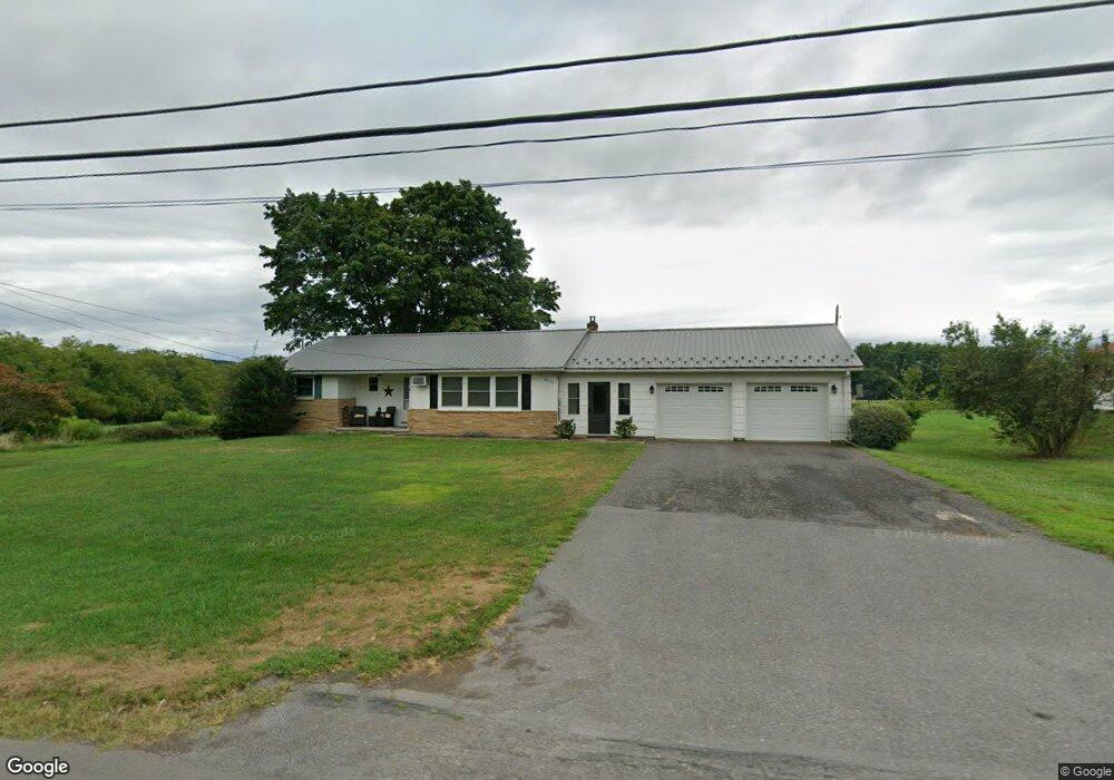
8045 State Route 304 Mifflinburg, PA 17844
Estimated Value: $167,000 - $224,000
2
Beds
1
Bath
1,117
Sq Ft
$176/Sq Ft
Est. Value
About This Home
This home is located at 8045 State Route 304, Mifflinburg, PA 17844 and is currently estimated at $196,035, approximately $175 per square foot. 8045 State Route 304 is a home with nearby schools including Mifflinburg Elementary School, Mifflinburg Area Intermediate School, and Mifflinburg Area Middle School.
Ownership History
Date
Name
Owned For
Owner Type
Purchase Details
Closed on
Apr 16, 2007
Sold by
Soles Vivian L and Soles Ronald C
Bought by
Yerger Scott A and Yerger Vera M
Current Estimated Value
Home Financials for this Owner
Home Financials are based on the most recent Mortgage that was taken out on this home.
Original Mortgage
$97,850
Outstanding Balance
$59,293
Interest Rate
6.19%
Mortgage Type
New Conventional
Estimated Equity
$136,742
Create a Home Valuation Report for This Property
The Home Valuation Report is an in-depth analysis detailing your home's value as well as a comparison with similar homes in the area
Home Values in the Area
Average Home Value in this Area
Purchase History
| Date | Buyer | Sale Price | Title Company |
|---|---|---|---|
| Yerger Scott A | $103,000 | None Available |
Source: Public Records
Mortgage History
| Date | Status | Borrower | Loan Amount |
|---|---|---|---|
| Open | Yerger Scott A | $97,850 |
Source: Public Records
Tax History Compared to Growth
Tax History
| Year | Tax Paid | Tax Assessment Tax Assessment Total Assessment is a certain percentage of the fair market value that is determined by local assessors to be the total taxable value of land and additions on the property. | Land | Improvement |
|---|---|---|---|---|
| 2025 | $1,925 | $90,300 | $19,100 | $71,200 |
| 2024 | $1,925 | $90,300 | $19,100 | $71,200 |
| 2023 | $1,867 | $90,300 | $19,100 | $71,200 |
| 2022 | $1,840 | $90,300 | $19,100 | $71,200 |
| 2021 | $1,824 | $90,300 | $19,100 | $71,200 |
| 2020 | $1,784 | $90,300 | $19,100 | $71,200 |
| 2019 | $1,742 | $90,300 | $19,100 | $71,200 |
| 2018 | $1,708 | $90,300 | $19,100 | $71,200 |
| 2017 | $1,673 | $90,300 | $19,100 | $71,200 |
| 2016 | $1,593 | $90,300 | $19,100 | $71,200 |
| 2015 | -- | $90,300 | $19,100 | $71,200 |
| 2014 | -- | $90,300 | $19,100 | $71,200 |
Source: Public Records
Map
Nearby Homes
- 224 Market St
- 222 High St
- 313 Market St
- 506 Front St
- LOT NO. 13 Motter Ln
- 654 Plum St
- 0 Pennsylvania 304
- 150 Adis Ln
- 204 Penn St
- 9 Walnut Ridge Estate
- PARCEL 3 Smalsh Barrick
- PARCEL 2 Smalsh Barrick
- 00 Smalsh Barrick Unit 3 PARCEL
- 00 Smalsh Barrick Unit 2 PARCEL
- 509 Lime Ridge Rd
- 809 Borough Line Rd
- 101 Chestnut St
- 107 Chestnut St
- 308 Green St
- 0 E Walnut St
- 8065 State Route 304
- 8078 State Route 304
- 8095 State Route 304
- 8125 State Route 304
- 8125 Pennsylvania 304
- 8145 State Route 304
- 8175 State Route 304
- 8225 State Route 304
- 7850 State Route 304
- 8255 State Route 304
- 7820 State Route 304
- 200 Risso Ln
- 210 Risso Ln
- 69 Hummel Rd
- 8335 State Route 304
- 114 Front St
- 110 Cedar Alley
- 123 Front St
- 125 Market St
- 122 Front St