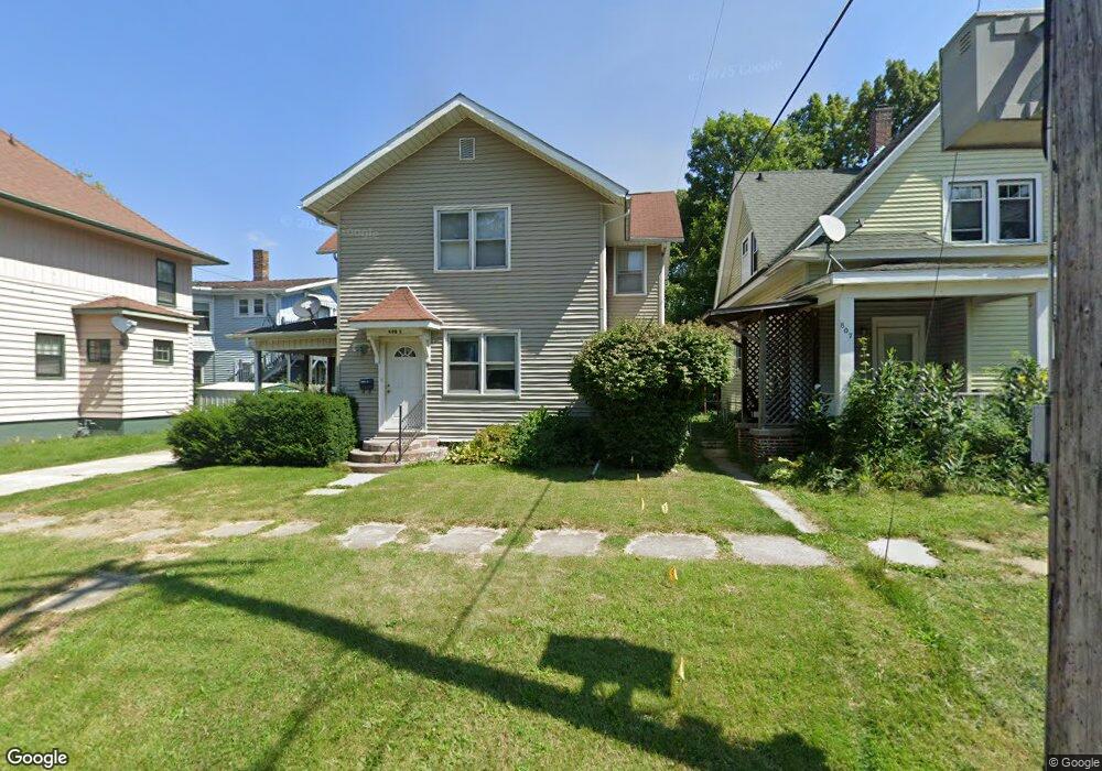
805 1/2 Adams St La Porte, IN 46350
Estimated Value: $145,000 - $178,842
3
Beds
2
Baths
1,848
Sq Ft
$89/Sq Ft
Est. Value
About This Home
This home is located at 805 1/2 Adams St, La Porte, IN 46350 and is currently estimated at $164,211, approximately $88 per square foot. 805 1/2 Adams St is a home located in LaPorte County with nearby schools including Carver Elementary School, Lincoln Elementary School, and Hailmann Elementary School.
Ownership History
Date
Name
Owned For
Owner Type
Purchase Details
Closed on
Jun 7, 2024
Sold by
Wawok Steven M and Wawok Regina C
Bought by
Weber Charles
Current Estimated Value
Home Financials for this Owner
Home Financials are based on the most recent Mortgage that was taken out on this home.
Original Mortgage
$119,200
Outstanding Balance
$117,722
Interest Rate
7.17%
Mortgage Type
New Conventional
Estimated Equity
$46,489
Purchase Details
Closed on
Aug 9, 2011
Sold by
Schlundt Darlene F
Bought by
Wawok Steven M and Wawok Regina C
Create a Home Valuation Report for This Property
The Home Valuation Report is an in-depth analysis detailing your home's value as well as a comparison with similar homes in the area
Home Values in the Area
Average Home Value in this Area
Purchase History
| Date | Buyer | Sale Price | Title Company |
|---|---|---|---|
| Weber Charles | -- | Meridian Title | |
| Wawok Steven M | -- | Meridian Title Corp |
Source: Public Records
Mortgage History
| Date | Status | Borrower | Loan Amount |
|---|---|---|---|
| Open | Weber Charles | $119,200 |
Source: Public Records
Tax History Compared to Growth
Tax History
| Year | Tax Paid | Tax Assessment Tax Assessment Total Assessment is a certain percentage of the fair market value that is determined by local assessors to be the total taxable value of land and additions on the property. | Land | Improvement |
|---|---|---|---|---|
| 2024 | $1,853 | $83,300 | $7,700 | $75,600 |
| 2022 | $1,778 | $88,900 | $8,000 | $80,900 |
| 2021 | $1,408 | $70,400 | $6,800 | $63,600 |
| 2020 | $1,374 | $70,400 | $6,800 | $63,600 |
| 2019 | $1,104 | $50,400 | $5,900 | $44,500 |
| 2018 | $1,094 | $49,900 | $5,600 | $44,300 |
| 2017 | $856 | $38,000 | $4,500 | $33,500 |
| 2016 | $1,588 | $74,600 | $10,900 | $63,700 |
| 2014 | $1,326 | $66,300 | $10,800 | $55,500 |
Source: Public Records
Map
Nearby Homes
- 202 Jefferson Ave
- 906 Linwood Ave
- 403 Rose St
- 107 Lincolnway
- 706 Detroit St
- 413 Jefferson Ave
- 206 Ohio St
- 330 Virginia Ave
- 910 Scott St
- 0 Brighton St Unit NRA542345
- 208 Norton St
- 503 Grove St
- 1207 Michigan Ave
- 1025 Indiana Ave
- 602 Plain St
- 414 Allen St
- 161 W Mcclung Rd
- 506 Pulaski St
- 207 Mccollum St
- 807 Division St
- 805 Adams St
- 807 Adams St
- 112 Jefferson Ave
- 110 Jefferson Ave
- 108 Jefferson Ave
- 101 Maple Ave
- 105 Maple Ave
- 104 Jefferson Ave
- 104 Rose St
- 204 Jefferson Ave
- 808 Adams St
- 111 Jefferson Ave
- 201 Maple Ave
- 201 Maple Ave
- 203 Maple Ave
- 113 Jefferson Ave
- 206 Jefferson Ave
- 107 Jefferson Ave
- 205 Maple Ave
- 113 Rose St