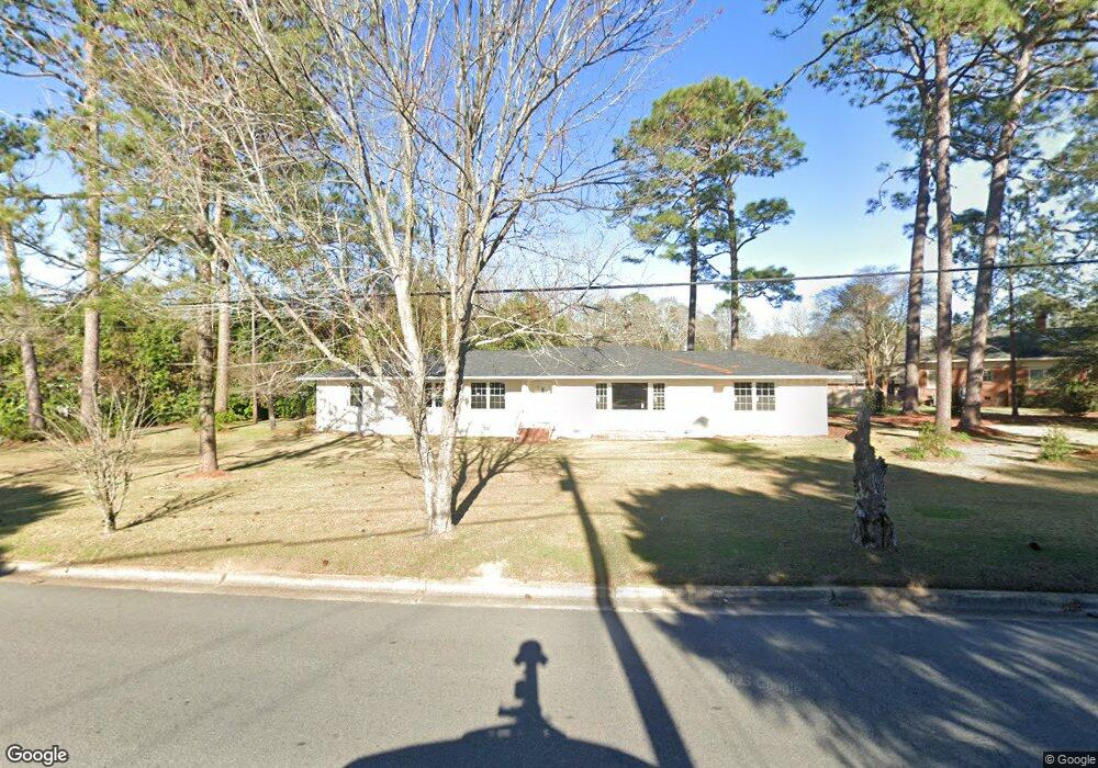
805 12th St W Tifton, GA 31794
Estimated Value: $209,173 - $272,000
3
Beds
3
Baths
2,358
Sq Ft
$107/Sq Ft
Est. Value
About This Home
This home is located at 805 12th St W, Tifton, GA 31794 and is currently estimated at $251,793, approximately $106 per square foot. 805 12th St W is a home located in Tift County with nearby schools including Len Lastinger Primary School, Charles Spencer Elementary School, and J.T. Reddick School.
Ownership History
Date
Name
Owned For
Owner Type
Purchase Details
Closed on
Jun 4, 2021
Sold by
Massey Brenda Louise
Bought by
Westherspoon Inc
Current Estimated Value
Purchase Details
Closed on
Oct 1, 2019
Sold by
Massey Larry G
Bought by
Massey Brenda Louise
Purchase Details
Closed on
Oct 19, 2017
Sold by
Massey Faye Ridley
Bought by
Massey Larry G
Purchase Details
Closed on
Aug 20, 1993
Sold by
Massey W G
Bought by
Massey Faye Ridley
Purchase Details
Closed on
Nov 24, 1952
Sold by
Webb Mrs Marye L
Bought by
Massey W G
Create a Home Valuation Report for This Property
The Home Valuation Report is an in-depth analysis detailing your home's value as well as a comparison with similar homes in the area
Home Values in the Area
Average Home Value in this Area
Purchase History
| Date | Buyer | Sale Price | Title Company |
|---|---|---|---|
| Westherspoon Inc | $85,000 | -- | |
| Massey Brenda Louise | -- | -- | |
| Massey Larry G | -- | -- | |
| Massey Faye Ridley | -- | -- | |
| Massey W G | -- | -- |
Source: Public Records
Tax History Compared to Growth
Tax History
| Year | Tax Paid | Tax Assessment Tax Assessment Total Assessment is a certain percentage of the fair market value that is determined by local assessors to be the total taxable value of land and additions on the property. | Land | Improvement |
|---|---|---|---|---|
| 2024 | $2,384 | $88,402 | $10,080 | $78,322 |
| 2023 | $2,534 | $33,889 | $6,000 | $27,889 |
| 2022 | $1,280 | $46,336 | $6,000 | $40,336 |
| 2021 | $1,755 | $46,336 | $6,000 | $40,336 |
| 2020 | $1,455 | $37,476 | $6,000 | $31,476 |
| 2019 | $1,455 | $37,476 | $6,000 | $31,476 |
| 2018 | $1,456 | $37,476 | $6,000 | $31,476 |
| 2017 | $1,093 | $37,476 | $6,000 | $31,476 |
| 2016 | $1,094 | $37,476 | $6,000 | $31,476 |
| 2015 | $1,094 | $37,476 | $6,000 | $31,476 |
| 2014 | $1,094 | $37,476 | $6,000 | $31,476 |
| 2013 | -- | $37,476 | $6,000 | $31,476 |
Source: Public Records
Map
Nearby Homes
- 711 10th St W
- 0 Penn Place
- 1601 Murray Ave
- 803 Forest Ave
- 803 Forrest Ave
- 821 Murray Ave
- 225 Alabama Dr
- 0 Lee Ball Rd
- 307 Fulwood Blvd
- 2021 Emory Dr
- 1617 Wilson Ave N
- 2202 Emory Dr
- 523 Alabama Dr Unit 15 & PT 16
- 523 Alabama Dr
- 416 6th St W
- 0 N U S Hwy 41
- 15 acres Us Highway 41
- 33.7 ac Us Highway 41
- 48 acres Us Highway 41
- 801 Ridge Ave N