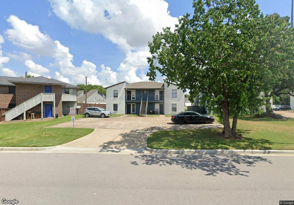
805 Autumn Cir Unit AD College Station, TX 77840
Estimated Value: $446,000 - $490,000
--
Bed
--
Bath
4,080
Sq Ft
$114/Sq Ft
Est. Value
About This Home
This home is located at 805 Autumn Cir Unit AD, College Station, TX 77840 and is currently estimated at $466,667, approximately $114 per square foot. 805 Autumn Cir Unit AD is a home located in Brazos County with nearby schools including College Hills Elementary School, A&M Consolidated Middle School, and Oakwood Intermediate School.
Ownership History
Date
Name
Owned For
Owner Type
Purchase Details
Closed on
Aug 10, 2022
Sold by
Ccshp Laurel Ridge Lp
Bought by
Cw Laurel Owner Llc
Current Estimated Value
Purchase Details
Closed on
Dec 4, 2012
Sold by
Spring Loop Quail Limited Partnership
Bought by
Aggie Laurel Limited Partnership
Create a Home Valuation Report for This Property
The Home Valuation Report is an in-depth analysis detailing your home's value as well as a comparison with similar homes in the area
Home Values in the Area
Average Home Value in this Area
Purchase History
Date | Buyer | Sale Price | Title Company |
---|---|---|---|
Cw Laurel Owner Llc | -- | New Title Company Name | |
Aggie Laurel Limited Partnership | -- | None Available |
Source: Public Records
Mortgage History
Date | Status | Borrower | Loan Amount |
---|---|---|---|
Previous Owner | Spring Loop Quail Limited Partnership | $0 | |
Previous Owner | Arbor Commercial Funding Llc | $0 | |
Previous Owner | Spring Loop Quail Lp | $2,520,000 | |
Closed | Cw Laurel Owner Llc | $0 |
Source: Public Records
Tax History Compared to Growth
Tax History
Year | Tax Paid | Tax Assessment Tax Assessment Total Assessment is a certain percentage of the fair market value that is determined by local assessors to be the total taxable value of land and additions on the property. | Land | Improvement |
---|---|---|---|---|
2023 | $5,586 | $293,122 | $60,500 | $232,622 |
2022 | $5,391 | $252,833 | $55,000 | $197,833 |
2021 | $7,040 | $311,692 | $55,000 | $256,692 |
2020 | $6,808 | $299,772 | $55,000 | $244,772 |
2019 | $6,066 | $256,710 | $55,000 | $201,710 |
2018 | $5,953 | $250,090 | $50,000 | $200,090 |
2017 | $5,966 | $253,480 | $50,000 | $203,480 |
2016 | $5,940 | $252,380 | $50,000 | $202,380 |
2015 | $5,267 | $235,700 | $50,000 | $185,700 |
2014 | $5,267 | $227,260 | $50,000 | $177,260 |
Source: Public Records
Map
Nearby Homes
- 220 Tarrow St
- 1011 Autumn Cir Unit AB
- 4513 Carter Creek Pkwy Unit 10
- 4509 Carter Creek Pkwy Unit 7
- 417 Chimney Hill Dr
- 828 S Rosemary Dr
- 4345 Carter Creek Pkwy Unit 1
- 4345 Carter Creek Pkwy Unit 11
- 4345 Carter Creek Pkwy Unit 7
- 4345 Carter Creek Pkwy Unit 5
- 4345 Carter Creek Pkwy Unit 17
- 1211 April Bloom Unit AB
- 1221 April Bloom Unit AB
- 152 Forest Dr Unit 152
- 821 Vine St
- 4204 Carter Creek Pkwy
- 3705 Old Oaks Dr
- 324 Forest Dr
- 331 Forest Dr
- 328 Forest Drive Loop
- 807 Autumn Cir Unit AD
- 803 Autumn Cir Unit A
- 803 Autumn Cir Unit B
- 803 Autumn Cir Unit C
- 803 Autumn Cir
- 803 Autumn Cir Unit D
- 809 Autumn Cir Unit AD
- 200 Winter Park Unit AD
- 806 Autumn Cir Unit AD
- 804 Autumn Cir Unit AD
- 202 Winter Park Unit AD
- 808 Autumn Cir Unit AD
- 204 Winter Park Unit AD
- 810 Autumn Cir Unit AD
- 812 Autumn Cir Unit AD
- 814 Autumn Cir Unit AD
- 1.66 Tarrow
- 201 Winter Park Unit AD
- 201 Winter Park Unit D
- 201 Winter Park Unit B