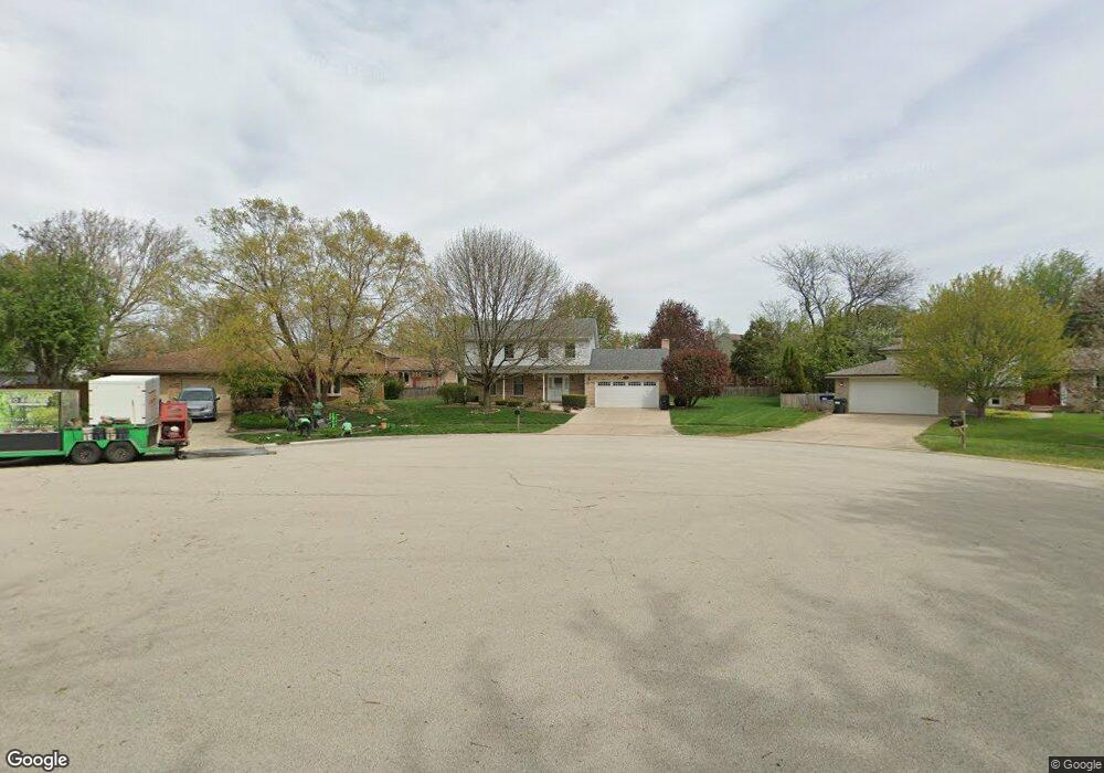
805 Cessna Ct New Lenox, IL 60451
Estimated Value: $412,519 - $458,000
--
Bed
--
Bath
--
Sq Ft
9,583
Sq Ft Lot
About This Home
This home is located at 805 Cessna Ct, New Lenox, IL 60451 and is currently estimated at $441,630. 805 Cessna Ct is a home located in Will County with nearby schools including Nelson Prairie School, Lincoln Way West, and St. Jude School.
Ownership History
Date
Name
Owned For
Owner Type
Purchase Details
Closed on
May 15, 2025
Sold by
Trust No 2021-805 and Wright Linda R
Bought by
Linda R Wright Living Trust and Wright
Current Estimated Value
Purchase Details
Closed on
Oct 4, 2021
Sold by
Wright Carter H and Wright Linda R
Bought by
Wright Carter H and Wright Linda R
Purchase Details
Closed on
Oct 25, 2004
Sold by
Wright Carter H and Wright Linda R
Bought by
Wright Carter H and Wright Linda R
Purchase Details
Closed on
Mar 10, 1989
Bought by
Wright Carter H
Create a Home Valuation Report for This Property
The Home Valuation Report is an in-depth analysis detailing your home's value as well as a comparison with similar homes in the area
Home Values in the Area
Average Home Value in this Area
Purchase History
| Date | Buyer | Sale Price | Title Company |
|---|---|---|---|
| Linda R Wright Living Trust | -- | None Listed On Document | |
| Wright Carter H | -- | None Available | |
| Wright Carter H | -- | -- | |
| Wright Carter H | $145,000 | -- |
Source: Public Records
Tax History Compared to Growth
Tax History
| Year | Tax Paid | Tax Assessment Tax Assessment Total Assessment is a certain percentage of the fair market value that is determined by local assessors to be the total taxable value of land and additions on the property. | Land | Improvement |
|---|---|---|---|---|
| 2024 | $8,717 | $123,413 | $32,465 | $90,948 |
| 2023 | $8,717 | $112,500 | $29,594 | $82,906 |
| 2022 | $8,016 | $103,639 | $27,263 | $76,376 |
| 2021 | $7,578 | $97,469 | $25,640 | $71,829 |
| 2020 | $7,344 | $93,991 | $24,725 | $69,266 |
| 2019 | $7,012 | $91,076 | $23,958 | $67,118 |
| 2018 | $6,832 | $87,937 | $23,132 | $64,805 |
| 2017 | $6,476 | $85,409 | $22,467 | $62,942 |
| 2016 | $6,273 | $83,123 | $21,866 | $61,257 |
| 2015 | $6,027 | $80,507 | $21,178 | $59,329 |
| 2014 | $6,027 | $79,514 | $20,917 | $58,597 |
| 2013 | $6,027 | $80,586 | $21,199 | $59,387 |
Source: Public Records
Map
Nearby Homes
- 400 W Joliet Hwy
- 574 Prairie Crossing Dr
- 709 Young Dr
- 2 Honey Ln
- 416 Manor Ct Unit B
- 315 S Pine St
- 202 Hickory St
- 00 NE Corner Cherry Hill Road and Moss Lane Rd
- Vacant W Maple St
- 331 Old Hickory Rd
- 718 S Prairie Rd
- 1701 Grand Prairie Dr
- 1500 Ramp
- 329 Hancock Dr
- 1007 Nelson Rd
- 338 Willow St
- 125 Kimber Dr
- 1000 S Cedar Rd
- 203 Fir St
- 328 E Lincoln Hwy
- 808 Corsair Ct
- 809 Cessna Ct
- 801 Cessna Ct
- 812 Corsair Ct
- 804 Corsair Ct
- 312 Boeing Dr Unit 2
- 800 Cessna Ct
- 308 Boeing Dr
- 812 Cessna Ct
- 800 Corsair Ct
- 808 Cessna Ct
- 804 Cessna Ct
- 400 Boeing Dr
- 809 Corsair Ct
- 708 Ridgefield Rd
- 709 Heartland Dr
- 805 Grumman Ct
- 801 Corsair Ct
- 805 Corsair Ct
- 813 Corsair Ct