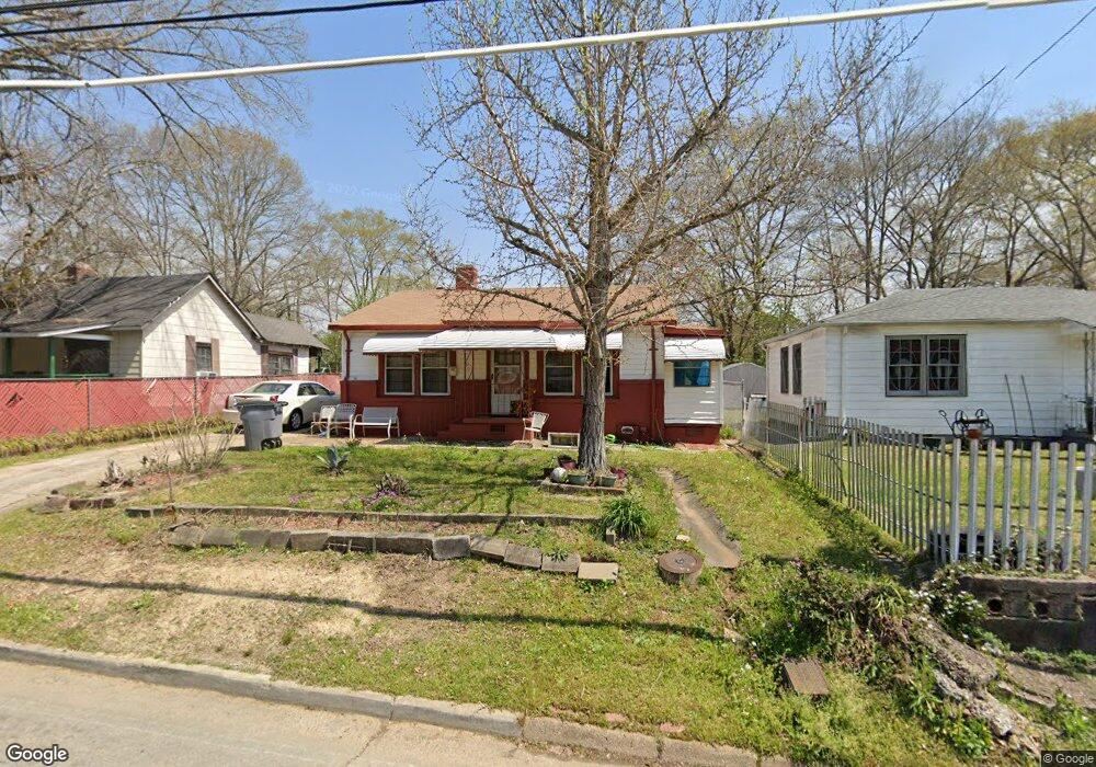
805 Daniel St Lagrange, GA 30241
Estimated Value: $71,000 - $139,000
4
Beds
2
Baths
1,673
Sq Ft
$67/Sq Ft
Est. Value
About This Home
This home is located at 805 Daniel St, Lagrange, GA 30241 and is currently estimated at $112,665, approximately $67 per square foot. 805 Daniel St is a home located in Troup County with nearby schools including Callaway Elementary School, Hogansville Elementary School, and Callaway Middle School.
Ownership History
Date
Name
Owned For
Owner Type
Purchase Details
Closed on
Nov 22, 2010
Sold by
Smith Betty G A
Bought by
Hudson Blanche A
Current Estimated Value
Home Financials for this Owner
Home Financials are based on the most recent Mortgage that was taken out on this home.
Original Mortgage
$13,029
Interest Rate
4.3%
Mortgage Type
New Conventional
Purchase Details
Closed on
Nov 18, 2010
Sold by
Smith Betty G A
Bought by
Hudson Blanche A
Home Financials for this Owner
Home Financials are based on the most recent Mortgage that was taken out on this home.
Original Mortgage
$13,029
Interest Rate
4.3%
Mortgage Type
New Conventional
Purchase Details
Closed on
Jan 1, 1948
Sold by
Johnny Evans
Bought by
Evans John and Annie Mae
Create a Home Valuation Report for This Property
The Home Valuation Report is an in-depth analysis detailing your home's value as well as a comparison with similar homes in the area
Purchase History
| Date | Buyer | Sale Price | Title Company |
|---|---|---|---|
| Hudson Blanche A | $14,250 | -- | |
| Hudson Blanche A | -- | -- | |
| Hudson Blanche A | $14,250 | -- | |
| Hudson Blanche A | -- | -- | |
| Evans John | -- | -- |
Source: Public Records
Mortgage History
| Date | Status | Borrower | Loan Amount |
|---|---|---|---|
| Closed | Hudson Blanche A | $13,029 | |
| Closed | Hudson Blanche A | $13,029 |
Source: Public Records
Tax History
| Year | Tax Paid | Tax Assessment Tax Assessment Total Assessment is a certain percentage of the fair market value that is determined by local assessors to be the total taxable value of land and additions on the property. | Land | Improvement |
|---|---|---|---|---|
| 2025 | $928 | $34,016 | $2,640 | $31,376 |
| 2024 | $852 | $31,256 | $2,640 | $28,616 |
| 2023 | $694 | $25,456 | $2,640 | $22,816 |
| 2022 | $660 | $23,656 | $2,640 | $21,016 |
| 2021 | $671 | $22,236 | $1,880 | $20,356 |
| 2020 | $671 | $22,236 | $1,880 | $20,356 |
| 2019 | $627 | $20,792 | $1,880 | $18,912 |
| 2018 | $628 | $20,820 | $1,908 | $18,912 |
| 2017 | $628 | $20,820 | $1,908 | $18,912 |
| 2016 | $622 | $20,610 | $1,908 | $18,702 |
| 2015 | $623 | $20,610 | $1,908 | $18,702 |
| 2014 | $594 | $19,640 | $1,908 | $17,732 |
| 2013 | -- | $20,875 | $1,908 | $18,967 |
Source: Public Records
Map
Nearby Homes
- 626 Smoot St
- 510 Smoot St
- 0 Brown St Unit 10550761
- 0 Brown St Unit 10550754
- 0 E Fendig St
- 113 E Fendig St
- 200 Mccall St
- 901 Whiteline St
- 203 Revis St
- 205 Revis St
- 0 Burr St
- 306 Burr St
- 105 Dix St
- 109 Bell St
- 0 Kelley St Unit 10550311
- 130 Edgewood Ave
- 0 Boggs St Unit 10550243
- 0 Boggs St Unit 10550231
- 0 Boggs St Unit 10550239
- 0 Boggs St Unit 10550250
Your Personal Tour Guide
Ask me questions while you tour the home.