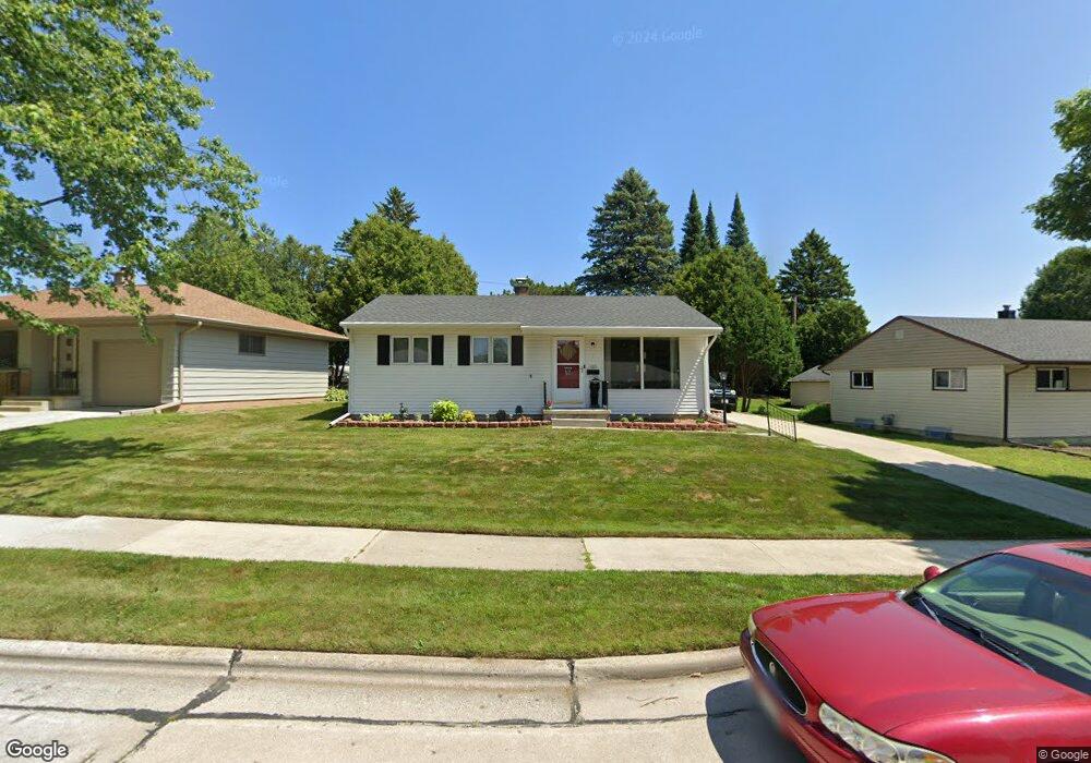
805 Forest Cir Manitowoc, WI 54220
Estimated Value: $179,000 - $184,478
3
Beds
1
Bath
999
Sq Ft
$182/Sq Ft
Est. Value
About This Home
This home is located at 805 Forest Cir, Manitowoc, WI 54220 and is currently estimated at $181,739, approximately $181 per square foot. 805 Forest Cir is a home located in Manitowoc County with nearby schools including Franklin Elementary School, Washington Junior High School, and Lincoln High School.
Ownership History
Date
Name
Owned For
Owner Type
Purchase Details
Closed on
May 25, 2017
Sold by
Sundling Patricia and Sundling Thomas
Bought by
Bonini Stephen and Bonini Jennifer
Current Estimated Value
Home Financials for this Owner
Home Financials are based on the most recent Mortgage that was taken out on this home.
Original Mortgage
$49,000
Outstanding Balance
$39,448
Interest Rate
2.99%
Mortgage Type
New Conventional
Estimated Equity
$142,291
Purchase Details
Closed on
Jul 21, 2016
Sold by
Steffen Thomas F and Raih Erna M
Bought by
Sundling Patricia
Create a Home Valuation Report for This Property
The Home Valuation Report is an in-depth analysis detailing your home's value as well as a comparison with similar homes in the area
Home Values in the Area
Average Home Value in this Area
Purchase History
| Date | Buyer | Sale Price | Title Company |
|---|---|---|---|
| Bonini Stephen | $62,500 | First American Title | |
| Sundling Patricia | $62,500 | First American Title |
Source: Public Records
Mortgage History
| Date | Status | Borrower | Loan Amount |
|---|---|---|---|
| Open | Bonini Stephen | $49,000 |
Source: Public Records
Tax History
| Year | Tax Paid | Tax Assessment Tax Assessment Total Assessment is a certain percentage of the fair market value that is determined by local assessors to be the total taxable value of land and additions on the property. | Land | Improvement |
|---|---|---|---|---|
| 2024 | $2,054 | $130,700 | $14,600 | $116,100 |
| 2023 | $1,875 | $130,700 | $14,600 | $116,100 |
| 2022 | $1,635 | $94,500 | $14,600 | $79,900 |
| 2021 | $1,618 | $94,500 | $14,600 | $79,900 |
| 2020 | $1,451 | $77,100 | $14,600 | $62,500 |
| 2019 | $1,420 | $77,100 | $14,600 | $62,500 |
| 2018 | $1,404 | $77,100 | $14,600 | $62,500 |
| 2017 | $1,405 | $77,100 | $14,600 | $62,500 |
| 2016 | $1,454 | $77,100 | $14,600 | $62,500 |
| 2015 | $1,503 | $77,100 | $14,600 | $62,500 |
| 2014 | $1,465 | $77,100 | $14,600 | $62,500 |
| 2013 | $1,486 | $77,100 | $14,600 | $62,500 |
Source: Public Records
Map
Nearby Homes
- 802 Forest Cir
- 3504 Forest Cir
- 914 S 35th St
- 921 Raton Ct
- 3702 Schroeder Dr
- 954 S 36th St
- 957 Macarthur Dr
- 703 S 33rd St
- 956 Circle Dr
- 631 S 32nd St
- 107 Mill Rd
- 502 S 29th St
- 1230 S 31st St
- 4017 Delta St
- 2616 Washington St
- 625 S 27th St
- 3810 Calumet Ave
- 3606 Division St
- 1401 S 31st St
- 1144 S 25th St
- 803 Forest Cir
- 811 Forest Cir
- 3609 Forest Cir
- 815 Forest Cir
- 817 Forest Cir
- 812 Forest Cir
- 3628 Forest Cir
- 3605 Forest Cir
- 816 Forest Cir
- 3622 Forest Cir
- 3614 Forest Cir
- 3706 Dale St
- 3620 Forest Cir
- 3606 Forest Cir
- 3519 Forest Cir
- 807 Schroeder Dr
- 803 Schroeder Dr
- 811 Schroeder Dr
- 3615 Dale St
- 3609 Dale St
Your Personal Tour Guide
Ask me questions while you tour the home.